


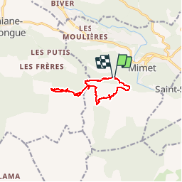

13.7 km | 20 km-effort


User


FREE GPS app for hiking
 SityTrail
IGN / Geographical institutes
SityTrail World
The world is yours!
Trail Walking of 10.9 km to be discovered at Provence-Alpes-Côte d'Azur, Bouches-du-Rhône, Mimet. This trail is proposed by ARPF.
P2 T2 17/11/2016 Philippe
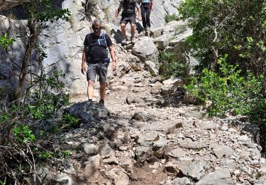
Attention passages glissants
montée du départ assez raide, puis passages délicats nécessitant de mettre les mains

Walking

Walking

Walking

Walking

Mountain bike
Mountain bike

Mountain bike

Walking
Walking