![](/images/other/stat-length.png)
![Trail Walking Rémalard en Perche - La Carrière de la Gaieté 5,0 Km - Photo](https://media.geolcdn.com/t/1900/400/94760946-202b-4cae-83d6-23afe09e3769.jpg&format=pjpeg&maxdim=2)
La Carrière de la Gaieté 5,0 Km
ODDAD78
User
![Length](/images/other/stat-length.png)
![Max alt](https://static1.geolcdn.com/siteimages/upload/files/1508320355ic_sort_altitude_max_24dp.png)
![Uphill gradient](https://static1.geolcdn.com/siteimages/upload/files/1508320355ic_sort_den_pos_24dp.png)
![Km-Effort](/images/other/stat-length.png)
![Min alt](https://static1.geolcdn.com/siteimages/upload/files/1508320355ic_sort_altitude_min_24dp.png)
![Downhill gradient](https://static1.geolcdn.com/siteimages/upload/files/1508320355ic_sort_den_neg_24dp.png)
![Boucle](https://static1.geolcdn.com/siteimages/upload/files/16400158638029165_repeat_loop_refresh_sync_direction_icon.png)
![Walking](https://static1.geolcdn.com/sitytour/trail-icons/101.png)
1h19
Difficulty : Easy
![Scan this QR Code to open this trail in the SityTrail application](https://capi.geolives.com/qq0zvz2zws4bq2lad0pu/sitytour/trails/660177/qr.png?size=200)
FREE GPS app for hiking
About
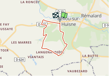
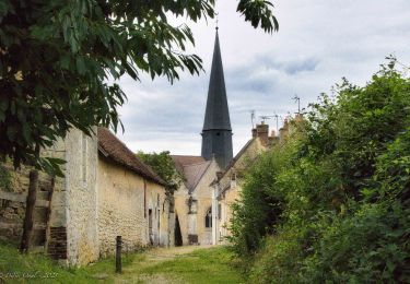
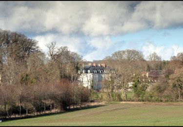
Trail Walking of 5 km to be discovered at Normandy, Orne, Rémalard en Perche. This trail is proposed by ODDAD78.
Description
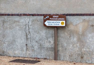
Circuit balisé signalétique (suivre les flèches "La Carrière de la Gaieté")
Pas à pas :
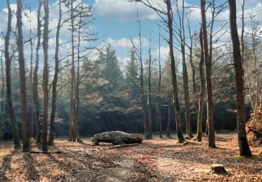
Prendre la rue Saint-Paterne. Au calvaire, continuer tout droit par le chemin de la Rosière.
Arrivé à la Rosière, à gauche par le chemin de la Petite Mansonnière, bifurquer à droite et emprunter un chemin en herbe conduisant à l'entrée d'une ancienne carrière de pierre (voir encadré}. Continuer par la droite ; monter un chemin encaissé jusqu'à un croisement.
Tourner à droite ; rejoindre l'Angenardière, puis déboucher sur une voie communale que l'on suit à droite sur 700 m.
À la rencontre de l'ancienne route royale de Paris au Mans, emprunter cette dernière à gauche sur quelques mètres, puis bifurquer à droite en prenant le chemin goudronné des Bertinières. De nouveau à droite. Après les Petites-Bertinières (joli point de vue}, à gauche, Couper la D 920 pour gagner la Voie Verte en descendant le chemin de la Fosse à la Fille.
Retour au point de départ par la Voie Verte et, à gauche, par la rue de Saint-Paterne
Commentaire :
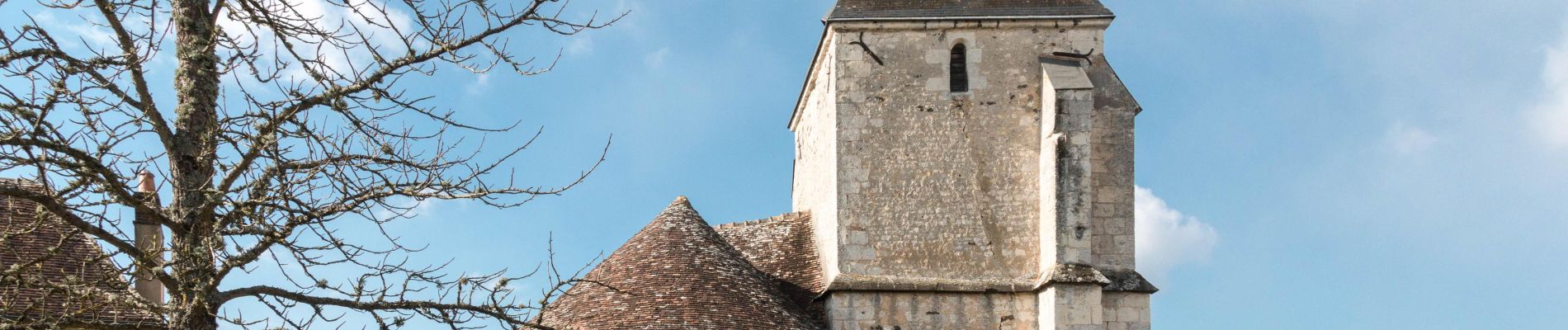
Un site géologique exceptionnel
Proche du hameau de la Mansonnière, s'ouvre une ancienne carrière souterraine creusée dans un calcaire poreux (tuffeau) ayant servi à édifier nombre de bâtiments, dont l'église Saint-Paterne, d'origine romane. Après le départ des carriers, l’entrée fut aménagée entre les deux guerres mondiales en lieu de divertissement comprenant guinguette, buvette et roseraie, d’où son surnom de “ Carrière de la Gaïefé”, avant de servir de champignonnière, entre 1951 et 1960.
Sa grande originalité réside dans son réseau de galeries naturelles : un labyrinthe de plus d'1 km de boyaux a déjà été exploré sur un total estimé au moins à 3 km. l'examen des comblements a démontré qu'il résultait de l'altération de la roche par les agents acides transportés par l'eau souterraine.
Par son étendue, ce site géologique, reconnu de portée mondiale par les scientifiques, est actuellement l'unique témoin des premières phases de creusement d'un réseau ”karstique” (constitué de cavités creusées par l'eau), exceptionnellement bien conservé.
Patrimoine naturel protégé, propriété de la commune de Bellou, la grotte est, pour les chauve-souris, l'un des principaux gites d'hibernation bas-normands.
La caverne est fragile : elle est creusée dans la craie-tuffeau, roche calcaire poreuse, très sensible aux effets du gel. Ce patrimoine minier a souffert du vandalisme (graffiti, destructions, dépots d'ordures). La présence hivernale des chauves-souris s’accommode mal d'une forte fréquentation humaine. Il a donc fallu protéger ce milieu par des travaux (confortement, pose de portes).
Positioning
Comments
Trails nearby
![Trail Walking Rémalard en Perche - La Nymphe du Perche 5,0 Km - Photo](https://media.geolcdn.com/t/375/260/17cc6b0d-b494-41c7-85a0-ede1466ba884.jpg&format=jpg&maxdim=2)
![Walking Walking](https://static1.geolcdn.com/sitytour/trail-icons/101.png)
Walking
![](/images/other/stat-length.png)
![](https://static1.geolcdn.com/siteimages/upload/files/16400158638029165_repeat_loop_refresh_sync_direction_icon.png)
![Trail Walking Rémalard en Perche - 2023-05-11_20h45m08_Randos 61 2023 3 Sur les terres du siège de Rémalard 9,5 km - Photo](https://media.geolcdn.com/t/375/260/4c079e8c-69f5-4bc5-9fc4-11ac01016a7e.jpg&format=jpg&maxdim=2)
![Walking Walking](https://static1.geolcdn.com/sitytour/trail-icons/101.png)
Walking
![](/images/other/stat-length.png)
![](https://static1.geolcdn.com/siteimages/upload/files/16400158638029165_repeat_loop_refresh_sync_direction_icon.png)
![Trail Walking Verrières - SityTrail - SityTrail - Les Vieilles Trognes 9 Km - Photo](https://media.geolcdn.com/t/375/260/2f52e433-da7f-4851-a063-0b8449b76186.jpg&format=jpg&maxdim=2)
![Walking Walking](https://static1.geolcdn.com/sitytour/trail-icons/101.png)
Walking
![](/images/other/stat-length.png)
![](https://static1.geolcdn.com/siteimages/upload/files/16400158638029165_repeat_loop_refresh_sync_direction_icon.png)
![Trail Walking Cour-Maugis sur Huisne - 12102996-Maison Maugis 22.37 - Photo](https://media.geolcdn.com/t/375/260/ext.jpg?maxdim=2&url=https%3A%2F%2Fstatic1.geolcdn.com%2Fsiteimages%2Fupload%2Ffiles%2F1553511878bg_sport_marche.png)
![Walking Walking](https://static1.geolcdn.com/sitytour/trail-icons/101.png)
Walking
![](/images/other/stat-length.png)
![](https://static1.geolcdn.com/siteimages/upload/files/16400158638029165_repeat_loop_refresh_sync_direction_icon.png)
![Trail Walking Rémalard en Perche - Nobles Logis du Perche (Rémalard) Variante 8,3 Km - Photo](https://media.geolcdn.com/t/375/260/8d898521-16be-4b88-87ed-874030b976e2.jpg&format=jpg&maxdim=2)
![Walking Walking](https://static1.geolcdn.com/sitytour/trail-icons/101.png)
Walking
![](/images/other/stat-length.png)
![](https://static1.geolcdn.com/siteimages/upload/files/16400158638029165_repeat_loop_refresh_sync_direction_icon.png)
![Trail Walking Cour-Maugis sur Huisne - Boissy-Maugis 8,4 km - Photo](https://media.geolcdn.com/t/375/260/b8f9aaa7-b59b-4d9c-ba02-624dc17d6137.jpg&format=jpg&maxdim=2)
![Walking Walking](https://static1.geolcdn.com/sitytour/trail-icons/101.png)
Walking
![](/images/other/stat-length.png)
![](https://static1.geolcdn.com/siteimages/upload/files/16400158638029165_repeat_loop_refresh_sync_direction_icon.png)
![Trail Walking Rémalard en Perche - Le ruisseau de Pontillon 11 Km - Photo](https://media.geolcdn.com/t/375/260/ff177aee-f1f8-438f-adec-36e6a48cd0c9.jpg&format=jpg&maxdim=2)
![Walking Walking](https://static1.geolcdn.com/sitytour/trail-icons/101.png)
Walking
![](/images/other/stat-length.png)
![](https://static1.geolcdn.com/siteimages/upload/files/16400158638029165_repeat_loop_refresh_sync_direction_icon.png)
![Trail Walking Rémalard en Perche - Nobles Logis du Perche (Rémalard) 24 Km - Photo](https://media.geolcdn.com/t/375/260/1e8cc532-bb5b-4a9b-8b5a-736f25271548.jpg&format=jpg&maxdim=2)
![Walking Walking](https://static1.geolcdn.com/sitytour/trail-icons/101.png)
Walking
![](/images/other/stat-length.png)
![](https://static1.geolcdn.com/siteimages/upload/files/16400158638029165_repeat_loop_refresh_sync_direction_icon.png)
![Trail Walking Cour-Maugis sur Huisne - La Clairière de Saint-Laurent 16,0 Km - Photo](https://media.geolcdn.com/t/375/260/5813c593-509f-42a8-97e4-39a0b1a6860f.jpg&format=jpg&maxdim=2)
![Walking Walking](https://static1.geolcdn.com/sitytour/trail-icons/101.png)
Walking
![](/images/other/stat-length.png)
![](https://static1.geolcdn.com/siteimages/upload/files/16400158638029165_repeat_loop_refresh_sync_direction_icon.png)