![](/images/other/stat-length.png)
La traversée des hameaux
jyv
User
![Length](/images/other/stat-length.png)
Length
23 km
![Max alt](https://static1.geolcdn.com/siteimages/upload/files/1508320355ic_sort_altitude_max_24dp.png)
Max alt
65 m
![Uphill gradient](https://static1.geolcdn.com/siteimages/upload/files/1508320355ic_sort_den_pos_24dp.png)
Uphill gradient
160 m
![Km-Effort](/images/other/stat-length.png)
Km-Effort
25 km
![Min alt](https://static1.geolcdn.com/siteimages/upload/files/1508320355ic_sort_altitude_min_24dp.png)
Min alt
28 m
![Downhill gradient](https://static1.geolcdn.com/siteimages/upload/files/1508320355ic_sort_den_neg_24dp.png)
Downhill gradient
160 m
![Boucle](https://static1.geolcdn.com/siteimages/upload/files/16400158638029165_repeat_loop_refresh_sync_direction_icon.png)
Boucle
Yes
Creation date :
2014-12-10 00:00:00.0
Updated on :
2014-12-10 00:00:00.0
![Cycle](https://static1.geolcdn.com/sitytour/trail-icons/200.png)
--
Difficulty : Easy
![Scan this QR Code to open this trail in the SityTrail application](https://capi.geolives.com/qq0zvz2zws4bq2lad0pu/sitytour/trails/65577/qr.png?size=200)
FREE GPS app for hiking
About
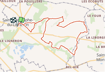
Trail Cycle of 23 km to be discovered at Pays de la Loire, Vendée, Saint-Christophe-du-Ligneron. This trail is proposed by jyv.
Description
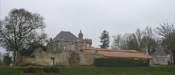
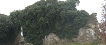
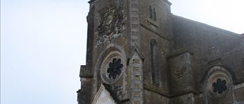
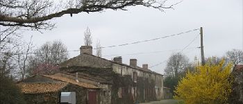
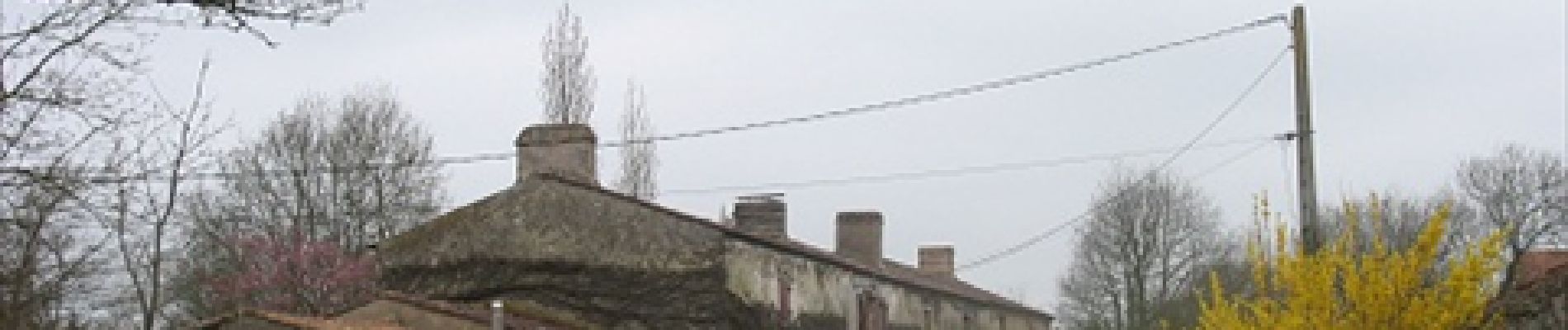
A 8 km de la Borderie de la Marchaizière, venez découvrir les hameaux du bocage vendéen. Habitat typique des agriculteurs, ils sont situés au plus près des champs et donc de la faune et de la flore.
Positioning
Country:
France
Region :
Pays de la Loire
Department/Province :
Vendée
Municipality :
Saint-Christophe-du-Ligneron
Location:
Unknown
Start:(Dec)
Start:(UTM)
594079 ; 5186101 (30T) N.
Comments
Trails nearby
![Trail Mountain bike Froidfond - FROIDFOND - Photo](https://media.geolcdn.com/t/375/260/ext.jpg?maxdim=2&url=https%3A%2F%2Fstatic1.geolcdn.com%2Fsiteimages%2Fupload%2Ffiles%2F1524743154velo.jpg)
![Mountain bike Mountain bike](https://static1.geolcdn.com/sitytour/trail-icons/202.png)
FROIDFOND
Mountain bike
Very easy
(1)
Froidfond,
Pays de la Loire,
Vendée,
France
![](/images/other/stat-length.png)
24 km | 25 km-effort
2h 0min
![](https://static1.geolcdn.com/siteimages/upload/files/16400158638029165_repeat_loop_refresh_sync_direction_icon.png)
Yes
![Trail Walking Saint-Christophe-du-Ligneron - St-Christophe-du-Ligneron - Photo](https://media.geolcdn.com/t/375/260/ext.jpg?maxdim=2&url=https%3A%2F%2Fstatic1.geolcdn.com%2Fsiteimages%2Fupload%2Ffiles%2F1553511878bg_sport_marche.png)
![Walking Walking](https://static1.geolcdn.com/sitytour/trail-icons/101.png)
St-Christophe-du-Ligneron
Walking
Very easy
Saint-Christophe-du-Ligneron,
Pays de la Loire,
Vendée,
France
![](/images/other/stat-length.png)
10.4 km | 11.1 km-effort
2h 27min
![](https://static1.geolcdn.com/siteimages/upload/files/16400158638029165_repeat_loop_refresh_sync_direction_icon.png)
Yes