

Nord - Pas-de-Calais - Ligne 252 - Prouvy-Thiant - Cateau

mich54
User

Length
30 km

Max alt
130 m

Uphill gradient
262 m

Km-Effort
33 km

Min alt
26 m

Downhill gradient
170 m
Boucle
No
Creation date :
2016-11-03 00:00:00.0
Updated on :
2016-11-03 00:00:00.0
5m
Difficulty : Unknown

FREE GPS app for hiking
About
Trail Other activity of 30 km to be discovered at Hauts-de-France, Nord, Thiant. This trail is proposed by mich54.
Description
La ligne de Prouvy - Thiant au Cateau était une ligne ferroviaire française de la région Nord-Pas-de-Calais, non électrifiée, à voie unique, qui reliait la gare de Prouvy - Thiant (et indirectement celle de Valenciennes) à celle du Cateau.(Source Wikipédia)
Positioning
Country:
France
Region :
Hauts-de-France
Department/Province :
Nord
Municipality :
Thiant
Location:
Unknown
Start:(Dec)
Start:(UTM)
531952 ; 5573489 (31U) N.
Comments
Trails nearby

Direction Le Quesnoy - Denain


Mountain bike
Medium
(1)
Wavrechain-sous-Denain,
Hauts-de-France,
Nord,
France

63 km | 70 km-effort
3h 0min
Yes
les pavés Bernard Hinault et pont femme à barbe


Walking
Easy
Haveluy,
Hauts-de-France,
Nord,
France

9.4 km | 10.1 km-effort
2h 0min
Yes
la querenaingeoise trace faite


Walking
Very easy
Quérénaing,
Hauts-de-France,
Nord,
France

9.1 km | 10.2 km-effort
1h 33min
Yes
Hérin, variante des 4 clochers


Walking
Easy
Hérin,
Hauts-de-France,
Nord,
France

8.7 km | 9.2 km-effort
1h 58min
Yes
Entre les canaux de la Scarpe et l'Escaut - Wavrechain-sous-Denain


Mountain bike
Medium
Wavrechain-sous-Denain,
Hauts-de-France,
Nord,
France

53 km | 57 km-effort
2h 30min
Yes
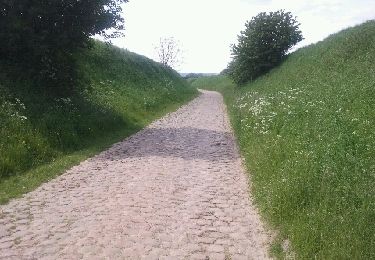
boucle autour de Maing


Mountain bike
Medium
Maing,
Hauts-de-France,
Nord,
France

16.5 km | 18.1 km-effort
2h 0min
Yes
Maing-circuit pas de boeuf, version 11km


Walking
Medium
Maing,
Hauts-de-France,
Nord,
France

11.2 km | 12.5 km-effort
2h 32min
Yes
Sortie VTT Porte du Hainaut - Wavrechain sous Denain


Mountain bike
Easy
Wavrechain-sous-Denain,
Hauts-de-France,
Nord,
France

54 km | 58 km-effort
2h 30min
Yes

rando des corbeaux


Walking
Easy
Quérénaing,
Hauts-de-France,
Nord,
France

8 km | 8.9 km-effort
2h 33min
Yes


 SityTrail


