![](/images/other/stat-length.png)
![Trail Walking Marche-en-Famenne - Transcalestienne MARCHE- ROCHEFORT Etape6(1) - Photo](https://media.geolcdn.com/t/1900/400/ext.pjpeg?maxdim=2&url=https%3A%2F%2Fstatic1.geolcdn.com%2Fsiteimages%2Fupload%2Ffiles%2F1553511878bg_sport_marche.png)
Transcalestienne MARCHE- ROCHEFORT Etape6(1)
so.duchateau
User
![Length](/images/other/stat-length.png)
![Max alt](https://static1.geolcdn.com/siteimages/upload/files/1508320355ic_sort_altitude_max_24dp.png)
![Uphill gradient](https://static1.geolcdn.com/siteimages/upload/files/1508320355ic_sort_den_pos_24dp.png)
![Km-Effort](/images/other/stat-length.png)
![Min alt](https://static1.geolcdn.com/siteimages/upload/files/1508320355ic_sort_altitude_min_24dp.png)
![Downhill gradient](https://static1.geolcdn.com/siteimages/upload/files/1508320355ic_sort_den_neg_24dp.png)
![Boucle](https://static1.geolcdn.com/siteimages/upload/files/16400158638029165_repeat_loop_refresh_sync_direction_icon.png)
![Walking](https://static1.geolcdn.com/sitytour/trail-icons/101.png)
4h00
Difficulty : Medium
![Scan this QR Code to open this trail in the SityTrail application](https://capi.geolives.com/qq0zvz2zws4bq2lad0pu/sitytour/trails/653594/qr.png?size=200)
FREE GPS app for hiking
About
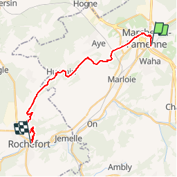
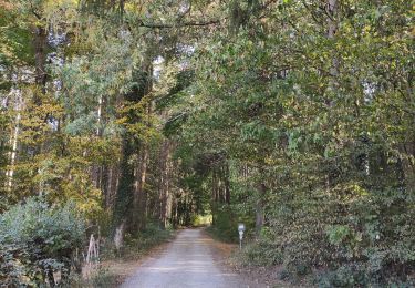
Trail Walking of 19.4 km to be discovered at Wallonia, Luxembourg, Marche-en-Famenne. This trail is proposed by so.duchateau.
Description
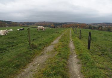
Après la découverte de Marche, direction le village d'Humain au relief accidenté et varié. Le village d'Humain compte quelques fermes de calcaire en long ou en U des 18 et 19 ème siècles ainsi que la ferme des moines datant du 17ème.
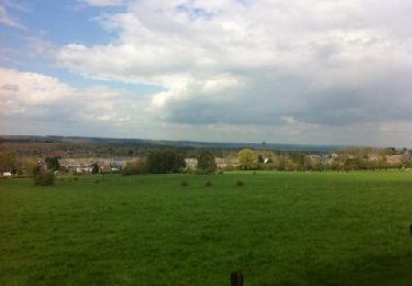
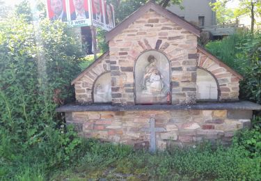
Passage devant l'Abbaye Notre-Dame de Saint-Rémy où est brassée la Trappiste de Rochefort.
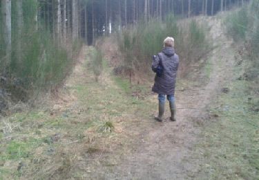
Sur le chemin, les carrières de la Martinette et son magnifique porche.
Tous les détails de cette étape :
www.cerclepegase.be/sejours/transcalestienne/transcalestienne11.htm
Positioning
Comments
Trails nearby
![Walking Walking](https://static1.geolcdn.com/sitytour/trail-icons/101.png)
Walking
![](/images/other/stat-length.png)
![](https://static1.geolcdn.com/siteimages/upload/files/16400158638029165_repeat_loop_refresh_sync_direction_icon.png)
![Trail Walking Marche-en-Famenne - Walk through the Hedrée valley - Photo](https://media.geolcdn.com/t/375/260/ab1d5669-7ecf-451e-a04e-4f6f7bcd2b0a.jpg&format=jpg&maxdim=2)
![Walking Walking](https://static1.geolcdn.com/sitytour/trail-icons/101.png)
Walking
![](/images/other/stat-length.png)
![](https://static1.geolcdn.com/siteimages/upload/files/16400158638029165_repeat_loop_refresh_sync_direction_icon.png)
![Walking Walking](https://static1.geolcdn.com/sitytour/trail-icons/101.png)
Walking
![](/images/other/stat-length.png)
![](https://static1.geolcdn.com/siteimages/upload/files/16400158638029165_repeat_loop_refresh_sync_direction_icon.png)
![Trail Walking Marche-en-Famenne - Champlon - Boucle qui alterne sous-bois et vues dégagées à 360°. Larges sentiers caillouteux et un peu de macadam. - Photo](https://media.geolcdn.com/t/375/260/f9518a34-3708-4717-a5a9-ec6d14ee87bd.jpg&format=jpg&maxdim=2)
![Walking Walking](https://static1.geolcdn.com/sitytour/trail-icons/101.png)
Walking
![](/images/other/stat-length.png)
![](https://static1.geolcdn.com/siteimages/upload/files/16400158638029165_repeat_loop_refresh_sync_direction_icon.png)
![Trail Walking Marche-en-Famenne - Aye chapelle + Gerny - Photo](https://media.geolcdn.com/t/375/260/ext.jpg?maxdim=2&url=https%3A%2F%2Fservices.sitytrail.com%2FGeolivesWS%2FDownloadMedia.ashx%3FTrailID%3D122579%26Media%3D20120420144516.jpg)
![Walking Walking](https://static1.geolcdn.com/sitytour/trail-icons/101.png)
Walking
![](/images/other/stat-length.png)
![](https://static1.geolcdn.com/siteimages/upload/files/16400158638029165_repeat_loop_refresh_sync_direction_icon.png)
![Trail Walking Marche-en-Famenne - Randoguide - Photo](https://media.geolcdn.com/t/375/260/ext.jpg?maxdim=2&url=https%3A%2F%2Fservices.sitytrail.com%2FGeolivesWS%2FDownloadMedia.ashx%3FTrailID%3D116543%26Media%3D20120310173342.jpeg)
![Walking Walking](https://static1.geolcdn.com/sitytour/trail-icons/101.png)
Walking
![](/images/other/stat-length.png)
![](https://static1.geolcdn.com/siteimages/upload/files/16400158638029165_repeat_loop_refresh_sync_direction_icon.png)
![Trail Walking Marche-en-Famenne - 20241015 - TOTEMUS MARCHE-EN-FAMENNE - 4.4 Km - Photo](https://media.geolcdn.com/t/375/260/83de28bf-aa3f-481a-9234-074e387477d3.jpeg&format=jpg&maxdim=2)
![Walking Walking](https://static1.geolcdn.com/sitytour/trail-icons/101.png)
Walking
![](/images/other/stat-length.png)
![](https://static1.geolcdn.com/siteimages/upload/files/16400158638029165_repeat_loop_refresh_sync_direction_icon.png)
![Trail Walking Marche-en-Famenne - Marche ADEPS 10km100 à Waha. - Photo](https://media.geolcdn.com/t/375/260/378b7256-ac9a-4615-8a02-61978d6d067a.jpg&format=jpg&maxdim=2)
![Walking Walking](https://static1.geolcdn.com/sitytour/trail-icons/101.png)
Walking
![](/images/other/stat-length.png)
![](https://static1.geolcdn.com/siteimages/upload/files/16400158638029165_repeat_loop_refresh_sync_direction_icon.png)
![Trail Walking Marche-en-Famenne - 5km ADEPS à Marche en Famenne - Photo](https://media.geolcdn.com/t/375/260/f5ab1d79-2bd0-4221-b395-b94689fafc98.jpg&format=jpg&maxdim=2)
![Walking Walking](https://static1.geolcdn.com/sitytour/trail-icons/101.png)
Walking
![](/images/other/stat-length.png)
![](https://static1.geolcdn.com/siteimages/upload/files/16400158638029165_repeat_loop_refresh_sync_direction_icon.png)