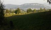
Trail Walking Vaulx - VAULX - Photo
 HERRY
HERRY

User GUIDE

© OpenStreetMap contributors
Length
Length
8.8 km
Max alt
Max alt
696 m
Uphill gradient
Uphill gradient
272 m
Km-Effort
Km-Effort  
12.5 km
Min alt
Min alt
520 m
Downhill gradient
Downhill gradient
272 m
Boucle
Boucle
Yes
Creation date :
2016-10-12 00:00:00.0
Updated on :
2016-10-12 00:00:00.0

(0 Reviews)

Walking
Walking
2h12
Difficulty : Easy

Scan this QR Code to open this trail in the SityTrail application

FREE GPS app for hiking

Logo SityTrail SityTrail

IGN / Geographical institutes

Download SityTrail from the App Store Download SityTrail from Google Play

Logo SityTrail SityTrail World

The world is yours!

Download SityTrail from the App Store Download SityTrail from Google Play Download SityTrail on Huawei AppGallery

About

Trail Walking of 8.8 km to be discovered at Auvergne-Rhône-Alpes, Upper Savoy, Vaulx. This trail is proposed by HERRY.

Description

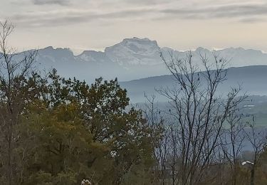
Promenade familiale relativement facile (290m de dénivelé pour 2H30 à 3H). Se garer au parking de l'église.Suivre sur 200m la route de Sillingy puis tourner à gauche pour trouver le balisage jaune avec panneau.Rejoindre la route de St Eusèbe que l'on quitte au bout de 200m pour prendre le chemin des Marguettes. Montée assez raide vers le bois des frênes.Au point1 restez sur votre droite et suivre la balise jaune pour rejoindre le centre équestre.Restez sur votre gauche pour aller au hameau de Frêne dessus puis suivez le chemin d'Angely qui sera indiqué jusqu'au Biolley.Passage au point 2 avec une belle vue sur Sillingy et la Mandallaz puis restez sur votre droite pour rejoindre le Biolley.Descendez tout droit pour atteindre la chapelle (point3). Prenez le chemin sur la droite qui vous mènera le long du ruisseau à la station d'épuration.Restez sur votre droite puis par le chemin du marais rejoignez le  point de départ.

Elevation profile

Photos

Points of interest

Point of interest Sillingy - Point 2 - Photo
HERRY
SILLINGY 
Point of interest Vaulx - Point 3 - Photo
HERRY
VAULX 
Point of interest Vaulx - POINT1 - Photo
HERRY
VAULX 

Positioning

Country:
France
Region :
Auvergne-Rhône-Alpes
Department/Province :
Upper Savoy
Municipality :
Vaulx
Location:
Unknown
Start:(UTM)
732464 ; 5090485 (31T) N.

Trails nearby

Trail Walking Chavanod - CHAVANOD - Photo
Walking
GUIDE
HERRY

Walking

Easy
(1)
Chavanod, Auvergne-Rhône-Alpes, Upper Savoy, France
8.9 km | 12.8 km-effort
2h 34min
Yes
Trail Walking Lovagny - 28/02/2022 - Gorges du Fier - Nonglard - Lovagny - Chavanod - Photo
Walking
GUIDE
Kargil

Walking

Medium
Lovagny, Auvergne-Rhône-Alpes, Upper Savoy, France
20 km | 28 km-effort
5h 11min
Yes
Trail Walking Sales - Pont Coppet - Photo
Walking
GUIDE
HERRY

Walking

Sales, Auvergne-Rhône-Alpes, Upper Savoy, France
8.6 km | 10.2 km-effort
1h 53min
Yes
Trail Mountain bike La Balme-de-Sillingy - MANDALLAZ super, pas pour débutant.  - Photo
Mountain bike
TFOLCHER

Mountain bike

Difficult
(1)
La Balme-de-Sillingy, Auvergne-Rhône-Alpes, Upper Savoy, France
17.2 km | 25 km-effort
2h 34min
No
Trail Walking Vaulx - Autour de la commune de Vaulx 74150  - Photo
Walking
GuyCharvier

Walking

Easy
Vaulx, Auvergne-Rhône-Alpes, Upper Savoy, France
14.4 km | 19.6 km-effort
3h 49min
Yes
Trail Walking Chavanod - CHAVANOD ... vers Montagny-les-Lanches. - Photo
Walking
GerardBouche

Walking

Easy
Chavanod, Auvergne-Rhône-Alpes, Upper Savoy, France
8.4 km | 10.7 km-effort
2h 5min
Yes
Trail Walking Chavanod - CHAVANOD ... les Gorges du Fier.  - Photo
Walking
GerardBouche

Walking

Medium
Chavanod, Auvergne-Rhône-Alpes, Upper Savoy, France
8 km | 10.8 km-effort
2h 20min
Yes
Trail sport Lovagny - 20230411 RANDONNÉE LOVAGNY - Photo
sport
Fabien.LOPEZ

sport

Very easy
Lovagny, Auvergne-Rhône-Alpes, Upper Savoy, France
5 km | 7.5 km-effort
Unknown
Yes
Trail Walking Nonglard - Nonglard - Photo
Walking
jpbo

Walking

Very easy
Nonglard, Auvergne-Rhône-Alpes, Upper Savoy, France
7.3 km | 10.8 km-effort
2h 37min
No


Close
My subscriptions