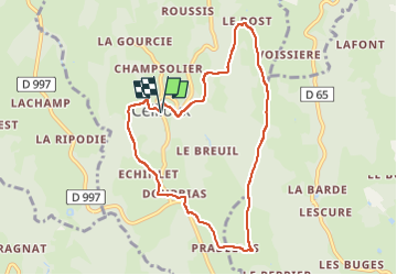
![](/images/other/stat-length.png)
Ceilloux_Bost
jagarnier
User GUIDE
![Length](/images/other/stat-length.png)
![Max alt](https://static1.geolcdn.com/siteimages/upload/files/1508320355ic_sort_altitude_max_24dp.png)
![Uphill gradient](https://static1.geolcdn.com/siteimages/upload/files/1508320355ic_sort_den_pos_24dp.png)
![Km-Effort](/images/other/stat-length.png)
![Min alt](https://static1.geolcdn.com/siteimages/upload/files/1508320355ic_sort_altitude_min_24dp.png)
![Downhill gradient](https://static1.geolcdn.com/siteimages/upload/files/1508320355ic_sort_den_neg_24dp.png)
![Boucle](https://static1.geolcdn.com/siteimages/upload/files/16400158638029165_repeat_loop_refresh_sync_direction_icon.png)
![Walking](https://static1.geolcdn.com/sitytour/trail-icons/101.png)
2h30
Difficulty : Easy
![Scan this QR Code to open this trail in the SityTrail application](https://capi.geolives.com/qq0zvz2zws4bq2lad0pu/sitytour/trails/643154/qr.png?size=200)
FREE GPS app for hiking
About
Trail Walking of 8.3 km to be discovered at Auvergne-Rhône-Alpes, Puy-de-Dôme, Ceilloux. This trail is proposed by jagarnier.
Description
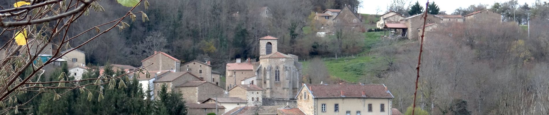
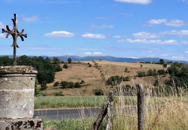
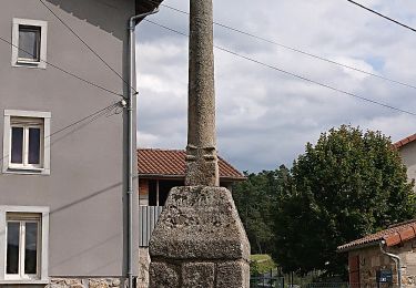
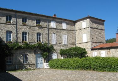
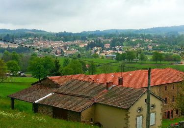
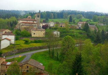
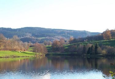
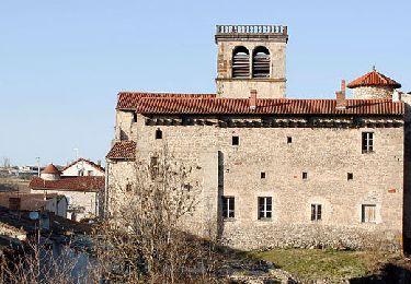
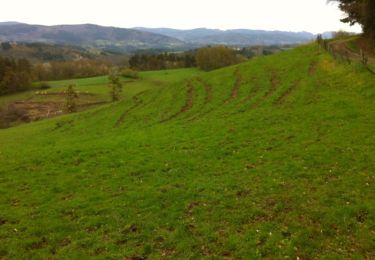
Une belle randonnée dans un remarquable patrimoine architectural et un paysage bocager, depuis le village en granit de Ceilloux et son prieuré. Suivent, la ferme fortifiée du Bost, les cabanes en pierre de Dourbias, le château des Martinanges et la chaumière de la Cissartie.
Positioning
Comments
Trails nearby
![Trail Walking Domaize - Domaize_Ronde_Fruits - Photo](https://media.geolcdn.com/t/375/260/f4a9ee34-bc35-4d34-92f2-e24618419a1f.jpg&format=jpg&maxdim=2)
![Walking Walking](https://static1.geolcdn.com/sitytour/trail-icons/101.png)
Walking
![](/images/other/stat-length.png)
![](https://static1.geolcdn.com/siteimages/upload/files/16400158638029165_repeat_loop_refresh_sync_direction_icon.png)
![Trail On foot Ceilloux - Le Chemin du Bost - Photo](https://media.geolcdn.com/t/375/260/ba816805-0ba6-4be0-9595-fd3279994b1d.jpeg&format=jpg&maxdim=2)
![On foot On foot](https://static1.geolcdn.com/sitytour/trail-icons/100.png)
On foot
![](/images/other/stat-length.png)
![](https://static1.geolcdn.com/siteimages/upload/files/16400158638029165_repeat_loop_refresh_sync_direction_icon.png)
![Trail On foot Saint-Dier-d'Auvergne - Des Ribes au Miodet - Photo](https://media.geolcdn.com/t/375/260/3eaf22db-7235-4d7c-b6de-2e786297c48d.jpeg&format=jpg&maxdim=2)
![On foot On foot](https://static1.geolcdn.com/sitytour/trail-icons/100.png)
On foot
![](/images/other/stat-length.png)
![](https://static1.geolcdn.com/siteimages/upload/files/16400158638029165_repeat_loop_refresh_sync_direction_icon.png)
![Trail On foot Cunlhat - La Pointe du Jour - Photo](https://media.geolcdn.com/t/375/260/2fa8e53b-b8eb-4d5b-89fc-8615fa6c98ff.jpeg&format=jpg&maxdim=2)
![On foot On foot](https://static1.geolcdn.com/sitytour/trail-icons/100.png)
On foot
![](/images/other/stat-length.png)
![](https://static1.geolcdn.com/siteimages/upload/files/16400158638029165_repeat_loop_refresh_sync_direction_icon.png)
![Trail On foot Auzelles - La Croix de Pradier - Photo](https://media.geolcdn.com/t/375/260/329d3c5e-d331-4c34-925f-d6dc7365d10e.jpeg&format=jpg&maxdim=2)
![On foot On foot](https://static1.geolcdn.com/sitytour/trail-icons/100.png)
On foot
![](/images/other/stat-length.png)
![](https://static1.geolcdn.com/siteimages/upload/files/16400158638029165_repeat_loop_refresh_sync_direction_icon.png)
![Trail Walking Tours-sur-Meymont - Tours_Meymont_Gorges_Dore - Photo](https://media.geolcdn.com/t/375/260/63fd52ef-9088-4caf-ab22-5e5d95806189.jpg&format=jpg&maxdim=2)
![Walking Walking](https://static1.geolcdn.com/sitytour/trail-icons/101.png)
Walking
![](/images/other/stat-length.png)
![](https://static1.geolcdn.com/siteimages/upload/files/16400158638029165_repeat_loop_refresh_sync_direction_icon.png)
![Trail Walking Cunlhat - Cunlhat_Pointe_Jour - Photo](https://media.geolcdn.com/t/375/260/28565595-e7b6-4d92-8863-622673064867.jpg&format=jpg&maxdim=2)
![Walking Walking](https://static1.geolcdn.com/sitytour/trail-icons/101.png)
Walking
![](/images/other/stat-length.png)
![](https://static1.geolcdn.com/siteimages/upload/files/16400158638029165_repeat_loop_refresh_sync_direction_icon.png)
![Trail Walking Saint-Dier-d'Auvergne - St_Dier_Ribes_Miodet - Photo](https://media.geolcdn.com/t/375/260/1ad077f2-ac13-4fa4-8893-456994b8d19d.jpg&format=jpg&maxdim=2)
![Walking Walking](https://static1.geolcdn.com/sitytour/trail-icons/101.png)
Walking
![](/images/other/stat-length.png)
![](https://static1.geolcdn.com/siteimages/upload/files/16400158638029165_repeat_loop_refresh_sync_direction_icon.png)
![Trail Walking Tours-sur-Meymont - De Tours sur Meymont au Moulin du Garret - Photo](https://media.geolcdn.com/t/375/260/ext.jpg?maxdim=2&url=https%3A%2F%2Fservices.sitytrail.com%2FGeolivesWS%2FDownloadMedia.ashx%3FTrailID%3D129777%26Media%3D13320_3.jpg)
![Walking Walking](https://static1.geolcdn.com/sitytour/trail-icons/101.png)
Walking
![](/images/other/stat-length.png)
![](https://static1.geolcdn.com/siteimages/upload/files/16400158638029165_repeat_loop_refresh_sync_direction_icon.png)