8.7 km | 10.4 km-effort
Rando Douce 1 Le boisgeloup - Gisors
marcel.F
User
Length
6.5 km
Max alt
149 m
Uphill gradient
97 m
Km-Effort
7.8 km
Min alt
68 m
Downhill gradient
95 m
Boucle
Yes
Creation date :
2019-04-01 20:23:18.336
Updated on :
2019-04-10 13:47:55.515
2h00
Difficulty : Medium
FREE GPS app for hiking
About
Trail Walking of 6.5 km to be discovered at Normandy, Eure, Gisors. This trail is proposed by marcel.F.
Description
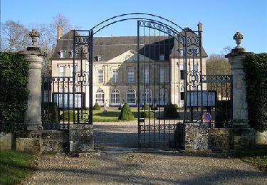
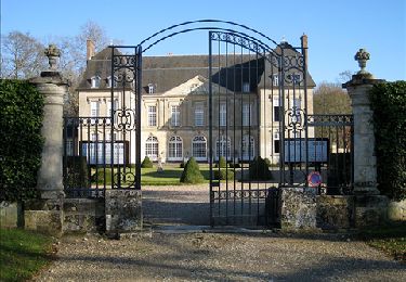
rendez vous près du château de Boisgeloup en face atelier Picasso au Boisgeloup (Gisors)
Positioning
Country:
France
Region :
Normandy
Department/Province :
Eure
Municipality :
Gisors
Location:
Unknown
Start:(Dec)
Start:(UTM)
411262 ; 5456741 (31U) N.
Comments
Trails nearby
Delincourt, Le Mesnil, Reilly, La vierge, Delincourt
Walking
Medium
(1)
Delincourt,
Hauts-de-France,
Oise,
France
2h 16min
Yes
Boury en Vexin - Hérouval
Walking
Easy
(3)
Boury-en-Vexin,
Hauts-de-France,
Oise,
France
10.9 km | 12.9 km-effort
2h 49min
Yes
Vaudancourt - Breuil et Boury
Walking
Easy
(1)
Vaudancourt,
Hauts-de-France,
Oise,
France
11.8 km | 14.3 km-effort
3h 5min
Yes
Marche Nordique 75 Boury en Vexin
Nordic walking
Easy
(1)
Boury-en-Vexin,
Hauts-de-France,
Oise,
France
10.3 km | 12.6 km-effort
1h 30min
Yes
Marche Nordique 71 Courcelles les Gisors
Nordic walking
Very easy
(2)
Courcelles-lès-Gisors,
Hauts-de-France,
Oise,
France
9.2 km | 10.9 km-effort
1h 26min
Yes
CHAMBORS - Lattainville-Delincourt-Reillly
Walking
Very easy
(1)
Chambors,
Hauts-de-France,
Oise,
France
12.3 km | 15.2 km-effort
2h 54min
Yes
Marche Nordique 61 Chambors
Nordic walking
Easy
(1)
Chambors,
Hauts-de-France,
Oise,
France
8.4 km | 10.3 km-effort
1h 30min
Yes
Trie Château - La vallée de l'Aunette
Walking
Difficult
(1)
Trie-Château,
Hauts-de-France,
Oise,
France
11.8 km | 13.7 km-effort
3h 0min
Yes
Montjavoult - Vaudancourt
Walking
Easy
(1)
Montjavoult,
Hauts-de-France,
Oise,
France
10.2 km | 12.2 km-effort
2h 39min
Yes