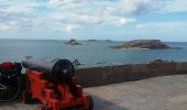
Trail Cycle Isigny-le-Buat - Véloscénie 4ème étape - Photo

Véloscénie 4ème étape

 destras
destras

User

© OpenStreetMap contributors
Length
Length
120 km
Max alt
Max alt
80 m
Uphill gradient
Uphill gradient
817 m
Km-Effort
Km-Effort  
131 km
Min alt
Min alt
0 m
Downhill gradient
Downhill gradient
826 m
Boucle
Boucle
No
Creation date :
2016-09-26 00:00:00.0
Updated on :
2016-09-26 00:00:00.0

(0 Reviews)

Cycle
Cycle
6h50
Difficulty : Easy

Scan this QR Code to open this trail in the SityTrail application

FREE GPS app for hiking

Logo SityTrail SityTrail

IGN / Geographical institutes

Download SityTrail from the App Store Download SityTrail from Google Play

Logo SityTrail SityTrail World

The world is yours!

Download SityTrail from the App Store Download SityTrail from Google Play Download SityTrail on Huawei AppGallery

About

Trail Cycle of 120 km to be discovered at Normandy, Manche, Isigny-le-Buat. This trail is proposed by destras.

Description

De Saint-Hilaire-du-Harcouët à Lancieux. J'ai prolongé la Véloscénie par la route direction Roscoff. VTC conseillé. Ne faite pas la même erreur que moi, prenez le bateau à Saint-Malo pour traverser la Rance juqu'à Dinar. Ainsi vous éviterez ainsi la 2 x 2 voies qui passe par le pont de la centrale électrique EDF sur la Rance.  

Elevation profile

Photos

Positioning

Country:
France
Region :
Normandy
Department/Province :
Manche
Municipality :
Isigny-le-Buat
Location:
Chalandrey
Start:(UTM)
631433 ; 5388660 (30U) N.

Trails nearby

Trail Running Saint-Laurent-de-Terregatte - Autour de la Roche qui Boit - Photo
Running
tracegps

Running

Very difficult
Saint-Laurent-de-Terregatte, Normandy, Manche, France
12.4 km | 16.7 km-effort
1h 30min
Yes
Trail Walking Saint-Laurent-de-Terregatte - Autour de la Roche qui Boit - Photo
Walking
tracegps

Walking

Very difficult
Saint-Laurent-de-Terregatte, Normandy, Manche, France
12.4 km | 16.7 km-effort
3h 30min
Yes
Trail Running Le Mesnil-Ozenne - Le Mesnil Ozenne - Photo
Running
tracegps

Running

Difficult
Le Mesnil-Ozenne, Normandy, Manche, France
4 km | 5.3 km-effort
19min
Yes
Trail Mountain bike Le Mesnil-Ozenne - Le Mesnil Ozenne - Photo
Mountain bike
tracegps

Mountain bike

Easy
Le Mesnil-Ozenne, Normandy, Manche, France
4 km | 5.3 km-effort
15min
Yes
Trail Walking Le Mesnil-Ozenne - Le Mesnil Ozenne - Photo
Walking
tracegps

Walking

Medium
Le Mesnil-Ozenne, Normandy, Manche, France
4 km | 5.3 km-effort
45min
Yes
Trail Walking Isigny-le-Buat - Randonnée Mont Saint Michel 4 partie - Photo
Walking
renauddefroidmont

Walking

Medium
Isigny-le-Buat, Normandy, Manche, France
30 km | 33 km-effort
7h 31min
No
Trail Walking Isigny-le-Buat - le sentier 4 - Photo
Walking
Huangdi

Walking

Very easy
Isigny-le-Buat, Normandy, Manche, France
29 km | 32 km-effort
7h 28min
No
Trail On foot Saint-Laurent-de-Terregatte - Barage de Vezins - Vers Saint James - Photo
On foot
pierre45

On foot

Easy
Saint-Laurent-de-Terregatte, Normandy, Manche, France
15.1 km | 20 km-effort
Unknown
Yes
Trail Walking Ducey-les-Chéris - DUCEY ---COURTILS - Photo
Walking
Bernardroland

Walking

Easy
Ducey-les-Chéris, Normandy, Manche, France
15 km | 16.1 km-effort
3h 51min
No


Close
My subscriptions