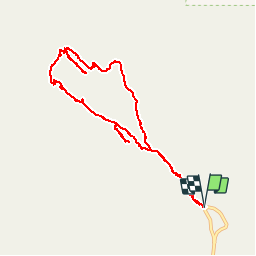
Trail Walking Unknown - devil's Garden  - Photo
 phi14
phi14

User

© OpenStreetMap contributors
Length
Length
10.7 km
Max alt
Max alt
1679 m
Uphill gradient
Uphill gradient
273 m
Km-Effort
Km-Effort  
14.4 km
Min alt
Min alt
1539 m
Downhill gradient
Downhill gradient
277 m
Boucle
Boucle
Yes
Creation date :
2016-11-02 00:00:00.0
Updated on :
2016-11-02 00:00:00.0

(0 Reviews)

Walking
Walking
3h14
Difficulty : Medium

Scan this QR Code to open this trail in the SityTrail application

FREE GPS app for hiking

Logo SityTrail SityTrail

IGN / Geographical institutes

Download SityTrail from the App Store Download SityTrail from Google Play

Logo SityTrail SityTrail World

The world is yours!

Download SityTrail from the App Store Download SityTrail from Google Play Download SityTrail on Huawei AppGallery

About

Trail Walking of 10.7 km to be discovered at Utah, Grand County. This trail is proposed by phi14.

Description

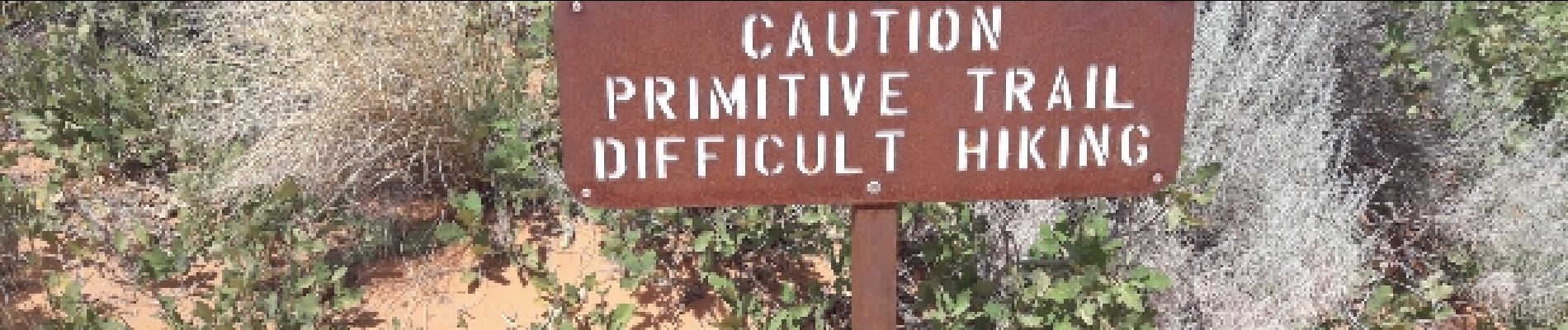
superbe randonnée. faire le primitive trail à la descente.

Elevation profile

Photos

Positioning

Country:
United States
Region :
Utah
Department/Province :
Grand County
Municipality :
Unknown
Location:
Unknown
Start:(UTM)
622016 ; 4293635 (12S) N.

Trails nearby

Trail Walking  - devil's garden et retour par le primitive trail - Photo
Walking
Lobin

Walking

Difficult
, Utah, Grand County, United States
10.7 km | 14.3 km-effort
3h 21min
Yes
Trail Walking  - Arches - Devils garden  - Photo
Walking
jcolonnadelega

Walking

Very easy
, Utah, Grand County, United States
10.2 km | 13.9 km-effort
3h 28min
No


Close
My subscriptions