Trail Walking Orcières - Sommet Drouvet - Dormillouse  - Photo
 Joludov
Joludov

User

© OpenStreetMap contributors
Length
Length
14.7 km
Max alt
Max alt
2782 m
Uphill gradient
Uphill gradient
386 m
Km-Effort
Km-Effort  
23 km
Min alt
Min alt
1681 m
Downhill gradient
Downhill gradient
1253 m
Boucle
Boucle
No
Creation date :
2016-08-29 00:00:00.0
Updated on :
2016-08-29 00:00:00.0

(0 Reviews)

Walking
Walking
6h31
Difficulty : Easy

Scan this QR Code to open this trail in the SityTrail application

FREE GPS app for hiking

Logo SityTrail SityTrail

IGN / Geographical institutes

Download SityTrail from the App Store Download SityTrail from Google Play

Logo SityTrail SityTrail World

The world is yours!

Download SityTrail from the App Store Download SityTrail from Google Play Download SityTrail on Huawei AppGallery

About

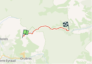
Trail Walking of 14.7 km to be discovered at Provence-Alpes-Côte d'Azur, Hautes-Alpes, Orcières. This trail is proposed by Joludov.

Description

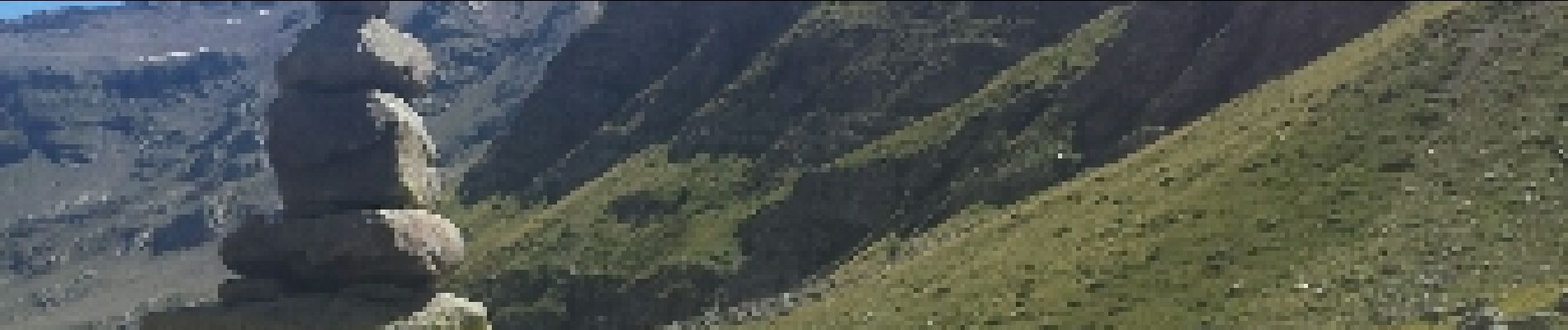
Lac des Estaris, Col de Freissinieres puis torent de Chichin.

Elevation profile

Photos

Points of interest

Point of interest Freissinières - Point 7 - Photo
Joludov
FREISSINIÈRES 

Positioning

Country:
France
Region :
Provence-Alpes-Côte d'Azur
Department/Province :
Hautes-Alpes
Municipality :
Orcières
Location:
Unknown
Start:(Dec)
Start:(UTM)
287607 ; 4955647 (32T) N.

Trails nearby

Trail Walking Orcières - Le Forest des marches - Photo
Walking
GUIDE
nadinebondoux

Walking

Easy
(2)
Orcières, Provence-Alpes-Côte d'Azur, Hautes-Alpes, France
6.3 km | 9.9 km-effort
1h 42min
Yes
Trail Walking Orcières - R45   Marmottes a Prapic - Photo
Walking
GUIDE+

Walking

Medium
(2)
Orcières, Provence-Alpes-Côte d'Azur, Hautes-Alpes, France
9 km | 14 km-effort
2h 57min
Yes
Trail Walking Orcières - Orcieres (Hautes Alpes) - Photo
Walking
ISATR

Walking

Very difficult
(1)
Orcières, Provence-Alpes-Côte d'Azur, Hautes-Alpes, France
12 km | 19.4 km-effort
4h 24min
Yes
Trail Walking Champoléon - Lac Surat ou lac de Prelle - Photo
Walking
GUIDE
Marco05

Walking

Very difficult
Champoléon, Provence-Alpes-Côte d'Azur, Hautes-Alpes, France
16.3 km | 30 km-effort
6h 50min
Yes
Trail Walking Orcières - Roc Diolon par le col de Fressinieres 11/08/23 - Photo
Walking
GUIDE
R@ph

Walking

Very difficult
Orcières, Provence-Alpes-Côte d'Azur, Hautes-Alpes, France
16.3 km | 32 km-effort
7h 21min
Yes
Trail Touring skiing Orcières - L'homme de Prapic  - Photo
Touring skiing
GUIDE
nadd73

Touring skiing

Medium
Orcières, Provence-Alpes-Côte d'Azur, Hautes-Alpes, France
15.8 km | 33 km-effort
4h 34min
Yes
Trail Walking Orcières - Saut du Laire - Photo
Walking
GUIDE
Marco05

Walking

Medium
Orcières, Provence-Alpes-Côte d'Azur, Hautes-Alpes, France
11.4 km | 18.9 km-effort
4h 17min
Yes
Trail On foot Champoléon - Refuge du Tourond - Photo
On foot
GUIDE
Marco05

On foot

Easy
Champoléon, Provence-Alpes-Côte d'Azur, Hautes-Alpes, France
8.4 km | 14.2 km-effort
3h 14min
Yes
Trail Walking Champoléon - Méollion - Photo
Walking
GUIDE
Marco05

Walking

Medium
Champoléon, Provence-Alpes-Côte d'Azur, Hautes-Alpes, France
7.5 km | 13.7 km-effort
2h 59min
Yes


Close
My subscriptions