Trail Mountain bike Ancizan - Zevtt - Lac de Payolle - Photo

Zevtt - Lac de Payolle

 kipoura
kipoura

User

© OpenStreetMap contributors
Length
Length
34 km
Max alt
Max alt
1644 m
Uphill gradient
Uphill gradient
1166 m
Km-Effort
Km-Effort  
49 km
Min alt
Min alt
1061 m
Downhill gradient
Downhill gradient
1155 m
Boucle
Boucle
Yes
Creation date :
2019-05-03 17:09:52.402
Updated on :
2019-05-03 17:09:52.467

(0 Reviews)

Mountain bike
Mountain bike
3h11
Difficulty : Difficult

Scan this QR Code to open this trail in the SityTrail application

FREE GPS app for hiking

Logo SityTrail SityTrail

IGN / Geographical institutes

Download SityTrail from the App Store Download SityTrail from Google Play

Logo SityTrail SityTrail World

The world is yours!

Download SityTrail from the App Store Download SityTrail from Google Play Download SityTrail on Huawei AppGallery

About

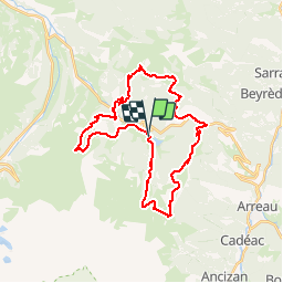
Trail Mountain bike of 34 km to be discovered at Occitania, Hautespyrenees, Ancizan. This trail is proposed by kipoura.

Description

Une virée VTT bien physique et ludique au départ du Lac de Payolle .....

Elevation profile

Positioning

Country:
France
Region :
Occitania
Department/Province :
Hautespyrenees
Municipality :
Ancizan
Location:
Unknown
Start:(UTM)
278991 ; 4757525 (31T) N.

Trails nearby

Trail Walking Esparros - Du Signal de Bassia vers le col de Beyrède par la crête sud-est et le Pas de Bassia - Photo
Walking
2034

Walking

Medium
(9)
Esparros, Occitania, Hautespyrenees, France
3.2 km | 5.1 km-effort
48min
No
Trail Walking Ancizan - Lac d'Arou - Payolle - Photo
Walking
tracegps

Walking

Medium
(4)
Ancizan, Occitania, Hautespyrenees, France
9.8 km | 14.9 km-effort
3h 30min
Yes
Trail Walking Ancizan - Vallée de la Gaoube - Photo
Walking
bliguet

Walking

Medium
(1)
Ancizan, Occitania, Hautespyrenees, France
6.6 km | 9.1 km-effort
4h 49min
Yes
Trail Walking Beyrède-Jumet-Camous - Signal de Bassia de Hèche - Photo
Walking
tracegps

Walking

Very difficult
(1)
Beyrède-Jumet-Camous, Occitania, Hautespyrenees, France
3.1 km | 8.2 km-effort
3h 30min
No
Trail On foot Campan - Boucle d'Espiadet - Photo
On foot
GUIDE+

On foot

Easy
Campan, Occitania, Hautespyrenees, France
4.2 km | 6.3 km-effort
1h 25min
No
Trail Walking Ancizan - Soum de Coste Oueillère - Photo
Walking
GUIDE
lhomme.ph

Walking

Difficult
(1)
Ancizan, Occitania, Hautespyrenees, France
9.6 km | 23 km-effort
4h 26min
Yes
Trail Walking Beyrède-Jumet-Camous - Le signal de Bassia depuis le col de Beyrède - Photo
Walking
2033

Walking

Medium
(3)
Beyrède-Jumet-Camous, Occitania, Hautespyrenees, France
4.1 km | 10.3 km-effort
1h 53min
Yes
Trail Walking Campan - Pic de  Bassia, Pic du Castillon, Pic de Paou - Photo
Walking
Prala

Walking

Very easy
(1)
Campan, Occitania, Hautespyrenees, France
10.3 km | 22 km-effort
3h 52min
No
Trail Snowshoes Campan - raquet 1 - Photo
Snowshoes
eliott3

Snowshoes

Easy
(1)
Campan, Occitania, Hautespyrenees, France
4.9 km | 7.2 km-effort
2h 10min
Yes


Close
My subscriptions