![](/images/other/stat-length.png)
![Trail Cycle Saint-Lô - 2016-Vélofrancette n° 9 - Photo](https://media.geolcdn.com/t/1900/400/ext.pjpeg?maxdim=2&url=https%3A%2F%2Fstatic1.geolcdn.com%2Fsiteimages%2Fupload%2Ffiles%2F1524743154velo.jpg)
2016-Vélofrancette n° 9
mimi53
User
![Length](/images/other/stat-length.png)
Length
34 km
![Max alt](https://static1.geolcdn.com/siteimages/upload/files/1508320355ic_sort_altitude_max_24dp.png)
Max alt
69 m
![Uphill gradient](https://static1.geolcdn.com/siteimages/upload/files/1508320355ic_sort_den_pos_24dp.png)
Uphill gradient
298 m
![Km-Effort](/images/other/stat-length.png)
Km-Effort
37 km
![Min alt](https://static1.geolcdn.com/siteimages/upload/files/1508320355ic_sort_altitude_min_24dp.png)
Min alt
9 m
![Downhill gradient](https://static1.geolcdn.com/siteimages/upload/files/1508320355ic_sort_den_neg_24dp.png)
Downhill gradient
263 m
![Boucle](https://static1.geolcdn.com/siteimages/upload/files/16400158638029165_repeat_loop_refresh_sync_direction_icon.png)
Boucle
No
Creation date :
2019-02-23 20:41:10.42
Updated on :
2019-02-23 20:41:10.632
![Cycle](https://static1.geolcdn.com/sitytour/trail-icons/200.png)
2h11
Difficulty : Easy
![Scan this QR Code to open this trail in the SityTrail application](https://capi.geolives.com/qq0zvz2zws4bq2lad0pu/sitytour/trails/612119/qr.png?size=200)
FREE GPS app for hiking
About
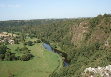
Trail Cycle of 34 km to be discovered at Normandy, Manche, Saint-Lô. This trail is proposed by mimi53.
Description
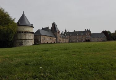
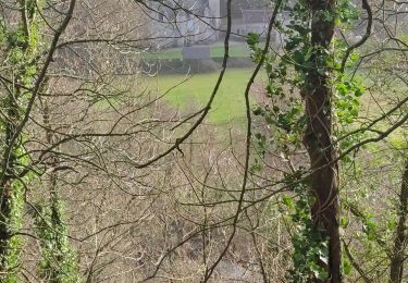
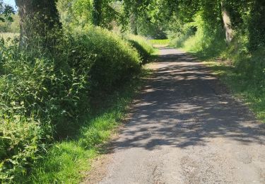
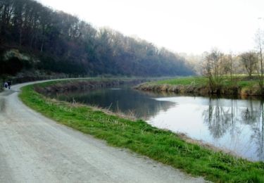
9 jours, Apres avoir passer un bonne nuit chez l habitant et avec un accueil chaleureux, on repart en direction de Pont Farcy en suivant le halage de la Vire
Positioning
Country:
France
Region :
Normandy
Department/Province :
Manche
Municipality :
Saint-Lô
Location:
Unknown
Start:(Dec)
Start:(UTM)
638635 ; 5442001 (30U) N.
Comments
Trails nearby
![Trail Walking Saint-Gilles - St Gilles Château de Canisy - Photo](https://media.geolcdn.com/t/375/260/db5febae-3142-43c2-8a06-1e780b067eee.jpg&format=jpg&maxdim=2)
![Walking Walking](https://static1.geolcdn.com/sitytour/trail-icons/101.png)
St Gilles Château de Canisy
Walking
Very easy
Saint-Gilles,
Normandy,
Manche,
France
![](/images/other/stat-length.png)
9 km | 10.7 km-effort
2h 26min
![](https://static1.geolcdn.com/siteimages/upload/files/16400158638029165_repeat_loop_refresh_sync_direction_icon.png)
Yes
![Trail Mountain bike Agneaux - L'Agnelaise 2014 - Agneaux - Photo](https://media.geolcdn.com/t/375/260/ext.jpg?maxdim=2&url=https%3A%2F%2Fservices.sitytrail.com%2FGeolivesWS%2FDownloadMedia.ashx%3FTrailID%3D317800%26Media%3D17129_4.jpg)
![Mountain bike Mountain bike](https://static1.geolcdn.com/sitytour/trail-icons/202.png)
L'Agnelaise 2014 - Agneaux
Mountain bike
Difficult
Agneaux,
Normandy,
Manche,
France
![](/images/other/stat-length.png)
44 km | 52 km-effort
3h 0min
![](https://static1.geolcdn.com/siteimages/upload/files/16400158638029165_repeat_loop_refresh_sync_direction_icon.png)
Yes
![Trail Walking Saint-Lô - Saint-Lô - La Vire et le Falaise - Photo](https://media.geolcdn.com/t/375/260/a4b62c59-4242-4d9f-b094-dbf8b73d474c.jpg&format=jpg&maxdim=2)
![Walking Walking](https://static1.geolcdn.com/sitytour/trail-icons/101.png)
Saint-Lô - La Vire et le Falaise
Walking
Easy
Saint-Lô,
Normandy,
Manche,
France
![](/images/other/stat-length.png)
5.4 km | 6.6 km-effort
1h 20min
![](https://static1.geolcdn.com/siteimages/upload/files/16400158638029165_repeat_loop_refresh_sync_direction_icon.png)
Yes
![Trail Walking Saint-Lô - BALLADE 2 JUIN - Photo](https://media.geolcdn.com/t/375/260/26c1ed40-ed31-4507-bef7-09f3441ee504.jpg&format=jpg&maxdim=2)
![Walking Walking](https://static1.geolcdn.com/sitytour/trail-icons/101.png)
BALLADE 2 JUIN
Walking
Very easy
Saint-Lô,
Normandy,
Manche,
France
![](/images/other/stat-length.png)
3.1 km | 3.7 km-effort
51min
![](https://static1.geolcdn.com/siteimages/upload/files/16400158638029165_repeat_loop_refresh_sync_direction_icon.png)
Yes
![Trail Walking Saint-Lô - Ballade 2 juin 2020 - Photo](https://media.geolcdn.com/t/375/260/0f66b39a-8cca-4e3f-ad8a-3abe33dff7b7.jpg&format=jpg&maxdim=2)
![Walking Walking](https://static1.geolcdn.com/sitytour/trail-icons/101.png)
Ballade 2 juin 2020
Walking
Very easy
Saint-Lô,
Normandy,
Manche,
France
![](/images/other/stat-length.png)
3.6 km | 4.2 km-effort
1h 2min
![](https://static1.geolcdn.com/siteimages/upload/files/16400158638029165_repeat_loop_refresh_sync_direction_icon.png)
Yes
![Trail Walking Saint-Lô - Ballade - Photo](https://media.geolcdn.com/t/375/260/0bb29947-3bff-4454-861d-57fdbde00341.jpg&format=jpg&maxdim=2)
![Walking Walking](https://static1.geolcdn.com/sitytour/trail-icons/101.png)
![Trail Walking Saint-Lô - Le Hutrel 27 ai 2020 - Photo](https://media.geolcdn.com/t/375/260/e03ee600-a6e3-4abf-99c3-6fe0b8bda48f.jpg&format=jpg&maxdim=2)
![Walking Walking](https://static1.geolcdn.com/sitytour/trail-icons/101.png)
Le Hutrel 27 ai 2020
Walking
Very easy
Saint-Lô,
Normandy,
Manche,
France
![](/images/other/stat-length.png)
2.3 km | 2.9 km-effort
48min
![](https://static1.geolcdn.com/siteimages/upload/files/16400158638029165_repeat_loop_refresh_sync_direction_icon.png)
Yes
![Trail Mountain bike Saint-Lô - Au pied des remparts de Saint-Lô - Photo](https://media.geolcdn.com/t/375/260/ext.jpg?maxdim=2&url=https%3A%2F%2Fservices.sitytrail.com%2FGeolivesWS%2FDownloadMedia.ashx%3FTrailID%3D111212%26Media%3D6737_1.jpg)
![Mountain bike Mountain bike](https://static1.geolcdn.com/sitytour/trail-icons/202.png)
Au pied des remparts de Saint-Lô
Mountain bike
Medium
Saint-Lô,
Normandy,
Manche,
France
![](/images/other/stat-length.png)
18.2 km | 23 km-effort
2h 0min
![](https://static1.geolcdn.com/siteimages/upload/files/16400158638029165_repeat_loop_refresh_sync_direction_icon.png)
Yes
![Trail Mountain bike Saint-Lô - Les Roches du Ham - Saint Lo - Photo](https://media.geolcdn.com/t/375/260/ext.jpg?maxdim=2&url=https%3A%2F%2Fservices.sitytrail.com%2FGeolivesWS%2FDownloadMedia.ashx%3FTrailID%3D106229%26Media%3D10554_2.jpg)
![Mountain bike Mountain bike](https://static1.geolcdn.com/sitytour/trail-icons/202.png)
Les Roches du Ham - Saint Lo
Mountain bike
Difficult
Saint-Lô,
Normandy,
Manche,
France
![](/images/other/stat-length.png)
31 km | 37 km-effort
2h 0min
![](https://static1.geolcdn.com/siteimages/upload/files/16400158638029165_repeat_loop_refresh_sync_direction_icon.png)
Yes