


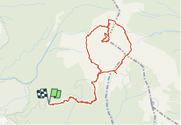


17.3 km | 37 km-effort


User


FREE GPS app for hiking
 SityTrail
IGN / Geographical institutes
SityTrail World
The world is yours!
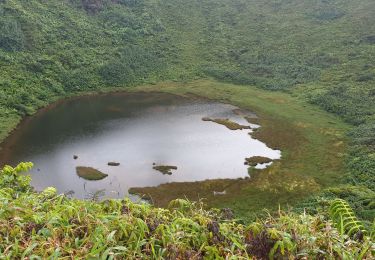
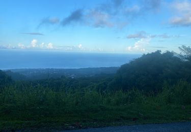
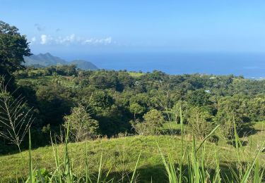
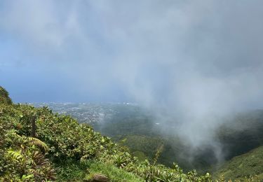
Trail Walking of 8.7 km to be discovered at Guadeloupe, Unknown, Saint-Claude. This trail is proposed by denis.petiaud.
Joli rando autour de la Soufrière en passant bien sûr par le sommet, avec à l'arrivée une mer de nuages. rando faite avec des enfants de 8 et 6 ans qui marche bien
Other activity
Walking
Walking
Walking

Walking
Trail
Trail
Trail
Walking