Trail Walking Ostend - Rond Stene  - Photo
© OpenStreetMap contributors
Length
Length
11.7 km
Max alt
Max alt
6 m
Uphill gradient
Uphill gradient
42 m
Km-Effort
Km-Effort  
12.3 km
Min alt
Min alt
-4 m
Downhill gradient
Downhill gradient
42 m
Boucle
Boucle
Yes
Creation date :
2016-08-07 00:00:00.0
Updated on :
2016-08-07 00:00:00.0

(0 Reviews)

Walking
Walking
2h04
Difficulty : Easy

Scan this QR Code to open this trail in the SityTrail application

FREE GPS app for hiking

Logo SityTrail SityTrail

IGN / Geographical institutes

Download SityTrail from the App Store Download SityTrail from Google Play

Logo SityTrail SityTrail World

The world is yours!

Download SityTrail from the App Store Download SityTrail from Google Play Download SityTrail on Huawei AppGallery

About

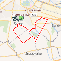
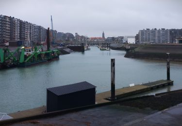
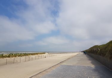
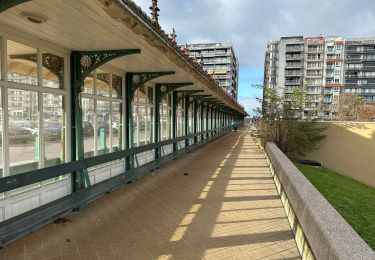
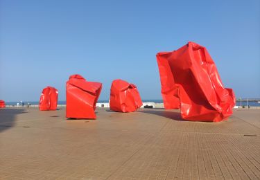
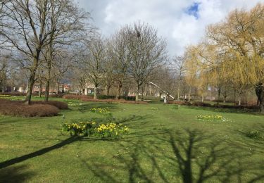
Trail Walking of 11.7 km to be discovered at Flanders, West Flanders, Ostend. This trail is proposed by JPasschyn.

Description

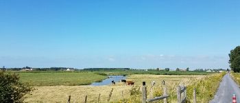
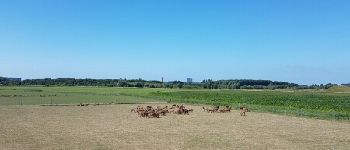
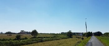
Vanuit Stene-Dorp,doorheen de schorren, het krekengebied en het stadsrandbos.

Elevation profile

Photos

Points of interest

Point of interest Gistel - Schorre - Photo
JPasschyn
GISTEL 
Point of interest Ostend - Kreken - Photo
JPasschyn
OSTEND 
Point of interest Ostend - Groene 62 - Photo
JPasschyn
OSTEND 
Point of interest Ostend - Blauwe sluis - Photo
JPasschyn
OSTEND 

Positioning

Country:
Belgium
Region :
Flanders
Department/Province :
West Flanders
Municipality :
Ostend
Location:
Stene
Start:(UTM)
494038 ; 5672353 (31U) N.

Trails nearby

Trail Walking Ostend - Ostende - Bredene - Photo
Walking
GUIDE
mumu.larandonneuse

Walking

Easy
Ostend, Flanders, West Flanders, Belgium
9.4 km | 10.3 km-effort
1h 41min
No
Trail On foot Ostend - Erfgoedwandelroute Oostende - Photo
On foot
PRO

On foot

Easy
Ostend, Flanders, West Flanders, Belgium
4.5 km | 5 km-effort
1h 7min
Yes
Trail Walking Ostend -  sgr kust (gr régional côte) day 3/4 - Photo
Walking
Charles Lemaire

Walking

Very difficult
Ostend, Flanders, West Flanders, Belgium
24 km | 26 km-effort
6h 3min
No
Trail Walking Ostend - ostende - Photo
Walking
tankomane

Walking

Very easy
Ostend, Flanders, West Flanders, Belgium
3.4 km | 3.9 km-effort
1h 4min
No
Trail Walking Ostend - 67.381 Oostende - Raversijde : Circuit Ensor - Photo
Walking
ADL339

Walking

Very easy
(1)
Ostend, Flanders, West Flanders, Belgium
17.4 km | 19.5 km-effort
4h 55min
Yes
Trail Walking Ostend - aan t'zeetje - Photo
Walking
De Man Joseph

Walking

Easy
Ostend, Flanders, West Flanders, Belgium
4.6 km | 5.1 km-effort
35min
Yes
Trail Walking Ostend - Ostende - Middelkerke  - Photo
Walking
Michael Heins

Walking

Very easy
Ostend, Flanders, West Flanders, Belgium
10.8 km | 12.8 km-effort
2h 2min
No
Trail Walking Ostend - Ostende - La Panne - Photo
Walking
seghth

Walking

Very difficult
Ostend, Flanders, West Flanders, Belgium
30 km | 33 km-effort
7h 0min
No
Trail On foot Ostend - Oudenburg - Oostende - Photo
On foot
FreddyTuerlinckx

On foot

Easy
Ostend, Flanders, West Flanders, Belgium
12.4 km | 13.3 km-effort
2h 12min
No


Close
My subscriptions