


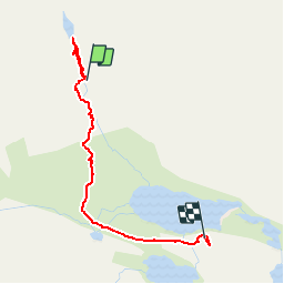


11.6 km | 19.6 km-effort

User


FREE GPS app for hiking
 SityTrail
IGN / Geographical institutes
SityTrail World
The world is yours!
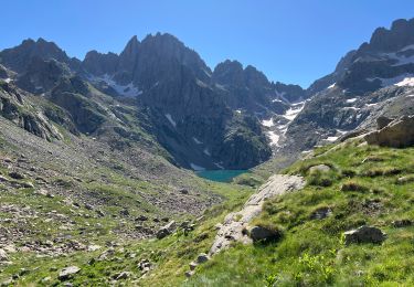
Trail Walking of 3.1 km to be discovered at Provence-Alpes-Côte d'Azur, Maritime Alps, Tende. This trail is proposed by patsure.
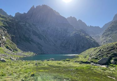
Depuis la fin de la rando avec guide monté au lac des Merveilles puis redescendre vers le refuge 11h-12h45


Walking

On foot

On foot

Walking

Walking

Walking

Walking
Walking
Walking