


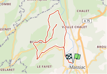

12 km | 17.4 km-effort


User GUIDE


FREE GPS app for hiking
 SityTrail
IGN / Geographical institutes
SityTrail World
The world is yours!
Trail Walking of 10.5 km to be discovered at Auvergne-Rhône-Alpes, Cantal, Massiac. This trail is proposed by jagarnier.
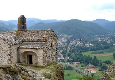
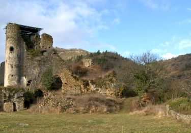
Le pays de Massiac s'ouvre au nord par une majestueuse porte naturelle. Deux forts se font face séparés par le cours de l'Alagnon. L'un et l'autre constituent de hautes lieux archéologiques.
L'éperon Saint-Victor porte les restes d'un village déserté.

Walking
Walking

Walking
Walking

4x4

Walking

Mountain bike
Walking
Walking