Trail Other activity Plats - Serre de Montchal 7 km300 par lareal  - Photo

Serre de Montchal 7 km300 par lareal

© OpenStreetMap contributors
Length
Length
7.3 km
Max alt
Max alt
510 m
Uphill gradient
Uphill gradient
200 m
Km-Effort
Km-Effort  
10 km
Min alt
Min alt
367 m
Downhill gradient
Downhill gradient
197 m
Boucle
Boucle
Yes
Creation date :
2016-07-05 00:00:00.0
Updated on :
2016-07-05 00:00:00.0

(0 Reviews)

Other activity
Other activity
3h00
Difficulty : Medium

Scan this QR Code to open this trail in the SityTrail application

FREE GPS app for hiking

Logo SityTrail SityTrail

IGN / Geographical institutes

Download SityTrail from the App Store Download SityTrail from Google Play

Logo SityTrail SityTrail World

The world is yours!

Download SityTrail from the App Store Download SityTrail from Google Play Download SityTrail on Huawei AppGallery

About

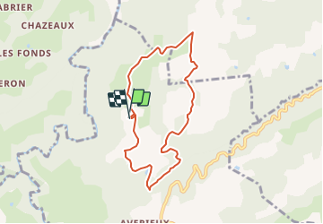
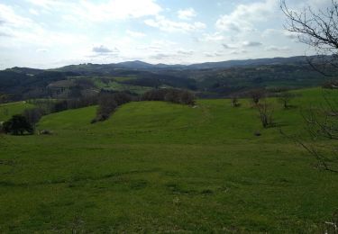
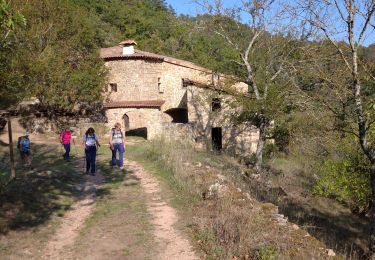
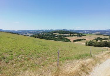
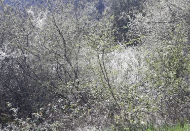
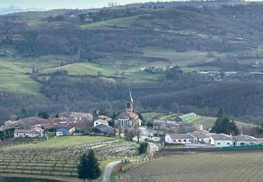
Trail Other activity of 7.3 km to be discovered at Auvergne-Rhône-Alpes, Ardèche, Plats. This trail is proposed by jacquesdunogier.

Description

serre de Montchal par laréal le bec le rey Raffin croix de corps Suzeux  

Elevation profile

Positioning

Country:
France
Region :
Auvergne-Rhône-Alpes
Department/Province :
Ardèche
Municipality :
Plats
Location:
Unknown
Start:(UTM)
639678 ; 4987928 (31T) N.

Trails nearby

Trail Mountain bike Tournon-sur-Rhône - Rando des tours 2009 - Photo
Mountain bike
ramsay

Mountain bike

Difficult
(1)
Tournon-sur-Rhône, Auvergne-Rhône-Alpes, Ardèche, France
40 km | 53 km-effort
3h 23min
Yes
Trail Walking Saint-Sylvestre - st sylvestre 2023 - Photo
Walking
floup6138

Walking

Medium
Saint-Sylvestre, Auvergne-Rhône-Alpes, Ardèche, France
14.7 km | 21 km-effort
4h 59min
Yes
Trail Mountain bike Tournon-sur-Rhône - Tournon-Meyras par la route-retour Tournon 21km  520m - Photo
Mountain bike
micheljullien

Mountain bike

Medium
(1)
Tournon-sur-Rhône, Auvergne-Rhône-Alpes, Ardèche, France
21 km | 28 km-effort
1h 54min
Yes
Trail Walking Saint-Barthélemy-le-Plain - 07 daronne - Photo
Walking
GUIDE
randodyssée

Walking

Medium
Saint-Barthélemy-le-Plain, Auvergne-Rhône-Alpes, Ardèche, France
17.9 km | 26 km-effort
4h 59min
Yes
Trail Walking Saint-Sylvestre - St Sylvestre  Pt Romain 14km - Photo
Walking
GUIDE
thonyc

Walking

Medium
Saint-Sylvestre, Auvergne-Rhône-Alpes, Ardèche, France
14.2 km | 21 km-effort
5h 20min
Yes
Trail Walking Mauves - Mauves  - Photo
Walking
bernadette revoux

Walking

Easy
Mauves, Auvergne-Rhône-Alpes, Ardèche, France
14.8 km | 22 km-effort
3h 51min
Yes
Trail Walking Tournon-sur-Rhône - F07300_Mauve_LT_AM_DS - Photo
Walking
ageo

Walking

Easy
(1)
Tournon-sur-Rhône, Auvergne-Rhône-Alpes, Ardèche, France
11.2 km | 16.2 km-effort
4h 0min
Yes
Trail Walking Colombier-le-Vieux - Gorges Daronne - Photo
Walking
Djac

Walking

Medium
(2)
Colombier-le-Vieux, Auvergne-Rhône-Alpes, Ardèche, France
10.4 km | 16.3 km-effort
3h 32min
Yes
Trail Walking Glun - st romain  de lerps - Photo
Walking
jphugon

Walking

Very difficult
Glun, Auvergne-Rhône-Alpes, Ardèche, France
14.7 km | 22 km-effort
7h 17min
Yes


Close
My subscriptions