


31 km | 41 km-effort


User


FREE GPS app for hiking
 SityTrail
IGN / Geographical institutes
SityTrail World
The world is yours!
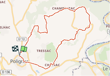
Trail Walking of 11.2 km to be discovered at Auvergne-Rhône-Alpes, Haute-Loire, Polignac. This trail is proposed by Pousscailleux.
D'après le Circuit n°378 : LA DENTELLIERE, fléchage vert, prélevé sur le site Internet de la mairie de Polignac.
Polignac- Chambeyrac- Marnhac- Chambeyrac- Polignac
Parking de la maison communale, à l'entrée sud ouest de la commune, rue des écoles.
Départ place de l’Eglise de Polignac, direction rue du Levant, puis rue du Toria. Prendre les escaliers à gauche au calvaire au bout de la rue du Toria, en face du chemin de Ridet. Chemin rural non goudronné.
Après la fontaine de Vassalh, traverser la route de Blanzac pour prendre le chemin jusqu’à Cheyrac
A Cheyrac, 200 mètres de route goudronnée pour traverser le village ; Maison Forte
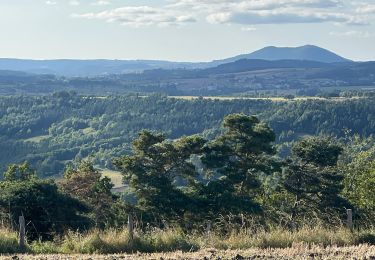
Chemin rural direction Marnhac : vue sur le rocher de la « Dentellière ». Au cours de la montée, très belle vue sur le Puy.
Longer la crête jusqu’à Marnhac : point de vue sur la vallée de la Loire et le Mézenc au loin.
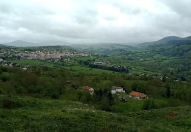
Traverser le village de Marnhac, et prendre à gauche à la sortie ; chemin rural : traversée du plateau jusqu’à Chambeyrac. A voir : pins de boulange, panorama sur Polignac et sur le Mézenc.
A Chambeyrac, rejoindre directement Polignac par le « Pey Gerbier » ( très belle vue sur le site de Polignac)

Walking

Walking

Walking

Walking
Walking
Walking
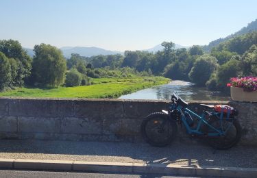
Electric bike
Walking
Walking