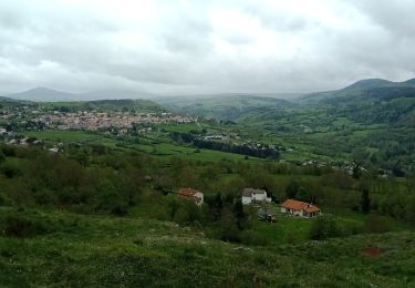
Trail Walking Polignac - Polignac - Bilhac _ 9,0 km - Photo

Polignac - Bilhac _ 9,0 km

© OpenStreetMap contributors
Length
Length
9 km
Max alt
Max alt
858 m
Uphill gradient
Uphill gradient
262 m
Km-Effort
Km-Effort  
12.5 km
Min alt
Min alt
691 m
Downhill gradient
Downhill gradient
258 m
Boucle
Boucle
Yes
Creation date :
2016-07-01 00:00:00.0
Updated on :
2016-07-01 00:00:00.0

(0 Reviews)

Walking
Walking
2h50
Difficulty : Medium

Scan this QR Code to open this trail in the SityTrail application

FREE GPS app for hiking

Logo SityTrail SityTrail

IGN / Geographical institutes

Download SityTrail from the App Store Download SityTrail from Google Play

Logo SityTrail SityTrail World

The world is yours!

Download SityTrail from the App Store Download SityTrail from Google Play Download SityTrail on Huawei AppGallery

About

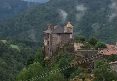
Trail Walking of 9 km to be discovered at Auvergne-Rhône-Alpes, Haute-Loire, Polignac. This trail is proposed by Pousscailleux.

Description

D'après le circuit N° 55 - Roche de Flayac, balisage vert - proposé par la mairie de Polignac sur son site Internet.
Parking de la maison communale, à l'entrée sud ouest de la commune, rue des écoles ; parking possible Place Princesse de Polignac, ou Place de l'église.
Départ entre la mairie et l’église, puis longer le mur d’enceinte du cimetière, ensuite tourner à gauche. Après une courte portion plate, le sentier s’élève en direction de Bilhac.

A Bilhac, passer entre la croix du centre du village et l’assemblée, poursuivre tout droit, monter vers le haut du village et prendre le chemin de terre à la dernière maison, jusqu’à la route nationale 102.

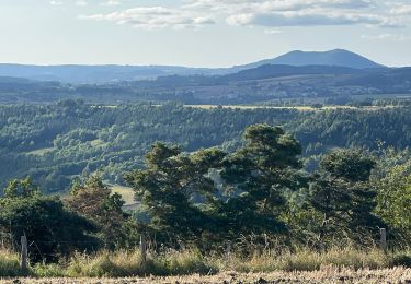
Traverser la nationale, puis suivre sur la droite un chemin de terre, possibilité de prendre le circuit n°376 sur les Estreys, vaste panorama sur la chaîne du Mézenc.

Après avoir à nouveau rejoint la RN 102, la traverser au «  Collet », et descendre par un petit sentier, puis la route départementale jusqu’à Polignac.

Elevation profile

Positioning

Country:
France
Region :
Auvergne-Rhône-Alpes
Department/Province :
Haute-Loire
Municipality :
Polignac
Location:
Unknown
Start:(UTM)
567691 ; 4991183 (31T) N.

Trails nearby

Trail Walking Le Puy-en-Velay - Compostelle : 1-Le Puy en Vely - St Didier d'Allier - Photo
Walking
prv

Walking

Very easy
(1)
Le Puy-en-Velay, Auvergne-Rhône-Alpes, Haute-Loire, France
31 km | 41 km-effort
8h 54min
No
Trail Walking Le Puy-en-Velay - Puy en velay - St Privat d'Allier - Chemin de Compostelle - Photo
Walking
tracegps

Walking

Very difficult
(2)
Le Puy-en-Velay, Auvergne-Rhône-Alpes, Haute-Loire, France
24 km | 32 km-effort
6h 4min
No
Trail Walking Le Puy-en-Velay - Le Puy Saugue Avril 2018 - Photo
Walking
GUIDE
Kargil

Walking

Difficult
Le Puy-en-Velay, Auvergne-Rhône-Alpes, Haute-Loire, France
44 km | 62 km-effort
13h 51min
No
Trail Walking Polignac - Polignac-La Source_9,7 km - Photo
Walking
Pousscailleux

Walking

Medium
(2)
Polignac, Auvergne-Rhône-Alpes, Haute-Loire, France
9.7 km | 13.8 km-effort
3h 8min
Yes
Trail Walking Le Puy-en-Velay - Compostelle 5 GR65 - Photo
Walking
Landreger

Walking

Medium
(4)
Le Puy-en-Velay, Auvergne-Rhône-Alpes, Haute-Loire, France
115 km | 154 km-effort
Unknown
No
Trail Walking Blanzac - Rachat - Chapelle de Chassaleuil - Photo
Walking
Jean-MarieFaux

Walking

Very easy
Blanzac, Auvergne-Rhône-Alpes, Haute-Loire, France
10.3 km | 11.7 km-effort
3h 0min
Yes
Trail Electric bike Le Puy-en-Velay - 130824 **** - Photo
Electric bike
ricou1964

Electric bike

Difficult
Le Puy-en-Velay, Auvergne-Rhône-Alpes, Haute-Loire, France
40 km | 52 km-effort
3h 12min
Yes
Trail Walking Le Puy-en-Velay - 1 Stevenson Le Puy en Velay - Le Monastier sur Gazeille - Photo
Walking
GUIDE
VANDERPUTTENMi

Walking

Very difficult
Le Puy-en-Velay, Auvergne-Rhône-Alpes, Haute-Loire, France
22 km | 31 km-effort
5h 21min
No
Trail Walking Polignac - Polignac  - Photo
Walking
boyer43

Walking

Very difficult
(1)
Polignac, Auvergne-Rhône-Alpes, Haute-Loire, France
22 km | 30 km-effort
6h 47min
Yes


Close
My subscriptions