Trail Mountain bike Saint-Pons-la-Calm - Que Du Bonheur - Photo
 Larage
Larage

User

© OpenStreetMap contributors
Length
Length
23 km
Max alt
Max alt
265 m
Uphill gradient
Uphill gradient
457 m
Km-Effort
Km-Effort  
29 km
Min alt
Min alt
109 m
Downhill gradient
Downhill gradient
458 m
Boucle
Boucle
Yes
Creation date :
2016-05-30 00:00:00.0
Updated on :
2016-05-30 00:00:00.0

(0 Reviews)

Mountain bike
Mountain bike
2h57
Difficulty : Medium

Scan this QR Code to open this trail in the SityTrail application

FREE GPS app for hiking

Logo SityTrail SityTrail

IGN / Geographical institutes

Download SityTrail from the App Store Download SityTrail from Google Play

Logo SityTrail SityTrail World

The world is yours!

Download SityTrail from the App Store Download SityTrail from Google Play Download SityTrail on Huawei AppGallery

About

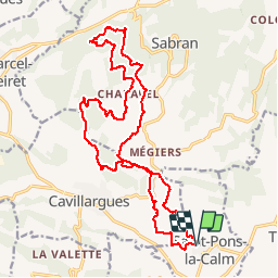
Trail Mountain bike of 23 km to be discovered at Occitania, Gard, Saint-Pons-la-Calm. This trail is proposed by Larage.

Description

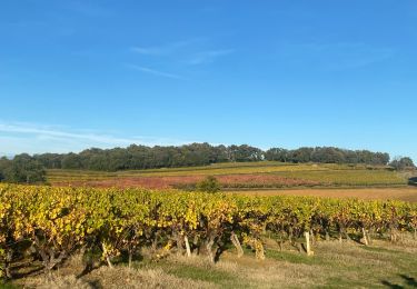
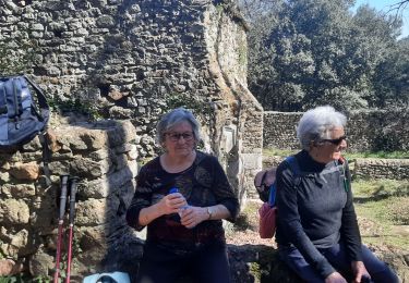
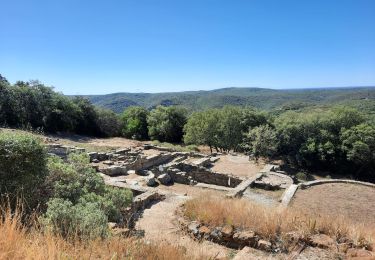
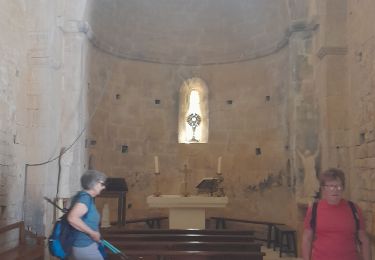
Belle rando organisé sur un parcour moyen, en sous-bois et monotrace.

Elevation profile

Positioning

Country:
France
Region :
Occitania
Department/Province :
Gard
Municipality :
Saint-Pons-la-Calm
Location:
Unknown
Start:(UTM)
624426 ; 4884678 (31T) N.

Trails nearby

Trail Walking Tresques - Autour de Tresques - Photo
Walking
tracegps

Walking

Medium
(1)
Tresques, Occitania, Gard, France
4.9 km | 5.6 km-effort
2h 0min
Yes
Trail Walking Cavillargues - Cavillargues  - Photo
Walking
GUIDE
Roger Philippe Wallez

Walking

Very difficult
Cavillargues, Occitania, Gard, France
22 km | 27 km-effort
7h 2min
Yes
Trail Walking Gaujac - Gaujac 160323 - Photo
Walking
fario

Walking

Difficult
Gaujac, Occitania, Gard, France
11 km | 14.3 km-effort
3h 15min
Yes
Trail Walking Le Pin - Le pin , la Garbie et oppidum - Photo
Walking
jcguew

Walking

Medium
Le Pin, Occitania, Gard, France
6.3 km | 8.3 km-effort
2h 42min
No
Trail Walking Sabran - Sabran marche vigneronne - Photo
Walking
poisson1103

Walking

Medium
Sabran, Occitania, Gard, France
14.3 km | 19.1 km-effort
3h 27min
Yes
Trail Walking Gaujac - L''Oppidum de Gaujac - Photo
Walking
tracegps

Walking

Medium
Gaujac, Occitania, Gard, France
13.1 km | 17.1 km-effort
3h 30min
Yes
Trail Mountain bike Cavillargues - Randonnée autour de Cavillargues - Photo
Mountain bike
tracegps

Mountain bike

Medium
Cavillargues, Occitania, Gard, France
17.8 km | 23 km-effort
2h 0min
Yes
Trail Walking Cavillargues - Randonnée autour de Cavillargues - Photo
Walking
tracegps

Walking

Medium
Cavillargues, Occitania, Gard, France
17.8 km | 23 km-effort
5h 0min
Yes
Trail Walking Tresques - 2010-08-26 - 20h42m26 - Photo
Walking
crouzet.thierry

Walking

Very easy
(1)
Tresques, Occitania, Gard, France
4.2 km | 4.7 km-effort
Unknown
Yes


Close
My subscriptions