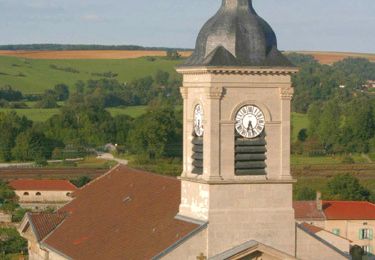
Trail Walking Apremont-la-Forêt - Marbotte - Photo
 bohynm
bohynm

User

© OpenStreetMap contributors
Length
Length
19.1 km
Max alt
Max alt
379 m
Uphill gradient
Uphill gradient
387 m
Km-Effort
Km-Effort  
24 km
Min alt
Min alt
243 m
Downhill gradient
Downhill gradient
387 m
Boucle
Boucle
Yes
Creation date :
2016-05-09 00:00:00.0
Updated on :
2016-05-09 00:00:00.0

(0 Reviews)

Walking
Walking
5h12
Difficulty : Medium

Scan this QR Code to open this trail in the SityTrail application

FREE GPS app for hiking

Logo SityTrail SityTrail

IGN / Geographical institutes

Download SityTrail from the App Store Download SityTrail from Google Play

Logo SityTrail SityTrail World

The world is yours!

Download SityTrail from the App Store Download SityTrail from Google Play Download SityTrail on Huawei AppGallery

About

Trail Walking of 19.1 km to be discovered at Grand Est, Meuse, Apremont-la-Forêt. This trail is proposed by bohynm.

Description

ben, l'onf ne fait pas frand chose pour preserver ce site historique.....

Elevation profile

Photos

Positioning

Country:
France
Region :
Grand Est
Department/Province :
Meuse
Municipality :
Apremont-la-Forêt
Location:
Marbotte
Start:(UTM)
689407 ; 5412286 (31U) N.

Trails nearby

Trail Walking Lérouville - Circuit des Mares - Lérouville - Photo
Walking
tracegps

Walking

Medium
Lérouville, Grand Est, Meuse, France
10.7 km | 13.3 km-effort
2h 40min
Yes
Trail Walking Apremont-la-Forêt - apremont petite - Photo
Walking
Nila81

Walking

Difficult
Apremont-la-Forêt, Grand Est, Meuse, France
10.4 km | 13.4 km-effort
3h 3min
Yes
Trail Walking Apremont-la-Forêt - st agnant liouville st julien  - Photo
Walking
kikkko

Walking

Medium
Apremont-la-Forêt, Grand Est, Meuse, France
12.3 km | 15.6 km-effort
2h 53min
Yes
Trail Walking Apremont-la-Forêt - Âprement - Photo
Walking
lorenzot54

Walking

Apremont-la-Forêt, Grand Est, Meuse, France
5.3 km | 6 km-effort
2h 10min
No
Trail Walking Mécrin - jacques revel lérouville populaire club la Vadrouille - Photo
Walking
cath310

Walking

Medium
(1)
Mécrin, Grand Est, Meuse, France
27 km | 32 km-effort
5h 38min
Yes
Trail Walking Lérouville - LEROUVILLE circuit des Mares - Photo
Walking
cath310

Walking

Very easy
Lérouville, Grand Est, Meuse, France
10.8 km | 13.4 km-effort
2h 54min
Yes
Trail Walking Lérouville - Lerouville  - Photo
Walking
Ludovic Fort

Walking

Medium
Lérouville, Grand Est, Meuse, France
9.5 km | 11.5 km-effort
2h 36min
Yes
Trail Walking Apremont-la-Forêt - apremont mat G2 - Photo
Walking
Nila81

Walking

Medium
Apremont-la-Forêt, Grand Est, Meuse, France
6.6 km | 8.5 km-effort
1h 55min
No
Trail Walking Saint-Julien-sous-les-Côtes - Coing morille jaune  - Photo
Walking
lucasjb

Walking

Medium
Saint-Julien-sous-les-Côtes, Grand Est, Meuse, France
5.4 km | 6.2 km-effort
42min
No


Close
My subscriptions