![](/images/other/stat-length.png)
![Trail Walking Ebersheim - Ebersheim et Ebersmunster - Photo](https://media.geolcdn.com/t/1900/400/ext.pjpeg?maxdim=2&url=https%3A%2F%2Fservices.sitytrail.com%2FGeolivesWS%2FDownloadMedia.ashx%3FTrailID%3D553491%26Media%3Dfix__20160414130310.jpg)
Ebersheim et Ebersmunster
VacheKiri67
User
![Length](/images/other/stat-length.png)
Length
8.3 km
![Max alt](https://static1.geolcdn.com/siteimages/upload/files/1508320355ic_sort_altitude_max_24dp.png)
Max alt
169 m
![Uphill gradient](https://static1.geolcdn.com/siteimages/upload/files/1508320355ic_sort_den_pos_24dp.png)
Uphill gradient
44 m
![Km-Effort](/images/other/stat-length.png)
Km-Effort
8.9 km
![Min alt](https://static1.geolcdn.com/siteimages/upload/files/1508320355ic_sort_altitude_min_24dp.png)
Min alt
156 m
![Downhill gradient](https://static1.geolcdn.com/siteimages/upload/files/1508320355ic_sort_den_neg_24dp.png)
Downhill gradient
44 m
![Boucle](https://static1.geolcdn.com/siteimages/upload/files/16400158638029165_repeat_loop_refresh_sync_direction_icon.png)
Boucle
Yes
Creation date :
2016-04-14 00:00:00.0
Updated on :
2016-04-14 00:00:00.0
![Walking](https://static1.geolcdn.com/sitytour/trail-icons/101.png)
2h28
Difficulty : Easy
![Scan this QR Code to open this trail in the SityTrail application](https://capi.geolives.com/qq0zvz2zws4bq2lad0pu/sitytour/trails/553491/qr.png?size=200)
FREE GPS app for hiking
About
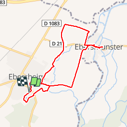
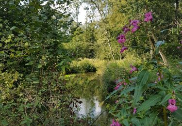
Trail Walking of 8.3 km to be discovered at Grand Est, Bas-Rhin, Ebersheim. This trail is proposed by VacheKiri67.
Description
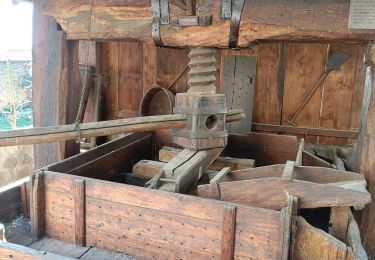
Faite le 14/04/2016 avec notre fils de 11 ans. D'après "Passion Vosges - Escapade en Alsace centrale" N°11 : Entre nature et culture. Durée indiquée pour le circuit : 2h30.
Positioning
Country:
France
Region :
Grand Est
Department/Province :
Bas-Rhin
Municipality :
Ebersheim
Location:
Unknown
Start:(Dec)
Start:(UTM)
388869 ; 5350782 (32U) N.
Comments
Trails nearby
![Trail Walking Sélestat - Sentier de l'Illwald - Photo](https://media.geolcdn.com/t/375/260/ext.jpg?maxdim=2&url=https%3A%2F%2Fservices.sitytrail.com%2FGeolivesWS%2FDownloadMedia.ashx%3FTrailID%3D108918%26Media%3D2607_1.jpg)
![Walking Walking](https://static1.geolcdn.com/sitytour/trail-icons/101.png)
Sentier de l'Illwald
Walking
Medium
(1)
Sélestat,
Grand Est,
Bas-Rhin,
France
![](/images/other/stat-length.png)
13.2 km | 14.6 km-effort
3h 45min
![](https://static1.geolcdn.com/siteimages/upload/files/16400158638029165_repeat_loop_refresh_sync_direction_icon.png)
Yes
![Trail On foot Muttersholtz - Circuit de la Chouette - Photo](https://media.geolcdn.com/t/375/260/8dfef33b-5472-4898-aedc-01912c133d95.jpeg&format=jpg&maxdim=2)
![On foot On foot](https://static1.geolcdn.com/sitytour/trail-icons/100.png)
Circuit de la Chouette
On foot
Easy
Muttersholtz,
Grand Est,
Bas-Rhin,
France
![](/images/other/stat-length.png)
6.2 km | 6.6 km-effort
1h 29min
![](https://static1.geolcdn.com/siteimages/upload/files/16400158638029165_repeat_loop_refresh_sync_direction_icon.png)
Yes
![Trail On foot Muttersholtz - Sentier de la Cigogne - Photo](https://media.geolcdn.com/t/375/260/8dfef33b-5472-4898-aedc-01912c133d95.jpeg&format=jpg&maxdim=2)
![On foot On foot](https://static1.geolcdn.com/sitytour/trail-icons/100.png)
Sentier de la Cigogne
On foot
Easy
Muttersholtz,
Grand Est,
Bas-Rhin,
France
![](/images/other/stat-length.png)
8.7 km | 9.4 km-effort
2h 7min
![](https://static1.geolcdn.com/siteimages/upload/files/16400158638029165_repeat_loop_refresh_sync_direction_icon.png)
Yes
![Trail Electric bike Sélestat - Vignoble - Photo](https://media.geolcdn.com/t/375/260/d954fb43-4e0e-478c-8563-9315c95797e7.jpg&format=jpg&maxdim=2)
![Electric bike Electric bike](https://static1.geolcdn.com/sitytour/trail-icons/205.png)
Vignoble
Electric bike
Very easy
Sélestat,
Grand Est,
Bas-Rhin,
France
![](/images/other/stat-length.png)
50 km | 57 km-effort
3h 4min
![](https://static1.geolcdn.com/siteimages/upload/files/16400158638029165_repeat_loop_refresh_sync_direction_icon.png)
No
![Trail Electric bike Sélestat - Sélestat eckbo - Photo](https://media.geolcdn.com/t/375/260/01c67454-8b4b-4061-b826-b14fbe83434d.jpg&format=jpg&maxdim=2)
![Electric bike Electric bike](https://static1.geolcdn.com/sitytour/trail-icons/205.png)
Sélestat eckbo
Electric bike
Medium
Sélestat,
Grand Est,
Bas-Rhin,
France
![](/images/other/stat-length.png)
65 km | 72 km-effort
4h 6min
![](https://static1.geolcdn.com/siteimages/upload/files/16400158638029165_repeat_loop_refresh_sync_direction_icon.png)
No
![Trail Horseback riding Hilsenheim - SityTrail - Boucle attelage Hilsenheim - Huttenheim - Photo](https://media.geolcdn.com/t/375/260/5f5785bd-3b27-425f-b1d3-694fb0df146e.jpg&format=jpg&maxdim=2)
![Horseback riding Horseback riding](https://static1.geolcdn.com/sitytour/trail-icons/301.png)
SityTrail - Boucle attelage Hilsenheim - Huttenheim
Horseback riding
Medium
Hilsenheim,
Grand Est,
Bas-Rhin,
France
![](/images/other/stat-length.png)
24 km | 25 km-effort
3h 17min
![](https://static1.geolcdn.com/siteimages/upload/files/16400158638029165_repeat_loop_refresh_sync_direction_icon.png)
Yes
![Trail Walking Sélestat - (09/9/2019) Le ried à Selestat - Photo](https://media.geolcdn.com/t/375/260/61c13918-1a44-482b-a858-b621aed8b81b.jpg&format=jpg&maxdim=2)
![Walking Walking](https://static1.geolcdn.com/sitytour/trail-icons/101.png)
(09/9/2019) Le ried à Selestat
Walking
Very easy
Sélestat,
Grand Est,
Bas-Rhin,
France
![](/images/other/stat-length.png)
15.3 km | 17 km-effort
3h 38min
![](https://static1.geolcdn.com/siteimages/upload/files/16400158638029165_repeat_loop_refresh_sync_direction_icon.png)
Yes
![Trail Walking Muttersholtz - LE RIED DE MUTTERSHOLTZ - Photo](https://media.geolcdn.com/t/375/260/dbd73ab6-0b8a-48e8-aa00-24527cdf655d.jpg&format=jpg&maxdim=2)
![Walking Walking](https://static1.geolcdn.com/sitytour/trail-icons/101.png)
LE RIED DE MUTTERSHOLTZ
Walking
Very easy
Muttersholtz,
Grand Est,
Bas-Rhin,
France
![](/images/other/stat-length.png)
11.6 km | 12.7 km-effort
3h 44min
![](https://static1.geolcdn.com/siteimages/upload/files/16400158638029165_repeat_loop_refresh_sync_direction_icon.png)
Yes
![Trail Mountain bike Sélestat - Ungersberg par GR5 - Photo](https://media.geolcdn.com/t/375/260/ext.jpg?maxdim=2&url=https%3A%2F%2Fservices.sitytrail.com%2FGeolivesWS%2FDownloadMedia.ashx%3FTrailID%3D481736%26Media%3Dfix__20151013123208.jpg)
![Mountain bike Mountain bike](https://static1.geolcdn.com/sitytour/trail-icons/202.png)
Ungersberg par GR5
Mountain bike
Difficult
Sélestat,
Grand Est,
Bas-Rhin,
France
![](/images/other/stat-length.png)
44 km | 59 km-effort
3h 46min
![](https://static1.geolcdn.com/siteimages/upload/files/16400158638029165_repeat_loop_refresh_sync_direction_icon.png)
Yes
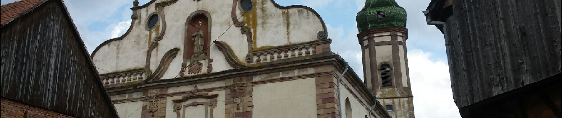
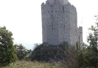
parcours exclusivement sur macadam, dommage. le principal intérêt est l'abbaye d'Ebersmunster et la petite chapelle de la Feldlach (hélas fermée) je conseillerais plutôt cette balade aux cyclistes.
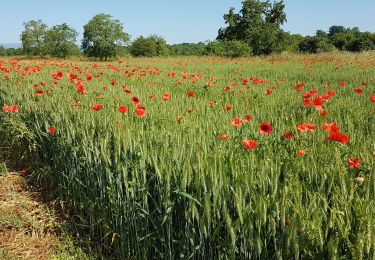
L'église d'Ebersmunster est remarquable et mérite elle 5 étoiles ! Pour le reste le parcours est sur terrain plat dans le Ried.