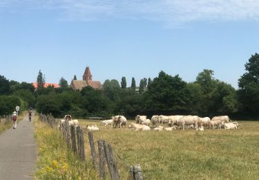
Trail Cycle Morsbronn-les-Bains - La source des sens aller - Photo

La source des sens aller

 lbguigui
lbguigui

User

© OpenStreetMap contributors
Length
Length
51 km
Max alt
Max alt
190 m
Uphill gradient
Uphill gradient
373 m
Km-Effort
Km-Effort  
56 km
Min alt
Min alt
128 m
Downhill gradient
Downhill gradient
408 m
Boucle
Boucle
No
Creation date :
2016-04-05 00:00:00.0
Updated on :
2016-04-05 00:00:00.0

(0 Reviews)

Cycle
Cycle
3h16
Difficulty : Medium

Scan this QR Code to open this trail in the SityTrail application

FREE GPS app for hiking

Logo SityTrail SityTrail

IGN / Geographical institutes

Download SityTrail from the App Store Download SityTrail from Google Play

Logo SityTrail SityTrail World

The world is yours!

Download SityTrail from the App Store Download SityTrail from Google Play Download SityTrail on Huawei AppGallery

About

Trail Cycle of 51 km to be discovered at Grand Est, Bas-Rhin, Morsbronn-les-Bains. This trail is proposed by lbguigui.

Elevation profile

Positioning

Country:
France
Region :
Grand Est
Department/Province :
Bas-Rhin
Municipality :
Morsbronn-les-Bains
Location:
Unknown
Start:(UTM)
408141 ; 5417517 (32U) N.

Trails nearby

Trail Mountain bike Wœrth - Woerth-Climbach retour Langensoultzbach - Photo
Mountain bike
simpsonus

Mountain bike

Very easy
(1)
Wœrth, Grand Est, Bas-Rhin, France
40 km | 51 km-effort
2h 44min
Yes
Trail Mountain bike Wœrth - Randoguide - Photo
Mountain bike
reymuben

Mountain bike

Medium
(1)
Wœrth, Grand Est, Bas-Rhin, France
30 km | 40 km-effort
2h 10min
No
Trail Walking Walbourg - 2023-06-18-Abbatiale de Walbourg - Photo
Walking
milou1941

Walking

Walbourg, Grand Est, Bas-Rhin, France
6.7 km | 7.6 km-effort
2h 56min
Yes
Trail Equestrian Mertzwiller - 2012-08-19 Chevauchée EquiLanta Mertzwiller - Photo
Equestrian
GUIDE
holtzv

Equestrian

Very easy
Mertzwiller, Grand Est, Bas-Rhin, France
19 km | 23 km-effort
4h 3min
Yes
Trail Walking Gundershoffen - retour Inspection balisage Gundershoffen  - Photo
Walking
Dominique Baudelocque

Walking

Medium
(1)
Gundershoffen, Grand Est, Bas-Rhin, France
5.7 km | 6.6 km-effort
1h 36min
No
Trail On foot Wœrth - Anneau bleu CVNR Woerth - Photo
On foot
Dominique Baudelocque

On foot

Easy
Wœrth, Grand Est, Bas-Rhin, France
8.3 km | 10.2 km-effort
2h 18min
Yes
Trail Walking Gunstett - Gunstett G3 - Photo
Walking
Dominique Baudelocque

Walking

Difficult
Gunstett, Grand Est, Bas-Rhin, France
15.2 km | 18.2 km-effort
2h 58min
No
Trail Walking Mertzwiller - Mertzwiller Griesbach via Thommrn - Photo
Walking
Dominique Baudelocque

Walking

Difficult
Mertzwiller, Grand Est, Bas-Rhin, France
12.6 km | 14.2 km-effort
3h 0min
Yes
Trail Walking Wœrth - Woerth Langensoultzbach Poste-rue de Nehwiller  - Photo
Walking
Dominique Baudelocque

Walking

Easy
Wœrth, Grand Est, Bas-Rhin, France
4.1 km | 4.9 km-effort
2h 4min
No


Close
My subscriptions