Trail Walking Gabriac - Les 5 clochers - Photo

Les 5 clochers

© OpenStreetMap contributors
Length
Length
11.6 km
Max alt
Max alt
650 m
Uphill gradient
Uphill gradient
210 m
Km-Effort
Km-Effort  
14.4 km
Min alt
Min alt
542 m
Downhill gradient
Downhill gradient
210 m
Boucle
Boucle
Yes
Creation date :
2016-03-31 00:00:00.0
Updated on :
2016-03-31 00:00:00.0

(0 Reviews)

Walking
Walking
3h07
Difficulty : Easy

Scan this QR Code to open this trail in the SityTrail application

FREE GPS app for hiking

Logo SityTrail SityTrail

IGN / Geographical institutes

Download SityTrail from the App Store Download SityTrail from Google Play

Logo SityTrail SityTrail World

The world is yours!

Download SityTrail from the App Store Download SityTrail from Google Play Download SityTrail on Huawei AppGallery

About

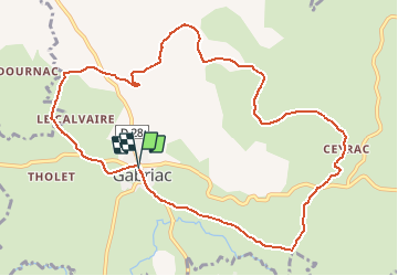
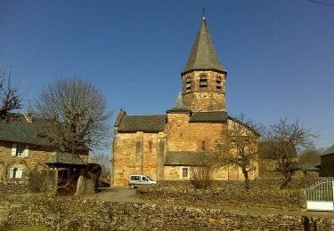
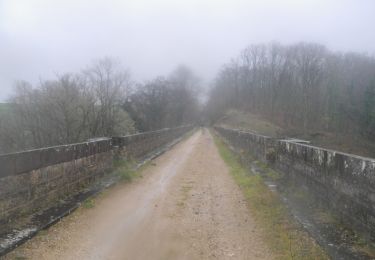
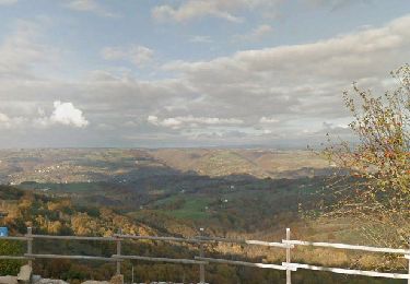
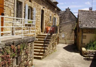
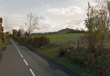
Trail Walking of 11.6 km to be discovered at Occitania, Aveyron, Gabriac. This trail is proposed by bbertrand974.

Description

Balade n°21 du Topo "Entre Causse et Dourdou"

Elevation profile

Positioning

Country:
France
Region :
Occitania
Department/Province :
Aveyron
Municipality :
Gabriac
Location:
Unknown
Start:(UTM)
483523 ; 4922228 (31T) N.

Trails nearby

Trail Walking Bertholène - les bourines - Photo
Walking
Lacaze

Walking

Easy
Bertholène, Occitania, Aveyron, France
9 km | 11 km-effort
2h 33min
Yes
Trail Walking Bertholène - les bourines - Photo
Walking
Lacaze

Walking

Easy
(1)
Bertholène, Occitania, Aveyron, France
9 km | 11 km-effort
2h 33min
Yes
Trail Walking Bozouls - Horizons et Clochers du Rouergue - Gillorgues - Photo
Walking
tracegps

Walking

Medium
Bozouls, Occitania, Aveyron, France
11.9 km | 15.5 km-effort
3h 0min
Yes
Trail Mountain bike Bozouls - Roquelaure au départ de Bozouls - Photo
Mountain bike
tracegps

Mountain bike

Difficult
Bozouls, Occitania, Aveyron, France
33 km | 43 km-effort
4h 19min
Yes
Trail On foot Espalion - Biounac, 4,5km  - Photo
On foot
Strabidja

On foot

Very easy
(1)
Espalion, Occitania, Aveyron, France
4.5 km | 5.4 km-effort
1h 15min
Yes
Trail Walking Palmas d'Aveyron - Tour du village de Cruejouls - Photo
Walking
tracegps

Walking

Easy
Palmas d'Aveyron, Occitania, Aveyron, France
1.5 km | 1.7 km-effort
30min
Yes
Trail Walking Bozouls - BOZOULS  - Photo
Walking
dchauprade

Walking

Easy
Bozouls, Occitania, Aveyron, France
7.9 km | 10.5 km-effort
3h 13min
Yes
Trail On foot Gabriac - BIOUNAC/CONDOURNAC 3.8KM - Photo
On foot
Strabidja

On foot

Easy
Gabriac, Occitania, Aveyron, France
3.8 km | 4.7 km-effort
Unknown
Yes
Trail Mountain bike Gabriac - Gabriac/Cruejouls VTT - Photo
Mountain bike
Strabidja

Mountain bike

Easy
Gabriac, Occitania, Aveyron, France
13 km | 16.3 km-effort
1h 30min
Yes


Close
My subscriptions