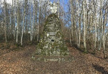
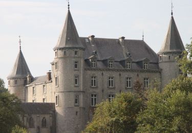
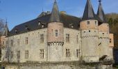
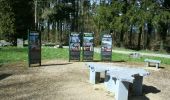
Trail Walking Yvoir - RF-Na-07-Spontin_Petite-boucle - Photo

RF-Na-07-Spontin_Petite-boucle

Randonnez sur et autour des GR ® wallons (Sentiers de Grande Randonnée). PRO

© OpenStreetMap contributors
Length
Length
6 km
Max alt
Max alt
242 m
Uphill gradient
Uphill gradient
105 m
Km-Effort
Km-Effort  
7.4 km
Min alt
Min alt
182 m
Downhill gradient
Downhill gradient
105 m
Boucle
Boucle
Yes
Creation date :
2019-08-07 07:20:05.605
Updated on :
2019-08-07 07:20:05.72

(2 Reviews)

Walking
Walking
1h36
Difficulty : Easy

Scan this QR Code to open this trail in the SityTrail application

FREE GPS app for hiking

Logo SityTrail SityTrail
IGN / Geographical institutes

Download SityTrail from the App Store Download SityTrail from Google Play

Logo SityTrail SityTrail World

The world is yours!

Download SityTrail from the App Store Download SityTrail from Google Play Download SityTrail on Huawei AppGallery

About

Trail Walking of 6 km to be discovered at Wallonia, Namur, Yvoir. This trail is proposed by GR Rando.

Description

Dans quel type de paysage notre famille randonne-t-elle ?
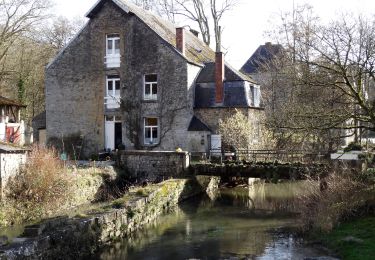
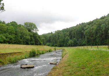
Au cours de cette randonnée, notre famille suit une charmante petite rivière, le Bocq, qui se jette dans la Meuse à Yvoir et qui se dévoile petit à petit au gré de ses méandres. En suivant la piste décrite, la petite tribu posera ses pieds sur le nombril (centre géographique) de la Wallonie.

Quelle difficulté rencontre-t-elle ?
Le parcours est assez facile. Par contre, de bonnes chaussures sont à conseiller, vu l’état de certains tronçons boueux et la traversée d’une prairie.
Comment y arrive-t-elle ?
Par la E 411, sortie Spontin.
Par la vallée de la Meuse, à Yvoir, prendre la direction de Spontin.

Que découvre-t-elle aujourd’hui ?
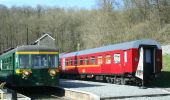
Après la balade, notre famille peut s’offrir un petit voyage en train touristique sur une ligne de chemin de fer très spectaculaire. Le Chemin de Fer du Bocq permet de découvrir la vallée de cette rivière sous un angle insolite.

Quelle est la carte IGN de référence ?
Carte IGN au  1:20 000, 54/1-2 « Ciney – Hamois ».

Photos

Points of interest

Point of interest Yvoir - Bouleaux - Photo
GR Rando
YVOIR 
Point of interest Yvoir - Château - Photo
GR Rando
YVOIR 
Point of interest Yvoir - Danger - Photo
GR Rando
YVOIR 
Point of interest Yvoir - Epicéas - Photo
GR Rando
YVOIR 
Point of interest Yvoir - Ferme de Salazinne - Photo
GR Rando
Point of interest Yvoir - Moulin à eau - Photo
GR Rando

Positioning

Country:
Belgium
Region :
Wallonia
Department/Province :
Namur
Municipality :
Yvoir
Location:
Spontin
Start:(UTM)
643052 ; 5576478 (31U) N.

Comments

Please log in to post a review or rate the element


top


Trails nearby

Trail Walking Assesse - RB-Na-02 Raccourci - Les collines de la vallée du Bocq - Photo
Walking
PRO

Walking

Medium
(7)
Assesse, Wallonia, Namur, Belgium
17 km | 23 km-effort
5h 32min
Yes
Trail Walking Ciney - CINEY- Braibant- Promenade du Bois des Aunes - Photo
Walking
PRO

Walking

Easy
(11)
Ciney, Wallonia, Namur, Belgium
6.8 km | 8.7 km-effort
1h 53min
Yes
Trail Walking Assesse - RB-Na-02 Les collines de la vallée du Bocq - Photo
Walking
PRO

Walking

Medium
(21)
Assesse, Wallonia, Namur, Belgium
21 km | 28 km-effort
5h 32min
Yes
Trail Walking Assesse - 05 Paysage condruzien - Photo
Walking
GUIDE+

Walking

Easy
(5)
Assesse, Wallonia, Namur, Belgium
10.2 km | 13.3 km-effort
2h 11min
No
Trail Walking Assesse - Promenade à Crupet - Photo
Walking
GUIDE
Desrumaux

Walking

Easy
(3)
Assesse, Wallonia, Namur, Belgium
8.3 km | 11.4 km-effort
2h 30min
Yes
Trail Walking Yvoir - Balade à Spontin - Photo
Walking
GUIDE
Desrumaux

Walking

Very easy
(4)
Yvoir, Wallonia, Namur, Belgium
5 km | 6.2 km-effort
1h 20min
Yes
Trail Walking Assesse - Bois et vallons autour de Crupet - Photo
Walking
GUIDE+

Walking

Medium
(3)
Assesse, Wallonia, Namur, Belgium
8.1 km | 11.5 km-effort
2h 25min
Yes
Trail Walking Ciney - CINEY- Sovet- Promenade de la Chapelle de Jet - Photo
Walking
PRO

Walking

Very easy
(2)
Ciney, Wallonia, Namur, Belgium
7.2 km | 8.9 km-effort
1h 52min
Yes
Trail Walking Hamois - HAMOIS-Natoye- Promenade de Natoye Ouest - Photo
Walking
PRO

Walking

Very easy
(1)
Hamois, Wallonia, Namur, Belgium
10.4 km | 12.7 km-effort
2h 33min
Yes


Close
My subscriptions