![](/images/other/stat-length.png)
RF-Na-06-Bambois_Grande-boucle
GR Rando
Randonnez sur et autour des GR ® wallons (Sentiers de Grande Randonnée). PRO
![Length](/images/other/stat-length.png)
![Max alt](https://static1.geolcdn.com/siteimages/upload/files/1508320355ic_sort_altitude_max_24dp.png)
![Uphill gradient](https://static1.geolcdn.com/siteimages/upload/files/1508320355ic_sort_den_pos_24dp.png)
![Km-Effort](/images/other/stat-length.png)
![Min alt](https://static1.geolcdn.com/siteimages/upload/files/1508320355ic_sort_altitude_min_24dp.png)
![Downhill gradient](https://static1.geolcdn.com/siteimages/upload/files/1508320355ic_sort_den_neg_24dp.png)
![Boucle](https://static1.geolcdn.com/siteimages/upload/files/16400158638029165_repeat_loop_refresh_sync_direction_icon.png)
![Walking](https://static1.geolcdn.com/sitytour/trail-icons/101.png)
2h57
Difficulty : Medium
![Scan this QR Code to open this trail in the SityTrail application](https://capi.geolives.com/qq0zvz2zws4bq2lad0pu/sitytour/trails/545755/qr.png?size=200)
FREE GPS app for hiking
About
Trail Walking of 11.6 km to be discovered at Wallonia, Namur, Fosses-la-Ville. This trail is proposed by GR Rando.
Description
Précaution
En automne, vérifier l'accès aux forêts en période de chasse. Contacts auprès de l'Asbl IDEF-lac de Bambois – 071 71 43 89 – www.lacdebambois.be
Dans quel type de paysage notre famille randonne-t-elle ?
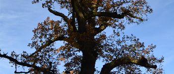
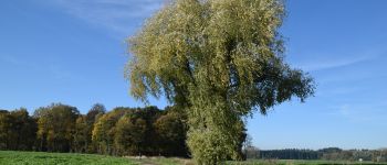
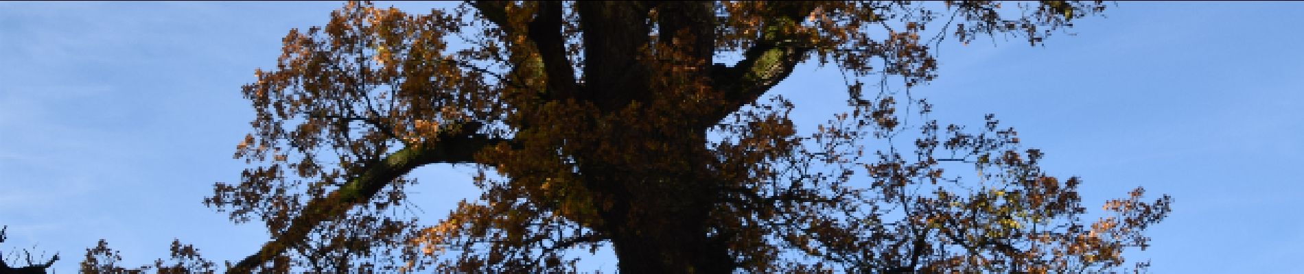
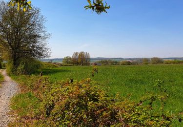
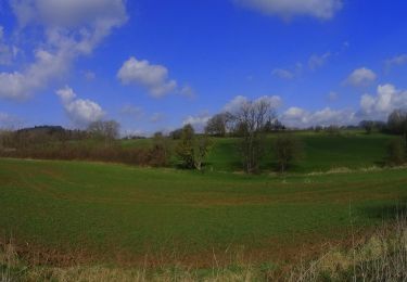
Itinéraire généralement forestier qui constitue, du moins pour la petite boucle, une bonne mise en jambe avant de visiter les jardins de l’étang de Bambois.
Quelle difficulté rencontre-t-elle ?
Aucune.
Sur quel GR randonne-t-elle ?
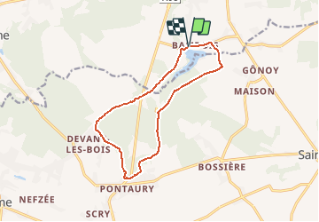
Notre famille Rando emprunte le GR 125 « Tour de l'Entre-Sambre-et-Meuse ».
Comment y arrive-t-elle ?
Via la E42/A15 sortie 14 à Sambreville direction Fosses-la-Ville sur la N98 ; quitter la N98 au sud de Fosses pour atteindre Bambois et le lac.
Via la route de la Basse-Sambre Namur - Charleroi (N90). À Sambreville, prendre la direction de Fosses.
Via la N97 Dinant - Philippeville, prendre la N98 vers Florennes, Mettet puis Bambois.
Que découvre-t-elle aujourd’hui ?
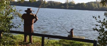
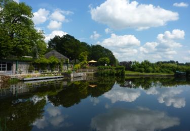
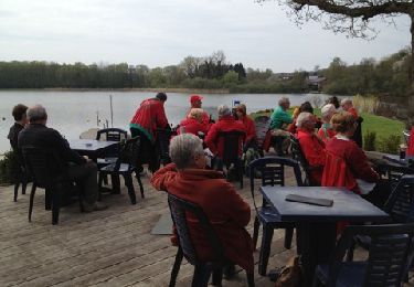
Notre famille Rando visite le grand étang de Fosses ou « Grand Vévi », mieux connu sous l'appellation « lac de Bambois ». Elle se promène dans les jardins, observe les oiseaux, se repose à la plage et profite de la cafétéria. Un beau programme, en somme.
Quelle est la carte IGN de référence ?
Carte IGN au 1:25 000, 53/1-2 « Mettet » et au 1:20 000 47/5-6 « Aiseau-Presles – Fosses-la-Ville ».
Positioning
Comments
Trails nearby
![Trail Walking Fosses-la-Ville - Circuit de Belle Eau 2- - Photo](https://media.geolcdn.com/t/375/260/ext.jpg?maxdim=2&url=https%3A%2F%2Fservices.sitytrail.com%2FGeolivesWS%2FDownloadMedia.ashx%3FTrailID%3D402513%26Media%3D8f521a0c-a043-4094-8396-27fd749e1a3d.JPG)
![Walking Walking](https://static1.geolcdn.com/sitytour/trail-icons/101.png)
Walking
![](/images/other/stat-length.png)
![](https://static1.geolcdn.com/siteimages/upload/files/16400158638029165_repeat_loop_refresh_sync_direction_icon.png)
![Trail Walking Fosses-la-Ville - De Fosses-la-Ville au Lac de bambois - Photo](https://media.geolcdn.com/t/375/260/ext.jpg?maxdim=2&url=https%3A%2F%2Fservices.sitytrail.com%2FGeolivesWS%2FDownloadMedia.ashx%3FTrailID%3D1007636%26Media%3D74e91318-5ce1-4bf1-b01d-724507cd1d0c.jpg)
![Walking Walking](https://static1.geolcdn.com/sitytour/trail-icons/101.png)
Walking
![](/images/other/stat-length.png)
![](https://static1.geolcdn.com/siteimages/upload/files/16400158638029165_repeat_loop_refresh_sync_direction_icon.png)
![Trail Walking Fosses-la-Ville - marche du lac - Photo](https://media.geolcdn.com/t/375/260/ext.jpg?maxdim=2&url=https%3A%2F%2Fservices.sitytrail.com%2FGeolivesWS%2FDownloadMedia.ashx%3FTrailID%3D188865%26Media%3D20130501123324.jpg)
![Walking Walking](https://static1.geolcdn.com/sitytour/trail-icons/101.png)
Walking
![](/images/other/stat-length.png)
![](https://static1.geolcdn.com/siteimages/upload/files/16400158638029165_repeat_loop_refresh_sync_direction_icon.png)
![Trail Walking Fosses-la-Ville - ELVOBAL-FOSSES LA VILLE -nov 2020 - 10kms - Photo](https://media.geolcdn.com/t/375/260/4e4f5698-5abd-4bff-94ba-3fb555d3f821.jpg&format=jpg&maxdim=2)
![Walking Walking](https://static1.geolcdn.com/sitytour/trail-icons/101.png)
Walking
![](/images/other/stat-length.png)
![](https://static1.geolcdn.com/siteimages/upload/files/16400158638029165_repeat_loop_refresh_sync_direction_icon.png)
![Trail Walking Fosses-la-Ville - Le Tour du Lac de Bambois - Photo](https://media.geolcdn.com/t/375/260/ext.jpg?maxdim=2&url=https%3A%2F%2Fstatic1.geolcdn.com%2Fsiteimages%2Fupload%2Ffiles%2F1553511878bg_sport_marche.png)
![Walking Walking](https://static1.geolcdn.com/sitytour/trail-icons/101.png)
Walking
![](/images/other/stat-length.png)
![](https://static1.geolcdn.com/siteimages/upload/files/16400158638029165_repeat_loop_refresh_sync_direction_icon.png)
![Trail Walking Fosses-la-Ville - De Fosses la Ville à Aisemont par le village de Vitrival - Photo](https://media.geolcdn.com/t/375/260/ext.jpg?maxdim=2&url=https%3A%2F%2Fstatic1.geolcdn.com%2Fsiteimages%2Fupload%2Ffiles%2F1553511878bg_sport_marche.png)
![Walking Walking](https://static1.geolcdn.com/sitytour/trail-icons/101.png)
Walking
![](/images/other/stat-length.png)
![](https://static1.geolcdn.com/siteimages/upload/files/16400158638029165_repeat_loop_refresh_sync_direction_icon.png)
![Trail Walking Mettet - La promenade du Planois à Biesme - Photo](https://media.geolcdn.com/t/375/260/600d0e2b-bbcb-4e03-9015-861245aafbce.jpeg&format=jpg&maxdim=2)
![Walking Walking](https://static1.geolcdn.com/sitytour/trail-icons/101.png)
Walking
![](/images/other/stat-length.png)
![](https://static1.geolcdn.com/siteimages/upload/files/16400158638029165_repeat_loop_refresh_sync_direction_icon.png)
![Mountain bike Mountain bike](https://static1.geolcdn.com/sitytour/trail-icons/202.png)
Mountain bike
![](/images/other/stat-length.png)
![](https://static1.geolcdn.com/siteimages/upload/files/16400158638029165_repeat_loop_refresh_sync_direction_icon.png)
![Trail On foot Mettet - Le Chant de la Sitelle - Photo](https://media.geolcdn.com/t/375/260/ext.jpg?maxdim=2&url=https%3A%2F%2Fpivotmedia.tourismewallonie.be%2FOTH-A0-0065-21ZK%2FOTH-A0-0065-21ZK.jpg)
![On foot On foot](https://static1.geolcdn.com/sitytour/trail-icons/100.png)
On foot
![](/images/other/stat-length.png)
![](https://static1.geolcdn.com/siteimages/upload/files/16400158638029165_repeat_loop_refresh_sync_direction_icon.png)
chouette balade mais à éviter en hiver, beaucoup beaucoup de boue
70.426
belle randonnée avec 75 % de parcours dans les bois et campagnes