![](/images/other/stat-length.png)
![Trail Walking Embrun - Mont Guillaume - Photo](https://media.geolcdn.com/t/1900/400/ext.pjpeg?maxdim=2&url=https%3A%2F%2Fservices.sitytrail.com%2FGeolivesWS%2FDownloadMedia.ashx%3FTrailID%3D544173%26Media%3De5c262cd-b1bb-4b33-86dc-b6c42d27f10d.jpg)
Mont Guillaume
marco62118
User
![Length](/images/other/stat-length.png)
![Max alt](https://static1.geolcdn.com/siteimages/upload/files/1508320355ic_sort_altitude_max_24dp.png)
![Uphill gradient](https://static1.geolcdn.com/siteimages/upload/files/1508320355ic_sort_den_pos_24dp.png)
![Km-Effort](/images/other/stat-length.png)
![Min alt](https://static1.geolcdn.com/siteimages/upload/files/1508320355ic_sort_altitude_min_24dp.png)
![Downhill gradient](https://static1.geolcdn.com/siteimages/upload/files/1508320355ic_sort_den_neg_24dp.png)
![Boucle](https://static1.geolcdn.com/siteimages/upload/files/16400158638029165_repeat_loop_refresh_sync_direction_icon.png)
![Walking](https://static1.geolcdn.com/sitytour/trail-icons/101.png)
5h24
Difficulty : Very difficult
![Scan this QR Code to open this trail in the SityTrail application](https://capi.geolives.com/qq0zvz2zws4bq2lad0pu/sitytour/trails/544173/qr.png?size=200)
FREE GPS app for hiking
About
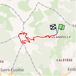
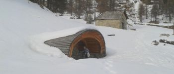
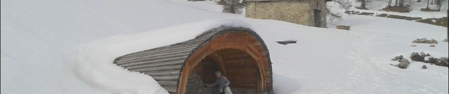
Trail Walking of 13.1 km to be discovered at Provence-Alpes-Côte d'Azur, Hautes-Alpes, Embrun. This trail is proposed by marco62118.
Description
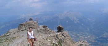
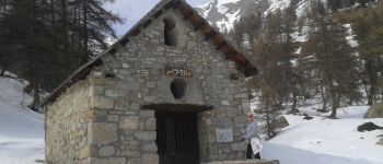
Randonnée du parking "portes de la forêt" jusqu'à la "chapelle du Mont Guillaume". En très bon état et pas en ruine. En passant par la source et la chapelle de "Séyères". Après la montée est un peu longue et raide. Suivre la crête après la chapelle et descendre par le col "Trempa Latz", descente dans le pierrier assez impressionnante.
Positioning
Comments
Trails nearby
![Trail Walking Embrun - Lac de l'Hivernet - Photo](https://media.geolcdn.com/t/375/260/ext.jpg?maxdim=2&url=https%3A%2F%2Fservices.sitytrail.com%2FGeolivesWS%2FDownloadMedia.ashx%3FTrailID%3D1027861%26Media%3Dfix__20180818122123.jpg)
![Walking Walking](https://static1.geolcdn.com/sitytour/trail-icons/101.png)
Walking
![](/images/other/stat-length.png)
![](https://static1.geolcdn.com/siteimages/upload/files/16400158638029165_repeat_loop_refresh_sync_direction_icon.png)
![Trail Walking Embrun - Mont Guillaume-Col de Chanté Perdrix-Lac de l'Hivernet(07-09-16) - Photo](https://media.geolcdn.com/t/375/260/ext.jpg?maxdim=2&url=https%3A%2F%2Fservices.sitytrail.com%2FGeolivesWS%2FDownloadMedia.ashx%3FTrailID%3D594349%26Media%3Dfix__20160707110131.jpg)
![Walking Walking](https://static1.geolcdn.com/sitytour/trail-icons/101.png)
Walking
![](/images/other/stat-length.png)
![](https://static1.geolcdn.com/siteimages/upload/files/16400158638029165_repeat_loop_refresh_sync_direction_icon.png)
![Trail Walking Châteauroux-les-Alpes - boucle cascade de la pisse - Photo](https://media.geolcdn.com/t/375/260/ext.jpg?maxdim=2&url=https%3A%2F%2Fservices.sitytrail.com%2FGeolivesWS%2FDownloadMedia.ashx%3FTrailID%3D455276%26Media%3Dfix__20150806173304.jpg)
![Walking Walking](https://static1.geolcdn.com/sitytour/trail-icons/101.png)
Walking
![](/images/other/stat-length.png)
![](https://static1.geolcdn.com/siteimages/upload/files/16400158638029165_repeat_loop_refresh_sync_direction_icon.png)
![Trail Walking Puy-Saint-Eusèbe - canal de reyssas jusqu'aux Touisses / retour par le GR Serre-Ponçon via ravin de la pisse - Photo](https://media.geolcdn.com/t/375/260/207bcfa3-5f2f-4889-95d2-ad39c84c3a40.jpg&format=jpg&maxdim=2)
![Walking Walking](https://static1.geolcdn.com/sitytour/trail-icons/101.png)
Walking
![](/images/other/stat-length.png)
![](https://static1.geolcdn.com/siteimages/upload/files/16400158638029165_repeat_loop_refresh_sync_direction_icon.png)
![Trail Walking Embrun - Mont Guillaume - Col de Trempa-Latz - 2671 - 10/09/23 - Photo](https://media.geolcdn.com/t/375/260/a1ad9c13-09fc-4e7a-a956-c96541f21c7a.jpg&format=jpg&maxdim=2)
![Walking Walking](https://static1.geolcdn.com/sitytour/trail-icons/101.png)
Walking
![](/images/other/stat-length.png)
![](https://static1.geolcdn.com/siteimages/upload/files/16400158638029165_repeat_loop_refresh_sync_direction_icon.png)
![Trail Walking Embrun - Mont Guillaume - Photo](https://media.geolcdn.com/t/375/260/8a5a6651-8a6c-4528-b5ff-78962c8c835d.jpg&format=jpg&maxdim=2)
![Walking Walking](https://static1.geolcdn.com/sitytour/trail-icons/101.png)
Walking
![](/images/other/stat-length.png)
![](https://static1.geolcdn.com/siteimages/upload/files/16400158638029165_repeat_loop_refresh_sync_direction_icon.png)
![Trail Walking Embrun - Mt Guillaume - Lac de l'Hivernet - Photo](https://media.geolcdn.com/t/375/260/cbed6be4-74aa-4976-902e-a579816616cf.jpg&format=jpg&maxdim=2)
![Walking Walking](https://static1.geolcdn.com/sitytour/trail-icons/101.png)
Walking
![](/images/other/stat-length.png)
![](https://static1.geolcdn.com/siteimages/upload/files/16400158638029165_repeat_loop_refresh_sync_direction_icon.png)
![Trail Walking Embrun - lac de l hivernet - Photo](https://media.geolcdn.com/t/375/260/544b0507-fa9b-4776-945d-9f01d5a68a38.jpg&format=jpg&maxdim=2)
![Walking Walking](https://static1.geolcdn.com/sitytour/trail-icons/101.png)
Walking
![](/images/other/stat-length.png)
![](https://static1.geolcdn.com/siteimages/upload/files/16400158638029165_repeat_loop_refresh_sync_direction_icon.png)
![Trail Walking Embrun - Embrun - 3.4km 90m 1h00 - 2018 06 26 - privé - Photo](https://media.geolcdn.com/t/375/260/ext.jpg?maxdim=2&url=https%3A%2F%2Fservices.sitytrail.com%2FGeolivesWS%2FDownloadMedia.ashx%3FTrailID%3D999315%26Media%3Dfix__20180626102346.jpg)
![Walking Walking](https://static1.geolcdn.com/sitytour/trail-icons/101.png)
Walking
![](/images/other/stat-length.png)
![](https://static1.geolcdn.com/siteimages/upload/files/16400158638029165_repeat_loop_refresh_sync_direction_icon.png)