![](/images/other/stat-length.png)
![Trail Snowshoes Formiguères - De Formiguere au refuge de la Lladura - Photo](https://media.geolcdn.com/t/1900/400/ext.pjpeg?maxdim=2&url=https%3A%2F%2Fservices.sitytrail.com%2FGeolivesWS%2FDownloadMedia.ashx%3FTrailID%3D541015%26Media%3Dfix__20160320132019.jpg)
De Formiguere au refuge de la Lladura
jpipacific
User
![Length](/images/other/stat-length.png)
Length
9.5 km
![Max alt](https://static1.geolcdn.com/siteimages/upload/files/1508320355ic_sort_altitude_max_24dp.png)
Max alt
1929 m
![Uphill gradient](https://static1.geolcdn.com/siteimages/upload/files/1508320355ic_sort_den_pos_24dp.png)
Uphill gradient
327 m
![Km-Effort](/images/other/stat-length.png)
Km-Effort
13.9 km
![Min alt](https://static1.geolcdn.com/siteimages/upload/files/1508320355ic_sort_altitude_min_24dp.png)
Min alt
1734 m
![Downhill gradient](https://static1.geolcdn.com/siteimages/upload/files/1508320355ic_sort_den_neg_24dp.png)
Downhill gradient
343 m
![Boucle](https://static1.geolcdn.com/siteimages/upload/files/16400158638029165_repeat_loop_refresh_sync_direction_icon.png)
Boucle
Yes
Creation date :
2016-03-20 00:00:00.0
Updated on :
2016-03-20 00:00:00.0
![Snowshoes](https://static1.geolcdn.com/sitytour/trail-icons/504.png)
3h21
Difficulty : Medium
![Scan this QR Code to open this trail in the SityTrail application](https://capi.geolives.com/qq0zvz2zws4bq2lad0pu/sitytour/trails/541015/qr.png?size=200)
FREE GPS app for hiking
About
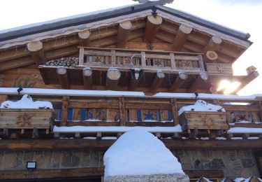
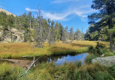
Trail Snowshoes of 9.5 km to be discovered at Occitania, Pyrénées-Orientales, Formiguères. This trail is proposed by jpipacific.
Description
Montée assez douce dans la forêt avec de belles vues. Longue descente vers le joli refuge de la Lladura. Retour par le même chemin.
Positioning
Country:
France
Region :
Occitania
Department/Province :
Pyrénées-Orientales
Municipality :
Formiguères
Location:
Unknown
Start:(Dec)
Start:(UTM)
423764 ; 4719274 (31T) N.
Comments
Trails nearby
![Trail Walking Formiguères - Les Camporells par la Lladure - Photo](https://media.geolcdn.com/t/375/260/ext.jpg?maxdim=2&url=https%3A%2F%2Fstatic1.geolcdn.com%2Fsiteimages%2Fupload%2Ffiles%2F1553511878bg_sport_marche.png)
![Walking Walking](https://static1.geolcdn.com/sitytour/trail-icons/101.png)
Les Camporells par la Lladure
Walking
Medium
(1)
Formiguères,
Occitania,
Pyrénées-Orientales,
France
![](/images/other/stat-length.png)
15.1 km | 24 km-effort
5h 7min
![](https://static1.geolcdn.com/siteimages/upload/files/16400158638029165_repeat_loop_refresh_sync_direction_icon.png)
Yes
![Trail sport Formiguères - 20240728 Station Formiguères - Camporeils - Photo](https://media.geolcdn.com/t/375/260/f876415d-ce02-429d-b141-5520f07207a5.jpg&format=jpg&maxdim=2)
20240728 Station Formiguères - Camporeils
sport
Very easy
Formiguères,
Occitania,
Pyrénées-Orientales,
France
![](/images/other/stat-length.png)
16 km | 27 km-effort
Unknown
![](https://static1.geolcdn.com/siteimages/upload/files/16400158638029165_repeat_loop_refresh_sync_direction_icon.png)
Yes
![Trail Walking Puyvalador - Puyvalador tour du lac - Photo](https://media.geolcdn.com/t/375/260/8f1726ec-7b11-4960-9385-ddf77a7154ab.jpg&format=jpg&maxdim=2)
![Walking Walking](https://static1.geolcdn.com/sitytour/trail-icons/101.png)
Puyvalador tour du lac
Walking
Very easy
Puyvalador,
Occitania,
Pyrénées-Orientales,
France
![](/images/other/stat-length.png)
12.1 km | 15.9 km-effort
3h 39min
![](https://static1.geolcdn.com/siteimages/upload/files/16400158638029165_repeat_loop_refresh_sync_direction_icon.png)
Yes
![Trail Walking Formiguères - 20210819 Porteille d’Orlu, étang du diable - Photo](https://media.geolcdn.com/t/375/260/dda65196-4e65-40c0-ab96-37c7b8dfe61a.jpg&format=jpg&maxdim=2)
![Walking Walking](https://static1.geolcdn.com/sitytour/trail-icons/101.png)
20210819 Porteille d’Orlu, étang du diable
Walking
Difficult
Formiguères,
Occitania,
Pyrénées-Orientales,
France
![](/images/other/stat-length.png)
16.4 km | 29 km-effort
5h 3min
![](https://static1.geolcdn.com/siteimages/upload/files/16400158638029165_repeat_loop_refresh_sync_direction_icon.png)
Yes
![Trail Walking Formiguères - 20210710 pla del bosc - Foumigueres - Photo](https://media.geolcdn.com/t/375/260/1179261a-6605-4660-a8d9-78a9473ad380.jpg&format=jpg&maxdim=2)
![Walking Walking](https://static1.geolcdn.com/sitytour/trail-icons/101.png)
20210710 pla del bosc - Foumigueres
Walking
Easy
Formiguères,
Occitania,
Pyrénées-Orientales,
France
![](/images/other/stat-length.png)
12.5 km | 18.3 km-effort
2h 47min
![](https://static1.geolcdn.com/siteimages/upload/files/16400158638029165_repeat_loop_refresh_sync_direction_icon.png)
Yes
![Snowshoes Snowshoes](https://static1.geolcdn.com/sitytour/trail-icons/504.png)
2021-02-11 Sortie CAF - Les Angles - vers les Camporells
Snowshoes
Medium
Les Angles,
Occitania,
Pyrénées-Orientales,
France
![](/images/other/stat-length.png)
16.8 km | 24 km-effort
7h 0min
![](https://static1.geolcdn.com/siteimages/upload/files/16400158638029165_repeat_loop_refresh_sync_direction_icon.png)
Yes
![Trail Snowshoes Formiguères - Formigueres el collet - Photo](https://media.geolcdn.com/t/375/260/fd8d553e-fbbc-4eac-9bcd-8fe4718e94f2.jpg&format=jpg&maxdim=2)
![Snowshoes Snowshoes](https://static1.geolcdn.com/sitytour/trail-icons/504.png)
Formigueres el collet
Snowshoes
Very easy
Formiguères,
Occitania,
Pyrénées-Orientales,
France
![](/images/other/stat-length.png)
6.4 km | 8.7 km-effort
2h 47min
![](https://static1.geolcdn.com/siteimages/upload/files/16400158638029165_repeat_loop_refresh_sync_direction_icon.png)
Yes
![Trail Snowshoes Matemale - Tour lac mattemale neige - Photo](https://media.geolcdn.com/t/375/260/46aed13f-af74-4409-96af-d8ee48a8d1a0.jpg&format=jpg&maxdim=2)
![Snowshoes Snowshoes](https://static1.geolcdn.com/sitytour/trail-icons/504.png)
Tour lac mattemale neige
Snowshoes
Very easy
Matemale,
Occitania,
Pyrénées-Orientales,
France
![](/images/other/stat-length.png)
9.1 km | 10.4 km-effort
3h 5min
![](https://static1.geolcdn.com/siteimages/upload/files/16400158638029165_repeat_loop_refresh_sync_direction_icon.png)
Yes
![Trail Walking Les Angles - Boucle depuis lac de Balcere vers Estany de l'Esparver - Photo](https://media.geolcdn.com/t/375/260/65251a6e-5cd5-4693-a93d-58132b74be2c.jpg&format=jpg&maxdim=2)
![Walking Walking](https://static1.geolcdn.com/sitytour/trail-icons/101.png)
Boucle depuis lac de Balcere vers Estany de l'Esparver
Walking
Medium
Les Angles,
Occitania,
Pyrénées-Orientales,
France
![](/images/other/stat-length.png)
13.4 km | 21 km-effort
4h 22min
![](https://static1.geolcdn.com/siteimages/upload/files/16400158638029165_repeat_loop_refresh_sync_direction_icon.png)
Yes