


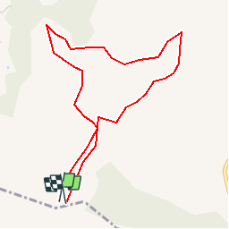

16.5 km | 24 km-effort


User


FREE GPS app for hiking
 SityTrail
IGN / Geographical institutes
SityTrail World
The world is yours!
Trail Walking of 4.8 km to be discovered at Provence-Alpes-Côte d'Azur, Bouches-du-Rhône, Roquefort-la-Bédoule. This trail is proposed by marchev.
pour agrandir rando les balcons de ceyreste

Walking

Walking

Walking

Walking

Walking

Nordic walking
Nordic walking

Walking
Walking
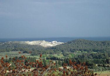
beaux points de vues. parcours assez aérien.