Trail Walking Lacombe - La Galaube - Photo
 Pierre11
Pierre11

User

© OpenStreetMap contributors
Length
Length
17.7 km
Max alt
Max alt
888 m
Uphill gradient
Uphill gradient
417 m
Km-Effort
Km-Effort  
23 km
Min alt
Min alt
698 m
Downhill gradient
Downhill gradient
413 m
Boucle
Boucle
Yes
Creation date :
2016-03-09 00:00:00.0
Updated on :
2016-03-09 00:00:00.0

(0 Reviews)

Walking
Walking
5h00
Difficulty : Easy

Scan this QR Code to open this trail in the SityTrail application

FREE GPS app for hiking

Logo SityTrail SityTrail

IGN / Geographical institutes

Download SityTrail from the App Store Download SityTrail from Google Play

Logo SityTrail SityTrail World

The world is yours!

Download SityTrail from the App Store Download SityTrail from Google Play Download SityTrail on Huawei AppGallery

About

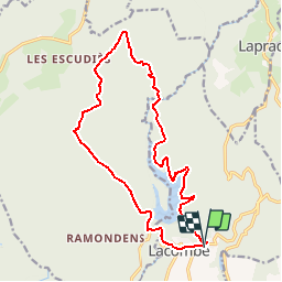
Trail Walking of 17.7 km to be discovered at Occitania, Aude, Lacombe. This trail is proposed by Pierre11.

Description

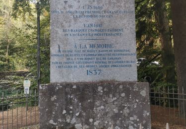
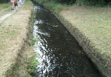
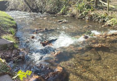
Randonnée entre lac et forêt domaniale depuis le hameau de Cals, le long de la réserve d'eau potable, que constitue le lac de la Galaube, jusqu'au GR7 qui traverse la forêt domaniale de Ramondens, avant de passer près du parc éolien d'Arfons-Sor. Retour en terre audoise après avoir franchi l'Alzeau à la prise d'Alzeau (source du Canal du Midi)
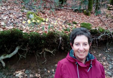
Parcours original très peu balisé, d'où utilité de récupérer les points GPX du tracé sur son Smartphone.

Elevation profile

Positioning

Country:
France
Region :
Occitania
Department/Province :
Aude
Municipality :
Lacombe
Location:
Unknown
Start:(UTM)
438446 ; 4805319 (31T) N.

Trails nearby

Trail Walking Saint-Denis - Saint Denis prise d'Alzeau - Photo
Walking
GUIDE
Ada11

Walking

Medium
Saint-Denis, Occitania, Aude, France
22 km | 29 km-effort
5h 2min
Yes
Trail Walking Saissac - RPT63 - Photo
Walking
dufland

Walking

Medium
(1)
Saissac, Occitania, Aude, France
9.2 km | 11.4 km-effort
2h 35min
Yes
Trail Walking Saissac - Boucle barrage St Denis-Prise de l'Alzeau - Photo
Walking
rocco58

Walking

Easy
(2)
Saissac, Occitania, Aude, France
8.8 km | 10.2 km-effort
Unknown
Yes
Trail Walking Fontiers-Cabardès - Frontiers cabardès - Photo
Walking
FOUCAULT

Walking

Fontiers-Cabardès, Occitania, Aude, France
4.6 km | 6.2 km-effort
1h 29min
Yes
Trail Walking Caudebronde - Caudreronde - Photo
Walking
GUIDE
Ada11

Walking

Medium
Caudebronde, Occitania, Aude, France
18.7 km | 28 km-effort
6h 38min
Yes
Trail On foot Les Martys - les Martys-la Tourette VM - Photo
On foot
dufland

On foot

Easy
(1)
Les Martys, Occitania, Aude, France
8.2 km | 11 km-effort
2h 22min
Yes
Trail Walking Saint-Denis - La Galaube 200519 - Photo
Walking
JohnTompa

Walking

Easy
(1)
Saint-Denis, Occitania, Aude, France
11.2 km | 13.6 km-effort
3h 22min
Yes
Trail Walking Arfons - ramondens100320 ex - Photo
Walking
arnoultjf

Walking

Very easy
Arfons, Occitania, Tarn, France
5.8 km | 8 km-effort
1h 26min
Yes
Trail Walking Cuxac-Cabardès - laprade faloque  - Photo
Walking
ziziojack

Walking

Medium
(1)
Cuxac-Cabardès, Occitania, Aude, France
12.4 km | 16.2 km-effort
Unknown
Yes


Close
My subscriptions