


Wahibas

rafa77
User
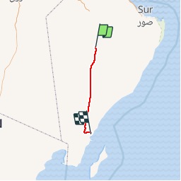

Length
158 km

Max alt
284 m

Uphill gradient
2066 m
Km-Effort
186 km

Min alt
2 m

Downhill gradient
2317 m
Boucle
No
Creation date :
2016-06-15 00:00:00.0
Updated on :
2016-06-15 00:00:00.0
6h00
Difficulty : Easy

FREE GPS app for hiking
 SityTrail
IGN / Geographical institutes
SityTrail World
The world is yours!
About
Trail Motor of 158 km to be discovered at Ash Sharqiyah North. This trail is proposed by rafa77.
Positioning
Country:
Oman
Region :
Ash Sharqiyah North
Department/Province :
Unknown
Municipality :
Unknown
Location:
Unknown
Start:(Dec)
Start:(UTM)
681477 ; 2445273 (40Q) N.
Comments
Trails nearby