


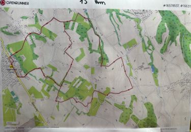
12.7 km | 25 km-effort


User


FREE GPS app for hiking
 SityTrail
IGN / Geographical institutes
SityTrail World
The world is yours!
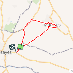
Trail Walking of 5.9 km to be discovered at Auvergne-Rhône-Alpes, Drôme, Bésayes. This trail is proposed by potan12.
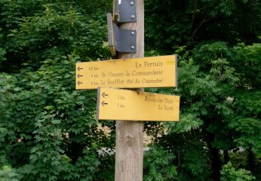
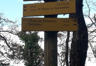
Petite balade sympa pour passer une heure trente c'est presque tout plat, hormis le village de Marches qui est perché

Walking

Walking

Walking

Walking
Walking
Walking
Walking

sport
Walking