Trail Walking Larchant - GLM-160204 - DameJouanne (tracé manuel) - Photo

GLM-160204 - DameJouanne (tracé manuel)

 randodan
randodan

User

© OpenStreetMap contributors
Length
Length
10.3 km
Max alt
Max alt
120 m
Uphill gradient
Uphill gradient
207 m
Km-Effort
Km-Effort  
13.1 km
Min alt
Min alt
69 m
Downhill gradient
Downhill gradient
208 m
Boucle
Boucle
Yes
Creation date :
2016-03-09 00:00:00.0
Updated on :
2016-03-09 00:00:00.0

(1 Reviews)

Walking
Walking
3h00
Difficulty : Medium

Scan this QR Code to open this trail in the SityTrail application

FREE GPS app for hiking

Logo SityTrail SityTrail

IGN / Geographical institutes

Download SityTrail from the App Store Download SityTrail from Google Play

Logo SityTrail SityTrail World

The world is yours!

Download SityTrail from the App Store Download SityTrail from Google Play Download SityTrail on Huawei AppGallery

About

Trail Walking of 10.3 km to be discovered at Ile-de-France, Seine-et-Marne, Larchant. This trail is proposed by randodan.

Description

Les Gais Lurons à la Dame Jouanne<br>- 4 février 2016 -<br>
GPS tombé en rade à la 1ère photo, le parcours est donc retracé manuellement . Dire que j'avais super préparé ce circuit (avec 34 annotations vocales que je n'ai donc pas pu utiliser).<br>
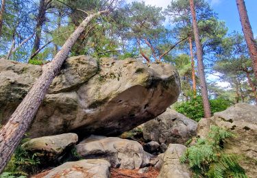
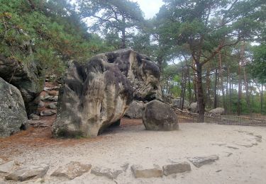
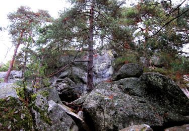
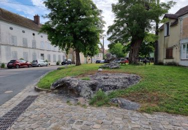
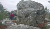
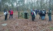
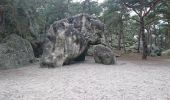
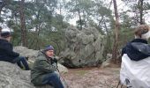
9h15, c'est parti sur le Denecourt n°19 . Le Mont Simonet, chacun imagine ce qu'il veut devant le rocher sommital (carte de France, gros pif, etc.) . Rocher de la Justice, un Oreille écoute ceux qui sont passés sur le Banc . L’Eléphant, on y fait la pause chamallows . La Fontaine Saint-Mathurin, le Auvent, puis c'est l'escalade du Mont Blanc . L'érosion et la fonte des neiges a ramené ses 4810 m à seulement 121 m.<br>
Cap sur le resto à présent, puis recherche - infructueuse - de la Fontaine Saint-Bernard (Bernard m'avait pourtant dit qu'il la connaissait SA fontaine, et Claude avait même sa position GPS, mais...) . Vers 11h30, un petit crachin pas trop méchant, m'obligeant juste à protéger mon sac, nous accompagne jusqu'à l'Auberge.<br>
12h20 à l'Auberge de la Dame Jouanne (Chalet Jobert) . Au menu : terrine Jobert, pavé de saumon, tarte aux noix, hummm !<br>
L'après-midi, nous ne sommes que 5 à repartir . Heureusement, ni pluie ni crachin, on peut donc faire le tour de la Dame Jouanne pour digérer comme prévu.<br>
Rapport mangeurs/marcheurs battu... 2 fois plus au resto qu'en marche => 17 marcheurs pour 34 à table !

Elevation profile

Photos

Points of interest

Point of interest Larchant - 01 - Sur le Mont Simonet - Photo
randodan
Point of interest Larchant - 02 - L’Éléphant - Photo
randodan

Positioning

Country:
France
Region :
Ile-de-France
Department/Province :
Seine-et-Marne
Municipality :
Larchant
Location:
Unknown
Start:(UTM)
470311 ; 5350052 (31U) N.

Comments

Please log in to post a review or rate the element


très pratique


Trails nearby

Trail Walking Recloses - Boucle recloses Nemours Grez/loing - Photo
Walking
GUIDE
chessyca

Walking

Medium
(1)
Recloses, Ile-de-France, Seine-et-Marne, France
30 km | 34 km-effort
6h 20min
Yes
Trail Walking Larchant - Larchant la Féérique  - Photo
Walking
GUIDE
chessyca

Walking

Medium
Larchant, Ile-de-France, Seine-et-Marne, France
19.6 km | 24 km-effort
5h 14min
Yes
Trail On foot Larchant - Sentier Denecourt-Colinet 19 - Photo
On foot
GUIDE+

On foot

Easy
Larchant, Ile-de-France, Seine-et-Marne, France
9.7 km | 12.3 km-effort
2h 47min
Yes
Trail Walking Villiers-sous-Grez - Villiers sous grez / Larchant - Photo
Walking
becor94

Walking

Very difficult
Villiers-sous-Grez, Ile-de-France, Seine-et-Marne, France
24 km | 29 km-effort
5h 31min
Yes
Trail Walking Recloses - Recloses Ve120124 pm - Photo
Walking
fmg

Walking

Medium
(1)
Recloses, Ile-de-France, Seine-et-Marne, France
8.9 km | 10.5 km-effort
2h 23min
Yes
Trail Walking Recloses - Recloses ve 120124 am - Photo
Walking
fmg

Walking

Medium
(1)
Recloses, Ile-de-France, Seine-et-Marne, France
10.8 km | 12.6 km-effort
2h 52min
Yes
Trail Walking Recloses - Recloses Ve 280423 SR30042323 PM10km - Photo
Walking
fmg

Walking

Medium
(1)
Recloses, Ile-de-France, Seine-et-Marne, France
9.9 km | 11.9 km-effort
2h 42min
Yes
Trail Nordic walking Larchant - Dame Juane - Photo
Nordic walking
pierre_mack

Nordic walking

Larchant, Ile-de-France, Seine-et-Marne, France
22 km | 26 km-effort
3h 6min
No
Trail Walking Recloses - Recloses Sentier Denecourt 20 - Photo
Walking
guydu41

Walking

Medium
Recloses, Ile-de-France, Seine-et-Marne, France
6.4 km | 8 km-effort
2h 17min
Yes


Close
My subscriptions