Trail Other activity Unknown - Alpine Crossing Tongarino - Photo
© OpenStreetMap contributors
Length
Length
19.6 km
Max alt
Max alt
1856 m
Uphill gradient
Uphill gradient
809 m
Km-Effort
Km-Effort  
32 km
Min alt
Min alt
750 m
Downhill gradient
Downhill gradient
1180 m
Boucle
Boucle
No
Creation date :
2016-02-04 00:00:00.0
Updated on :
2016-02-04 00:00:00.0

(0 Reviews)

Other activity
Other activity
6h36
Difficulty : Difficult

Scan this QR Code to open this trail in the SityTrail application

FREE GPS app for hiking

Logo SityTrail SityTrail

IGN / Geographical institutes

Download SityTrail from the App Store Download SityTrail from Google Play

Logo SityTrail SityTrail World

The world is yours!

Download SityTrail from the App Store Download SityTrail from Google Play Download SityTrail on Huawei AppGallery

About

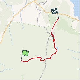
Trail Other activity of 19.6 km to be discovered at Manawatu-Whanganui, Ruapehu District. This trail is proposed by zoe.vienne.

Description

Magnifique

Elevation profile

Positioning

Country:
New Zealand
Region :
Manawatu-Whanganui
Department/Province :
Ruapehu District
Municipality :
Unknown
Location:
Unknown
Start:(UTM)
377372 ; 5666254 (60H) S.

Trails nearby

Trail Walking  - taranaki trail  - Photo
Walking
goffinm@gmail.com

Walking

Easy
, Manawatu-Whanganui, Ruapehu District, New Zealand
6.5 km | 8.3 km-effort
2h 3min
Yes


Close
My subscriptions