![](/images/other/stat-length.png)
![Trail Walking Nandrin - NANDRIN - Promenade de Yernée - Photo](https://media.geolcdn.com/t/1900/400/ext.pjpeg?maxdim=2&url=https%3A%2F%2Fservices.sitytrail.com%2FGeolivesWS%2FDownloadMedia.ashx%3FTrailID%3D517623%26Media%3D7ab957a9-1257-4946-923e-041eda79bd03.jpg)
NANDRIN - Promenade de Yernée
henrineupre
User
![Length](/images/other/stat-length.png)
Length
9.1 km
![Max alt](https://static1.geolcdn.com/siteimages/upload/files/1508320355ic_sort_altitude_max_24dp.png)
Max alt
244 m
![Uphill gradient](https://static1.geolcdn.com/siteimages/upload/files/1508320355ic_sort_den_pos_24dp.png)
Uphill gradient
192 m
![Km-Effort](/images/other/stat-length.png)
Km-Effort
11.6 km
![Min alt](https://static1.geolcdn.com/siteimages/upload/files/1508320355ic_sort_altitude_min_24dp.png)
Min alt
101 m
![Downhill gradient](https://static1.geolcdn.com/siteimages/upload/files/1508320355ic_sort_den_neg_24dp.png)
Downhill gradient
195 m
![Boucle](https://static1.geolcdn.com/siteimages/upload/files/16400158638029165_repeat_loop_refresh_sync_direction_icon.png)
Boucle
Yes
![Signpost](https://services.sitytrail.com/GeolivesWS/DownloadMedia.ashx?TrailID=517623&Media=balise.png)
Signpost
Creation date :
2017-03-17 00:00:00.0
Updated on :
2017-03-17 00:00:00.0
![Walking](https://static1.geolcdn.com/sitytour/trail-icons/101.png)
2h30
Difficulty : Medium
![Scan this QR Code to open this trail in the SityTrail application](https://capi.geolives.com/qq0zvz2zws4bq2lad0pu/sitytour/trails/517623/qr.png?size=200)
FREE GPS app for hiking
About
Trail Walking of 9.1 km to be discovered at Wallonia, Liège, Nandrin. This trail is proposed by henrineupre.
Description
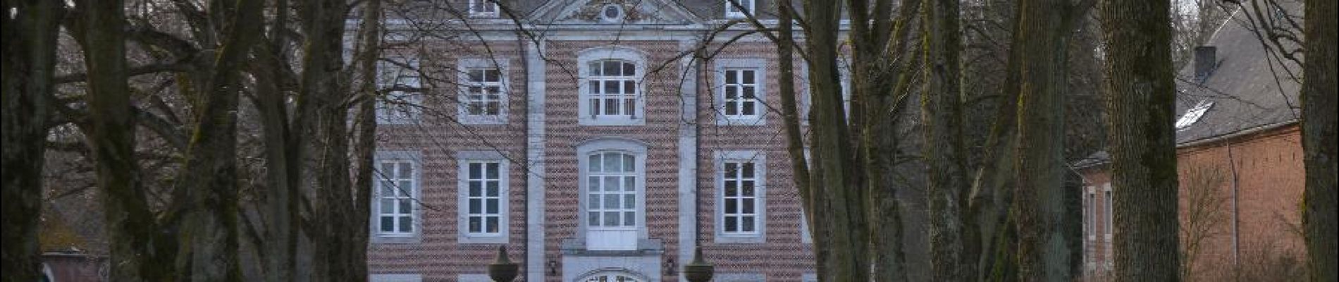
Le village en déclivité s’étire le long de la route d’Ombret, qui le traverse pour rejoindre la vallée, pour peu, on se croirait en Ardennes.
BALISE: losange rouge
Positioning
Country:
Belgium
Region :
Wallonia
Department/Province :
Liège
Municipality :
Nandrin
Location:
Yernée-Fraineux
Start:(Dec)
Start:(UTM)
668807 ; 5600048 (31U) N.
Comments
Trails nearby
![Trail Walking Modave - Rausa GR 575 bis - Photo](https://media.geolcdn.com/t/375/260/ext.jpg?maxdim=2&url=https%3A%2F%2Fstatic1.geolcdn.com%2Fsiteimages%2Fupload%2Ffiles%2F1553511878bg_sport_marche.png)
![Walking Walking](https://static1.geolcdn.com/sitytour/trail-icons/101.png)
Rausa GR 575 bis
Walking
Easy
(12)
Modave,
Wallonia,
Liège,
Belgium
![](/images/other/stat-length.png)
6 km | 7.7 km-effort
1h 38min
![](https://static1.geolcdn.com/siteimages/upload/files/16400158638029165_repeat_loop_refresh_sync_direction_icon.png)
Yes
![Trail Walking Amay - marche adeps jehay 10km 2024 - Photo](https://media.geolcdn.com/t/375/260/04b81805-d462-4e76-9141-5bf7a46a778a.jpg&format=jpg&maxdim=2)
![Walking Walking](https://static1.geolcdn.com/sitytour/trail-icons/101.png)
marche adeps jehay 10km 2024
Walking
Medium
(1)
Amay,
Wallonia,
Liège,
Belgium
![](/images/other/stat-length.png)
9.8 km | 11.8 km-effort
2h 20min
![](https://static1.geolcdn.com/siteimages/upload/files/16400158638029165_repeat_loop_refresh_sync_direction_icon.png)
Yes
![Trail Walking Nandrin - Villers le temple . st jean sart . clemaude - Photo](https://media.geolcdn.com/t/375/260/c7438fda-ad3c-4a12-91ed-f3aabfc6b7ce.jpg&format=jpg&maxdim=2)
![Walking Walking](https://static1.geolcdn.com/sitytour/trail-icons/101.png)
Villers le temple . st jean sart . clemaude
Walking
Very easy
(1)
Nandrin,
Wallonia,
Liège,
Belgium
![](/images/other/stat-length.png)
7.9 km | 10.4 km-effort
2h 12min
![](https://static1.geolcdn.com/siteimages/upload/files/16400158638029165_repeat_loop_refresh_sync_direction_icon.png)
Yes
![Trail Walking Modave - MODAVE - Froide Fontaine - Photo](https://media.geolcdn.com/t/375/260/ext.jpg?maxdim=2&url=https%3A%2F%2Fservices.sitytrail.com%2FGeolivesWS%2FDownloadMedia.ashx%3FTrailID%3D163540%26Media%3Da9dfd4e0-07be-4695-be31-23a02d75fa1f.jpg)
![Walking Walking](https://static1.geolcdn.com/sitytour/trail-icons/101.png)
MODAVE - Froide Fontaine
Walking
Medium
(2)
Modave,
Wallonia,
Liège,
Belgium
![](/images/other/stat-length.png)
8.6 km | 10.6 km-effort
2h 14min
![](https://static1.geolcdn.com/siteimages/upload/files/16400158638029165_repeat_loop_refresh_sync_direction_icon.png)
Yes
![Trail Mountain bike Amay - casse gueul - Photo](https://media.geolcdn.com/t/375/260/ext.jpg?maxdim=2&url=https%3A%2F%2Fservices.sitytrail.com%2FGeolivesWS%2FDownloadMedia.ashx%3FTrailID%3D285464%26Media%3Dfix__20140511121633.jpg)
![Mountain bike Mountain bike](https://static1.geolcdn.com/sitytour/trail-icons/202.png)
casse gueul
Mountain bike
Difficult
(1)
Amay,
Wallonia,
Liège,
Belgium
![](/images/other/stat-length.png)
27 km | 33 km-effort
2h 21min
![](https://static1.geolcdn.com/siteimages/upload/files/16400158638029165_repeat_loop_refresh_sync_direction_icon.png)
No
![Trail Walking Nandrin - promenade de la rochette : villers le temple - grand fond d'oxhe - villers le temple - Photo](https://media.geolcdn.com/t/375/260/6a65eaf0-07ca-4e09-ab79-c1ffba2fba6b.jpg&format=jpg&maxdim=2)
![Walking Walking](https://static1.geolcdn.com/sitytour/trail-icons/101.png)
promenade de la rochette : villers le temple - grand fond d'oxhe - villers le...
Walking
Medium
(1)
Nandrin,
Wallonia,
Liège,
Belgium
![](/images/other/stat-length.png)
10 km | 13.3 km-effort
2h 47min
![](https://static1.geolcdn.com/siteimages/upload/files/16400158638029165_repeat_loop_refresh_sync_direction_icon.png)
Yes
![Trail Walking Modave - Stree reco 21 12 - Photo](https://media.geolcdn.com/t/375/260/ext.jpg?maxdim=2&url=https%3A%2F%2Fstatic1.geolcdn.com%2Fsiteimages%2Fupload%2Ffiles%2F1553511878bg_sport_marche.png)
![Walking Walking](https://static1.geolcdn.com/sitytour/trail-icons/101.png)
Stree reco 21 12
Walking
Medium
(2)
Modave,
Wallonia,
Liège,
Belgium
![](/images/other/stat-length.png)
7.6 km | 9.3 km-effort
1h 55min
![](https://static1.geolcdn.com/siteimages/upload/files/16400158638029165_repeat_loop_refresh_sync_direction_icon.png)
Yes
![Trail Walking Amay - 20230726 - TOTEMUS Amay - 6.1 Km - Photo](https://media.geolcdn.com/t/375/260/4112cd7d-32fc-4690-94e7-6dc07eacc03d.jpeg&format=jpg&maxdim=2)
![Walking Walking](https://static1.geolcdn.com/sitytour/trail-icons/101.png)
20230726 - TOTEMUS Amay - 6.1 Km
Walking
Medium
Amay,
Wallonia,
Liège,
Belgium
![](/images/other/stat-length.png)
6.1 km | 6.6 km-effort
1h 42min
![](https://static1.geolcdn.com/siteimages/upload/files/16400158638029165_repeat_loop_refresh_sync_direction_icon.png)
Yes
![Trail On foot Amay - Promenade d'Ombret - Photo](https://media.geolcdn.com/t/375/260/bbfa7314-541b-4540-af6f-869e2bd08b94.jpeg&format=jpg&maxdim=2)
![On foot On foot](https://static1.geolcdn.com/sitytour/trail-icons/100.png)