


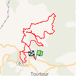

17.6 km | 24 km-effort


User


FREE GPS app for hiking
 SityTrail
IGN / Geographical institutes
SityTrail World
The world is yours!
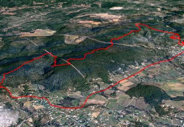
Trail Walking of 13.9 km to be discovered at Provence-Alpes-Côte d'Azur, Var, Tourtour. This trail is proposed by Sugg.
Reco, pas de passage aux Moulières côte 691, la zone du ruisseau est impraticable.
Voir parcours Tourtour - Les Infirmières .


Walking
Walking

Walking

Other activity

Mountain bike
Mountain bike

Walking
Walking
Walking
attention deux tronçons à travers tout