![](/images/other/stat-length.png)
![Trail Walking Ribeauvillé - Trois chateaux La Grande Verrerie - Photo](https://media.geolcdn.com/t/1900/400/ext.pjpeg?maxdim=2&url=https%3A%2F%2Fstatic1.geolcdn.com%2Fsiteimages%2Fupload%2Ffiles%2F1553511878bg_sport_marche.png)
Trois chateaux La Grande Verrerie
markrei
User
![Length](/images/other/stat-length.png)
Length
17.6 km
![Max alt](https://static1.geolcdn.com/siteimages/upload/files/1508320355ic_sort_altitude_max_24dp.png)
Max alt
933 m
![Uphill gradient](https://static1.geolcdn.com/siteimages/upload/files/1508320355ic_sort_den_pos_24dp.png)
Uphill gradient
990 m
![Km-Effort](/images/other/stat-length.png)
Km-Effort
31 km
![Min alt](https://static1.geolcdn.com/siteimages/upload/files/1508320355ic_sort_altitude_min_24dp.png)
Min alt
237 m
![Downhill gradient](https://static1.geolcdn.com/siteimages/upload/files/1508320355ic_sort_den_neg_24dp.png)
Downhill gradient
991 m
![Boucle](https://static1.geolcdn.com/siteimages/upload/files/16400158638029165_repeat_loop_refresh_sync_direction_icon.png)
Boucle
Yes
Creation date :
2016-01-04 00:00:00.0
Updated on :
2016-01-04 00:00:00.0
![Walking](https://static1.geolcdn.com/sitytour/trail-icons/101.png)
6h18
Difficulty : Medium
![Scan this QR Code to open this trail in the SityTrail application](https://capi.geolives.com/qq0zvz2zws4bq2lad0pu/sitytour/trails/509215/qr.png?size=200)
FREE GPS app for hiking
About
Trail Walking of 17.6 km to be discovered at Grand Est, Haut-Rhin, Ribeauvillé. This trail is proposed by markrei.
Description
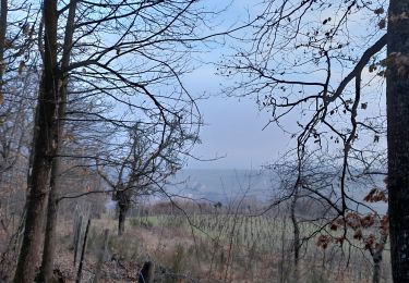
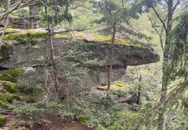
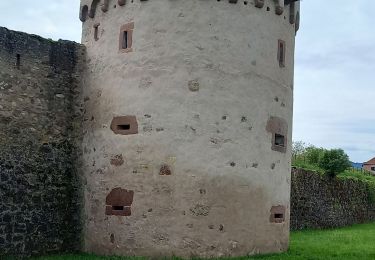
Ribeauvillé-St Ulrich-Girsberg-château Ribeaupierr-carrefour du Cerisier Noir-Rocher de la Paix d'Udine-Rocher des Titans-La grande Vererie-Abri-Ribeauvillé
Positioning
Country:
France
Region :
Grand Est
Department/Province :
Haut-Rhin
Municipality :
Ribeauvillé
Location:
Unknown
Start:(Dec)
Start:(UTM)
375530 ; 5339091 (32U) N.
Comments
Trails nearby
![Trail Mountain bike Ribeauvillé - Ribeauvillé Riquewihr - Photo](https://media.geolcdn.com/t/375/260/ext.jpg?maxdim=2&url=https%3A%2F%2Fservices.sitytrail.com%2FGeolivesWS%2FDownloadMedia.ashx%3FTrailID%3D101224%26Media%3D712_1.jpg)
![Mountain bike Mountain bike](https://static1.geolcdn.com/sitytour/trail-icons/202.png)
Ribeauvillé Riquewihr
Mountain bike
Medium
(1)
Ribeauvillé,
Grand Est,
Haut-Rhin,
France
![](/images/other/stat-length.png)
19.3 km | 24 km-effort
1h 30min
![](https://static1.geolcdn.com/siteimages/upload/files/16400158638029165_repeat_loop_refresh_sync_direction_icon.png)
Yes
![Trail Walking Ribeauvillé - 2023-08-26 Marche Ribeauville Taennchel - Photo](https://media.geolcdn.com/t/375/260/74d8ac69-de70-4d04-a080-288de3ed9a04.jpg&format=jpg&maxdim=2)
![Walking Walking](https://static1.geolcdn.com/sitytour/trail-icons/101.png)
2023-08-26 Marche Ribeauville Taennchel
Walking
Medium
(1)
Ribeauvillé,
Grand Est,
Haut-Rhin,
France
![](/images/other/stat-length.png)
20 km | 34 km-effort
7h 45min
![](https://static1.geolcdn.com/siteimages/upload/files/16400158638029165_repeat_loop_refresh_sync_direction_icon.png)
Yes
![Trail Walking Hunawihr - Hunawihr - Riquewihr - Photo](https://media.geolcdn.com/t/375/260/ext.jpg?maxdim=2&url=https%3A%2F%2Fstatic1.geolcdn.com%2Fsiteimages%2Fupload%2Ffiles%2F1553511878bg_sport_marche.png)
![Walking Walking](https://static1.geolcdn.com/sitytour/trail-icons/101.png)
Hunawihr - Riquewihr
Walking
Easy
(1)
Hunawihr,
Grand Est,
Haut-Rhin,
France
![](/images/other/stat-length.png)
6.3 km | 9 km-effort
2h 15min
![](https://static1.geolcdn.com/siteimages/upload/files/16400158638029165_repeat_loop_refresh_sync_direction_icon.png)
Yes
![Trail Walking Riquewihr - Sentier des grands crus - Photo](https://media.geolcdn.com/t/375/260/ext.jpg?maxdim=2&url=https%3A%2F%2Fservices.sitytrail.com%2FGeolivesWS%2FDownloadMedia.ashx%3FTrailID%3D482185%26Media%3D8532cb29-bcf9-4719-bd1f-5f2e4165e237.jpg)
![Walking Walking](https://static1.geolcdn.com/sitytour/trail-icons/101.png)
Sentier des grands crus
Walking
Medium
(2)
Riquewihr,
Grand Est,
Haut-Rhin,
France
![](/images/other/stat-length.png)
11.5 km | 14.4 km-effort
3h 7min
![](https://static1.geolcdn.com/siteimages/upload/files/16400158638029165_repeat_loop_refresh_sync_direction_icon.png)
Yes
![Trail Walking Saint-Hippolyte - St hippolyte ht koenigsbourg - Photo](https://media.geolcdn.com/t/375/260/ext.jpg?maxdim=2&url=https%3A%2F%2Fstatic1.geolcdn.com%2Fsiteimages%2Fupload%2Ffiles%2F1553511878bg_sport_marche.png)
![Walking Walking](https://static1.geolcdn.com/sitytour/trail-icons/101.png)
St hippolyte ht koenigsbourg
Walking
Medium
(2)
Saint-Hippolyte,
Grand Est,
Haut-Rhin,
France
![](/images/other/stat-length.png)
12 km | 18.7 km-effort
3h 27min
![](https://static1.geolcdn.com/siteimages/upload/files/16400158638029165_repeat_loop_refresh_sync_direction_icon.png)
Yes
![Trail Walking Hunawihr - Hunawihr 2025-01 - Photo](https://media.geolcdn.com/t/375/260/b6bd9225-093a-48dc-8f70-42791125d53f.jpg&format=jpg&maxdim=2)
![Walking Walking](https://static1.geolcdn.com/sitytour/trail-icons/101.png)
Hunawihr 2025-01
Walking
Medium
Hunawihr,
Grand Est,
Haut-Rhin,
France
![](/images/other/stat-length.png)
13.4 km | 21 km-effort
3h 30min
![](https://static1.geolcdn.com/siteimages/upload/files/16400158638029165_repeat_loop_refresh_sync_direction_icon.png)
No
![Trail sport Ribeauvillé - Grande verrerie - Rocher des Géants - Photo](https://media.geolcdn.com/t/375/260/30248580-5737-46ba-92f8-71cb1fb9f570.jpg&format=jpg&maxdim=2)
Grande verrerie - Rocher des Géants
sport
Very easy
Ribeauvillé,
Grand Est,
Haut-Rhin,
France
![](/images/other/stat-length.png)
9.3 km | 15.3 km-effort
Unknown
![](https://static1.geolcdn.com/siteimages/upload/files/16400158638029165_repeat_loop_refresh_sync_direction_icon.png)
No
![Trail Walking Bergheim - Berghien - Photo](https://media.geolcdn.com/t/375/260/9521df30-806f-464d-a648-d6cec2b043b6.jpg&format=jpg&maxdim=2)
![Walking Walking](https://static1.geolcdn.com/sitytour/trail-icons/101.png)
![Trail Walking Saint-Hippolyte - St-Hippolyte - Rorschwihr - Grasberg - Bergheim - Reichenberg - Rodern - Photo](https://media.geolcdn.com/t/375/260/44aae6a9-c2ff-44af-afea-23b4ed406441.jpg&format=jpg&maxdim=2)
![Walking Walking](https://static1.geolcdn.com/sitytour/trail-icons/101.png)
St-Hippolyte - Rorschwihr - Grasberg - Bergheim - Reichenberg - Rodern
Walking
Medium
Saint-Hippolyte,
Grand Est,
Haut-Rhin,
France
![](/images/other/stat-length.png)
17.3 km | 22 km-effort
4h 28min
![](https://static1.geolcdn.com/siteimages/upload/files/16400158638029165_repeat_loop_refresh_sync_direction_icon.png)
Yes