


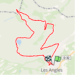

13.9 km | 19.1 km-effort


User


FREE GPS app for hiking
 SityTrail
IGN / Geographical institutes
SityTrail World
The world is yours!
Trail Walking of 12.7 km to be discovered at Occitania, Pyrénées-Orientales, Les Angles. This trail is proposed by Paulodst.
marche

Snowshoes

Walking

Walking

Walking

Walking

Snowshoes
Walking


sport
Walking
pas de carte
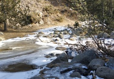
belle balade à faire en raquettes si beaucoup de neige