Trail Mountain bike Saint-Rémy-lès-Chevreuse - Jean Racine 2011 raid 60kms - Photo
 macleon
macleon

User

© OpenStreetMap contributors
Length
Length
65 km
Max alt
Max alt
190 m
Uphill gradient
Uphill gradient
1342 m
Km-Effort
Km-Effort  
83 km
Min alt
Min alt
74 m
Downhill gradient
Downhill gradient
1363 m
Boucle
Boucle
No
Creation date :
2014-12-10 00:00:00.0
Updated on :
2014-12-10 00:00:00.0

(0 Reviews)

Mountain bike
Mountain bike
--
Difficulty : Difficult

Scan this QR Code to open this trail in the SityTrail application

FREE GPS app for hiking

Logo SityTrail SityTrail

IGN / Geographical institutes

Download SityTrail from the App Store Download SityTrail from Google Play

Logo SityTrail SityTrail World

The world is yours!

Download SityTrail from the App Store Download SityTrail from Google Play Download SityTrail on Huawei AppGallery

About

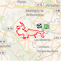
Trail Mountain bike of 65 km to be discovered at Ile-de-France, Yvelines, Saint-Rémy-lès-Chevreuse. This trail is proposed by macleon.

Description

version 60 kmsGarmin Edge 705 -> basecamp -> export GPX

Elevation profile

Positioning

Country:
France
Region :
Ile-de-France
Department/Province :
Yvelines
Municipality :
Saint-Rémy-lès-Chevreuse
Location:
Unknown
Start:(UTM)
431721 ; 5394635 (31U) N.

Trails nearby

Trail Walking Saint-Rémy-lès-Chevreuse - _Entre vallées et châteaux - Photo
Walking
GUIDE+

Walking

Medium
(13)
Saint-Rémy-lès-Chevreuse, Ile-de-France, Yvelines, France
7.8 km | 9.6 km-effort
2h 0min
Yes
Trail Walking Chevreuse - _La balade de tous les plaisirs - Photo
Walking
GUIDE+

Walking

Easy
(8)
Chevreuse, Ile-de-France, Yvelines, France
5.5 km | 7 km-effort
1h 30min
Yes
Trail Walking Chevreuse - _Sur les pas de Racine (première partie) - Photo
Walking
GUIDE+

Walking

Easy
(7)
Chevreuse, Ile-de-France, Yvelines, France
10.7 km | 14.5 km-effort
2h 30min
Yes
Trail Walking Choisel - _Si Choisel m'était conté - Photo
Walking
GUIDE+

Walking

Easy
(8)
Choisel, Ile-de-France, Yvelines, France
5.6 km | 6.6 km-effort
1h 27min
Yes
Trail Walking Gif-sur-Yvette - _Gif sur Yvette, une ville à la campagne - Photo
Walking
GUIDE+

Walking

Medium
(3)
Gif-sur-Yvette, Ile-de-France, Essonne, France
8.6 km | 10.5 km-effort
2h 0min
Yes
Trail Walking Magny-les-Hameaux - _La Vallée de la Mérantaise - Photo
Walking
GUIDE+

Walking

Easy
(5)
Magny-les-Hameaux, Ile-de-France, Yvelines, France
9.7 km | 11.6 km-effort
2h 30min
Yes
Trail Walking Saint-Lambert - _Sur les pas de Racine (deuxième partie) - Photo
Walking
GUIDE+

Walking

Easy
(2)
Saint-Lambert, Ile-de-France, Yvelines, France
10.5 km | 12.5 km-effort
2h 30min
Yes
Trail Walking Gometz-le-Châtel - Autour de Gometz le Châtel - Photo
Walking
tracegps

Walking

Medium
(1)
Gometz-le-Châtel, Ile-de-France, Essonne, France
7.8 km | 10.6 km-effort
2h 30min
Yes
Trail Walking Châteaufort - gitane à  Chateaufort  - Photo
Walking
philou91

Walking

Easy
(1)
Châteaufort, Ile-de-France, Yvelines, France
6.4 km | 7.7 km-effort
2h 3min
Yes


Close
My subscriptions