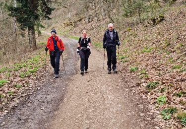
Trail Walking Wattwiller - Le Vieil Armand depuis Wattwiller 26122015 - Photo

Le Vieil Armand depuis Wattwiller 26122015

© OpenStreetMap contributors
Length
Length
11 km
Max alt
Max alt
952 m
Uphill gradient
Uphill gradient
622 m
Km-Effort
Km-Effort  
19.3 km
Min alt
Min alt
387 m
Downhill gradient
Downhill gradient
621 m
Boucle
Boucle
Yes
Creation date :
2017-10-01 00:00:00.0
Updated on :
2020-05-25 17:55:00.711

(0 Reviews)

Walking
Walking
3h29
Difficulty : Difficult

Scan this QR Code to open this trail in the SityTrail application

FREE GPS app for hiking

Logo SityTrail SityTrail

IGN / Geographical institutes

Download SityTrail from the App Store Download SityTrail from Google Play

Logo SityTrail SityTrail World

The world is yours!

Download SityTrail from the App Store Download SityTrail from Google Play Download SityTrail on Huawei AppGallery

About

Trail Walking of 11 km to be discovered at Grand Est, Haut-Rhin, Wattwiller. This trail is proposed by Fourmis.nf.

Description

Depuis Wattwiller rue de la 1ere Armée le parking de la chapelle à droite : de bonnes chaussures et batons de marche : 12km, 700  et 3h30 (hors pauses)
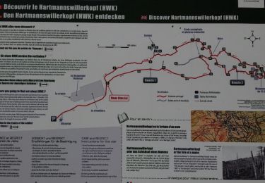
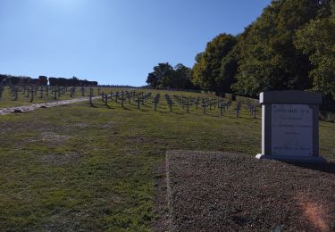
A gauche du panneau du Club Vosgien, prendre le petit sentier cercle bleu en direction de HirtzenStein. Poursuivre sur ce sentier (cercle bleu), traverser le parcours de santé pour rejoindre après quelques…instants de grimpette la route des crêtes. prendre à droite le long de la route pour trouver enfin le HWK (HartmannsWillerKopf !!! Une petite visite de ce site exceptionnel s'impose, devoir de mémoire mais aussi l'occasion d'une plongée dans le quotidien des soldats, des hommes qui se sont battues pour leurs nations. Derrière le cimetière les vestiges du frond très bien conservés, des tranchées et boyaux, des abris et guets…
Rester sur le chemin touristique et rejoindre le disque bleu pour entamer la descente. Les batons vont devenir indispensables, la pente est raide, chaotique, glissante. Sur ce chemin des Sycomores remarquables qui jalonneront le chemin jusqu'au monument Allemand plus bas, et qui lui offre un point de vue immanquable sur la plaine alsacienne. Rectangle rouge en direction de la cantine Zeller, puis poursuivre vers le parking du HirzenStein. A gauche du parking prendre le sentier en direction de Wattwiller en contournant le HirtzenStein, roche Quartzitique mise à nue lors de l'effondrement bassin rhénan début du Miocène (25 Ma). Descendre vers Wattwiller pour rejoindre la chapelle et le parking

Elevation profile

Positioning

Country:
France
Region :
Grand Est
Department/Province :
Haut-Rhin
Municipality :
Wattwiller
Location:
Unknown
Start:(UTM)
363299 ; 5299910 (32T) N.

Trails nearby

Trail Walking Soultz-Haut-Rhin - Hartmannswillerkopf - Circuit découverte - Photo
Walking
VacheKiri67

Walking

Easy
(1)
Soultz-Haut-Rhin, Grand Est, Haut-Rhin, France
3.6 km | 5.2 km-effort
1h 46min
Yes
Trail Walking Soultz-Haut-Rhin - Hartmannswillerkopf - Circuit anneau bleu - Photo
Walking
VacheKiri67

Walking

Medium
(1)
Soultz-Haut-Rhin, Grand Est, Haut-Rhin, France
3.7 km | 5.9 km-effort
1h 37min
Yes
Trail Other activity Steinbach - lac du ballon - Photo
Other activity
rodabruna

Other activity

Very easy
(1)
Steinbach, Grand Est, Haut-Rhin, France
33 km | 64 km-effort
5h 1min
No
Trail Road bike Cernay - Le Grand ballon de Cernay  - Photo
Road bike
GUIDE
nadd73

Road bike

Difficult
Cernay, Grand Est, Haut-Rhin, France
23 km | 36 km-effort
2h 15min
No
Trail Trail Wattwiller - The History Ultra - stage 1 - Photo
Trail
Olivier Houette

Trail

Very easy
(1)
Wattwiller, Grand Est, Haut-Rhin, France
28 km | 48 km-effort
Unknown
No
Trail Walking Uffholtz - Molkenrain 1 - Photo
Walking
regisbodilis

Walking

Difficult
(1)
Uffholtz, Grand Est, Haut-Rhin, France
15.4 km | 26 km-effort
4h 0min
Yes
Trail Walking Steinbach - Cascade de Erzenbach - Photo
Walking
dudu42

Walking

Medium
Steinbach, Grand Est, Haut-Rhin, France
6 km | 8.8 km-effort
1h 32min
Yes
Trail Walking Jungholtz - Rando Retrouvailles...01/03/2024.par Jean Marc - Photo
Walking
boubou68

Walking

Very difficult
Jungholtz, Grand Est, Haut-Rhin, France
11.3 km | 19.2 km-effort
1h 35min
Yes
Trail Walking Steinbach - Rando CLAS du 02/11/2023 - Photo
Walking
boubou68

Walking

Very difficult
Steinbach, Grand Est, Haut-Rhin, France
17.7 km | 27 km-effort
4h 35min
Yes


Close
My subscriptions