Trail Walking Condat-sur-Ganaveix - La Bessade- La Forêt - Photo
 houbart
houbart

User

© OpenStreetMap contributors
Length
Length
8.4 km
Max alt
Max alt
464 m
Uphill gradient
Uphill gradient
191 m
Km-Effort
Km-Effort  
10.9 km
Min alt
Min alt
380 m
Downhill gradient
Downhill gradient
191 m
Boucle
Boucle
Yes
Creation date :
2019-03-28 15:47:26.709
Updated on :
2019-03-28 15:47:26.752

(0 Reviews)

Walking
Walking
2h21
Difficulty : Medium

Scan this QR Code to open this trail in the SityTrail application

FREE GPS app for hiking

Logo SityTrail SityTrail

IGN / Geographical institutes

Download SityTrail from the App Store Download SityTrail from Google Play

Logo SityTrail SityTrail World

The world is yours!

Download SityTrail from the App Store Download SityTrail from Google Play Download SityTrail on Huawei AppGallery

About

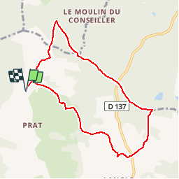
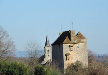
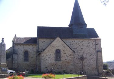
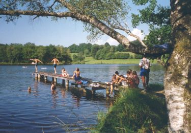
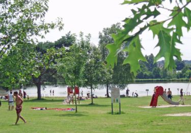
Trail Walking of 8.4 km to be discovered at New Aquitaine, Corrèze, Condat-sur-Ganaveix. This trail is proposed by houbart.

Description

Découverte du Ganaveix qui serpente à travers bois et prairies, des hameaux de caractère et un superbe panorama sur les Monédières.

Elevation profile

Positioning

Country:
France
Region :
New Aquitaine
Department/Province :
Corrèze
Municipality :
Condat-sur-Ganaveix
Location:
Unknown
Start:(UTM)
389524 ; 5040997 (31T) N.

Comments

Please log in to post a review or rate the element


Trails nearby

Trail Walking Salon-la-Tour - Entre étangs et châteaux - Salon la Tour - Pays Vézère Auvézère - Photo
Walking
tracegps

Walking

Medium
(2)
Salon-la-Tour, New Aquitaine, Corrèze, France
9.5 km | 12.1 km-effort
3h 30min
Yes
Trail Mountain bike Salon-la-Tour - Entre étangs et châteaux - Salon la Tour - Pays Vézère Auvézère - Photo
Mountain bike
tracegps

Mountain bike

Medium
Salon-la-Tour, New Aquitaine, Corrèze, France
9.5 km | 12.1 km-effort
1h 0min
Yes
Trail Walking Condat-sur-Ganaveix - Du Ganaveix au Bradascou - Condat sur Ganaveix - Photo
Walking
tracegps

Walking

Medium
(1)
Condat-sur-Ganaveix, New Aquitaine, Corrèze, France
14.3 km | 18.5 km-effort
4h 0min
Yes
Trail Walking Meilhards - Par monts et par vaux - Meilhards - Pays Vézère Auvézère - Photo
Walking
tracegps

Walking

Medium
Meilhards, New Aquitaine, Corrèze, France
9.7 km | 12.6 km-effort
2h 30min
Yes
Trail Walking Lamongerie - Circuit du plan d'eau - Lamongerie - Pays Vézère Auvézère - Photo
Walking
tracegps

Walking

Medium
Lamongerie, New Aquitaine, Corrèze, France
8.1 km | 10.5 km-effort
2h 15min
Yes
Trail Walking Lamongerie - Circuit du bourg - Lamongerie - Pays Vézère Auvézère - Photo
Walking
tracegps

Walking

Medium
Lamongerie, New Aquitaine, Corrèze, France
9.1 km | 11.6 km-effort
2h 30min
Yes
Trail Walking Lamongerie - Lamongerie - Photo
Walking
personono

Walking

Difficult
Lamongerie, New Aquitaine, Corrèze, France
9.4 km | 12 km-effort
2h 24min
Yes
Trail Walking Lamongerie - Lamongerie  - Photo
Walking
Georges 18

Walking

Medium
Lamongerie, New Aquitaine, Corrèze, France
9.4 km | 11.9 km-effort
2h 9min
Yes
Trail Other activity Salon-la-Tour - vigeois-rmb - Photo
Other activity
fengels

Other activity

Very easy
(1)
Salon-la-Tour, New Aquitaine, Corrèze, France
445 km | 501 km-effort
9h 46min
No


Close
My subscriptions