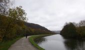
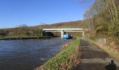
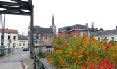
Trail Walking Montigny-le-Tilleul - Balade en Val de Sambre - De Landelies à l'Abbaye d'Aulne  - Photo

Balade en Val de Sambre - De Landelies à l'Abbaye d'Aulne

 Desrumaux
Desrumaux

User GUIDE

© OpenStreetMap contributors
Length
Length
6.6 km
Max alt
Max alt
144 m
Uphill gradient
Uphill gradient
102 m
Km-Effort
Km-Effort  
8 km
Min alt
Min alt
102 m
Downhill gradient
Downhill gradient
101 m
Boucle
Boucle
Yes
Creation date :
2015-11-30 00:00:00.0
Updated on :
2015-11-30 00:00:00.0

(1 Reviews)

Walking
Walking
1h49
Difficulty : Very easy

Scan this QR Code to open this trail in the SityTrail application

FREE GPS app for hiking

Logo SityTrail SityTrail

IGN / Geographical institutes

Download SityTrail from the App Store Download SityTrail from Google Play

Logo SityTrail SityTrail World

The world is yours!

Download SityTrail from the App Store Download SityTrail from Google Play Download SityTrail on Huawei AppGallery

About

Trail Walking of 6.6 km to be discovered at Wallonia, Hainaut, Montigny-le-Tilleul. This trail is proposed by Desrumaux.

Description

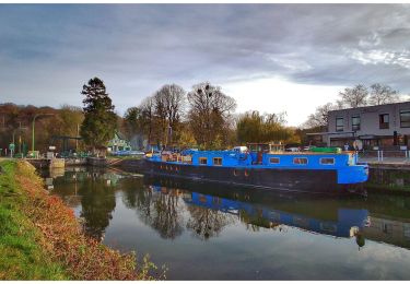
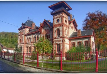
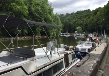
L'abbaye d’Aulne est située dans une vallée escarpée sur la rive droite de la Sambre, un lieu dénommé "Vallée de la Paix". Aujourd'hui, les vestiges se présentent tel un havre de paix où il fait bon se promener. Le port de plaisance de Landelies, havre de quiétude, fut construit en 1980. Les ports de plaisance de Landelies et d’Erquelinnes, portes de la Haute Sambre, les relais nautiques de Thuin et de Lobbes et la halte nautique de Merbes sont les maillons essentiels de la promotion du tourisme fluvial qui se développe de plus en plus et attire sur la Haute Sambre des visiteurs venant de plusieurs pays d’Europe et même d’Outre-mer, compensant ainsi le déclin de la navigation marchande. ® Départ : Eglise de Landelies

Elevation profile

Photos

Points of interest

Point of interest Thuin - Abbaye d'Aulne - Photo
Desrumaux
Point of interest Montigny-le-Tilleul - Landelies - Photo
Desrumaux
MONTIGNY-LE-TILLEUL 
Point of interest Thuin - Abbaye d'Aulne - Photo
Desrumaux
Point of interest Thuin - Landelies - Photo
Desrumaux
THUIN 
Point of interest Montigny-le-Tilleul - Landelies - Photo
Desrumaux
MONTIGNY-LE-TILLEUL 

Positioning

Country:
Belgium
Region :
Wallonia
Department/Province :
Hainaut
Municipality :
Montigny-le-Tilleul
Location:
Landelies
Start:(UTM)
596361 ; 5581683 (31U) N.

Comments

Please log in to post a review or rate the element


Trails nearby

Trail Walking Montigny-le-Tilleul - A la découverte des sentes et venelles de Montigny-le-Tilleul - Photo
Walking
GUIDE
Desrumaux

Walking

Easy
(6)
Montigny-le-Tilleul, Wallonia, Hainaut, Belgium
7.8 km | 9.9 km-effort
2h 0min
Yes
Trail Walking Fontaine-l'Évêque - de l'Abbaye d'Aulne au hameau de Hourpes - Thuin - Photo
Walking
GUIDE
Desrumaux

Walking

Very easy
(2)
Fontaine-l'Évêque, Wallonia, Hainaut, Belgium
8.7 km | 10.9 km-effort
3h 16min
Yes
Trail Walking Charleroi - Balade de Marchienne-au-Pont à Charleroi - Photo
Walking
GUIDE
Desrumaux

Walking

Medium
(3)
Charleroi, Wallonia, Hainaut, Belgium
12.8 km | 15.8 km-effort
3h 23min
Yes
Trail Walking Thuin - La balade du Bois des Waibes. - Photo
Walking
GUIDE
Desrumaux

Walking

Easy
(4)
Thuin, Wallonia, Hainaut, Belgium
9.9 km | 12 km-effort
2h 41min
Yes
Trail Walking Fontaine-l'Évêque - Balade à Fontaine l'Evêque - Photo
Walking
GUIDE
Desrumaux

Walking

Easy
(5)
Fontaine-l'Évêque, Wallonia, Hainaut, Belgium
7.9 km | 9.6 km-effort
2h 6min
Yes
Trail Walking Montigny-le-Tilleul - BE-Montigny-le-Tilleul - Landelies - Aulne - 2 - Photo
Walking
GUIDE
MicDul

Walking

Very easy
(1)
Montigny-le-Tilleul, Wallonia, Hainaut, Belgium
7.1 km | 9.6 km-effort
2h 4min
Yes
Trail Walking Charleroi - Balade à Monceau-sur-Sambre - Photo
Walking
GUIDE
Desrumaux

Walking

Very easy
(4)
Charleroi, Wallonia, Hainaut, Belgium
8.9 km | 10.7 km-effort
2h 21min
Yes
Trail Walking Thuin - RB-Ha-08 – Raccourci 1 - Tours et détours entre Beaumont et Barbençon - Photo
Walking
PRO

Walking

Very difficult
(2)
Thuin, Wallonia, Hainaut, Belgium
25 km | 32 km-effort
7h 12min
Yes
Trail Walking Thuin - RB-Ha-08 - Tours et détours entre Beaumont et Barbençon - Photo
Walking
PRO

Walking

Very difficult
(2)
Thuin, Wallonia, Hainaut, Belgium
22 km | 28 km-effort
6h 26min
Yes


Close
My subscriptions