Trail Mountain bike Chessy -  - Photo
 arsene77
arsene77

User

© OpenStreetMap contributors
Length
Length
31 km
Max alt
Max alt
139 m
Uphill gradient
Uphill gradient
200 m
Km-Effort
Km-Effort  
34 km
Min alt
Min alt
103 m
Downhill gradient
Downhill gradient
201 m
Boucle
Boucle
Yes
Creation date :
2014-12-10 00:00:00.0
Updated on :
2014-12-10 00:00:00.0

(0 Reviews)

Mountain bike
Mountain bike
2h00
Difficulty : Unknown

Scan this QR Code to open this trail in the SityTrail application

FREE GPS app for hiking

Logo SityTrail SityTrail

IGN / Geographical institutes

Download SityTrail from the App Store Download SityTrail from Google Play

Logo SityTrail SityTrail World

The world is yours!

Download SityTrail from the App Store Download SityTrail from Google Play Download SityTrail on Huawei AppGallery

About

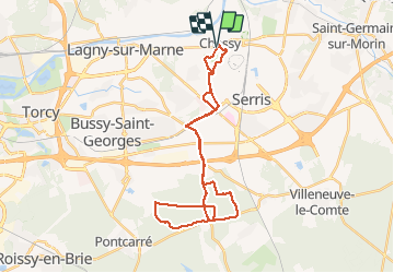
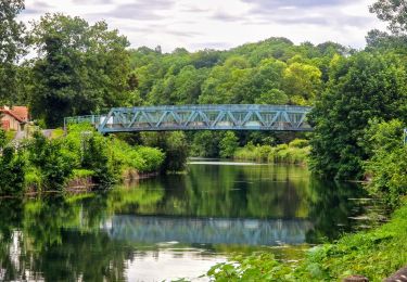
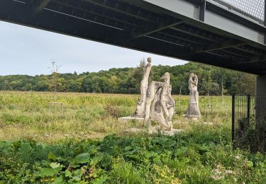
Trail Mountain bike of 31 km to be discovered at Ile-de-France, Seine-et-Marne, Chessy. This trail is proposed by arsene77.

Description

Parcours idéal pour reprise d''entraînement en autome/hiver ou VTTistes régulier de niveau moyen, avec des secteurs de route, et des chemins stabilisés ou de boue en automne / hiver
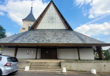
Départ du parking de la pharmacie du bourg de Chessy, route jusqu''à Jossigny, puis chemins en forêt entre Jossigny, Villeneuve Saint-Denis et Ferrière, puis retour
Le temps de parcours a été fait un dimanche de novembre, dans des conditions de neige fondue (environ 5cm durant la semaine).

Elevation profile

Positioning

Country:
France
Region :
Ile-de-France
Department/Province :
Seine-et-Marne
Municipality :
Chessy
Location:
Unknown
Start:(UTM)
482686 ; 5414025 (31U) N.

Trails nearby

Trail Walking Jablines - SM_JABLINES_7.4Km - Photo
Walking
GR77LP

Walking

Medium
(7)
Jablines, Ile-de-France, Seine-et-Marne, France
7.4 km | 8 km-effort
1h 49min
Yes
Trail Walking Coupvray - Boucle > 30 km Coupvray -Meaux - Photo
Walking
GUIDE
chessyca

Walking

Very difficult
(1)
Coupvray, Ile-de-France, Seine-et-Marne, France
33 km | 37 km-effort
6h 28min
Yes
Trail Walking Dampmart - SM_DAMPMART-EST_8.1Km - Photo
Walking
GR77LP

Walking

Medium
(3)
Dampmart, Ile-de-France, Seine-et-Marne, France
8.1 km | 9.5 km-effort
2h 9min
Yes
Trail Walking Coupvray - SM_COUPVRAY_7.8Km - Photo
Walking
GR77LP

Walking

Medium
(1)
Coupvray, Ile-de-France, Seine-et-Marne, France
7.8 km | 9.8 km-effort
2h 16min
Yes
Trail On foot Lesches - 16 km autour de la Sixtine de Seine et Marne - Photo
On foot
GUIDE
chessyca

On foot

Easy
Lesches, Ile-de-France, Seine-et-Marne, France
16.1 km | 18.2 km-effort
4h 8min
Yes
Trail Walking Coupvray -  Boucle Coupvray - Meaux - Photo
Walking
GUIDE
chessyca

Walking

Very difficult
Coupvray, Ile-de-France, Seine-et-Marne, France
30 km | 33 km-effort
6h 9min
Yes
Trail Walking Dampmart - ASAM Dampmart La Dhuys - Photo
Walking
PatCant

Walking

Easy
(1)
Dampmart, Ile-de-France, Seine-et-Marne, France
4.5 km | 5.4 km-effort
1h 13min
Yes
Trail Walking Dampmart - Boucle 23 km Dampmart Annet sur Marne Base de Jabeline - Photo
Walking
GUIDE
chessyca

Walking

Medium
Dampmart, Ile-de-France, Seine-et-Marne, France
23 km | 27 km-effort
5h 11min
Yes
Trail Walking Dampmart - Boucle autour de Dampmart - Photo
Walking
GUIDE
chessyca

Walking

Medium
Dampmart, Ile-de-France, Seine-et-Marne, France
22 km | 25 km-effort
6h 24min
Yes


Close
My subscriptions