Trail Winter sports Mijoux - Piste de La Germine (rouge - 15,5km) - Photo

Piste de La Germine (rouge - 15,5km)

 otgex
otgex

User

© OpenStreetMap contributors
Length
Length
15.1 km
Max alt
Max alt
1373 m
Uphill gradient
Uphill gradient
316 m
Km-Effort
Km-Effort  
19.4 km
Min alt
Min alt
1262 m
Downhill gradient
Downhill gradient
323 m
Boucle
Boucle
Yes
Creation date :
2014-12-10 00:00:00.0
Updated on :
2014-12-10 00:00:00.0

(0 Reviews)

Winter sports
Winter sports
2h30
Difficulty : Unknown

Scan this QR Code to open this trail in the SityTrail application

FREE GPS app for hiking

Logo SityTrail SityTrail

IGN / Geographical institutes

Download SityTrail from the App Store Download SityTrail from Google Play

Logo SityTrail SityTrail World

The world is yours!

Download SityTrail from the App Store Download SityTrail from Google Play Download SityTrail on Huawei AppGallery

About

Trail Winter sports of 15.1 km to be discovered at Auvergne-Rhône-Alpes, Ain, Mijoux. This trail is proposed by otgex.

Description

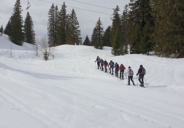
Principe de balisage à La Vattay : chaque panneau indique le nom de la piste avec sa couleur (ici rouge), le kilométrage total (ici 15,5km) et sur chaque panneau la distance déjà parcourue.Sur l''aire de départ, passer la cabane de contrôle puis suivre sur la gauche les panneaux "Germine" balisés en rouge. D''abord parcours commun avec les pistes du Plateau, de la Girantette, de la Pillarde et de Sonnailley.
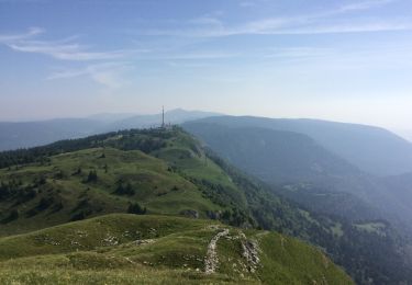
Après la bifurcation de la Girantette qui part sur la gauche, le parcours se fait face au sommet de la Dôle hérissé d''antennes de télécommunications.
Après le croisement de La Pillarde qui part sur la gauche la piste est en territoire Suisse et le reste jusqu''au moment de retrouver la Pillarde.
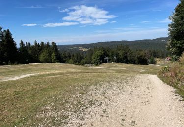
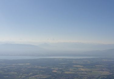
Le sommet de la piste à 1370 m est juste sous la Dôle, beau panorama vers le sud sur les plateaux de La Vattay, la vallée de la Valserine et les sommets de la Haute Chaîne du Jura.
Après une longue descente la piste se dirige sur la droite vers la vallée des Dappes pour arriver à proximité des pistes de ski alpin du massif de La Dôle.
retour par les pistes bien dégagées du plateau de La Vattay.

Elevation profile

Points of interest

Point of interest La Rippe - Panorama - Photo
otgex
LA RIPPE 
Point of interest Divonne-les-Bains - Chalet de La Girantette - Photo
otgex
DIVONNE-LES-BAINS 
Point of interest Mijoux - entrée du Plateau - Photo
otgex
Point of interest Mijoux - Centre nordique - Photo
otgex
Point of interest Mijoux - La Vattay - Photo
otgex
MIJOUX 
Point of interest La Rippe - Chalet de La Germine - Photo
otgex
Point of interest Divonne-les-Bains - Chalet de La Greffière - Photo
otgex
DIVONNE-LES-BAINS 

Positioning

Country:
France
Region :
Auvergne-Rhône-Alpes
Department/Province :
Ain
Municipality :
Mijoux
Location:
Unknown
Start:(UTM)
273467 ; 5141509 (32T) N.

Trails nearby

Trail On foot Gingins - La Dôle - Photo
On foot
GUIDE+

On foot

Easy
Gingins, Vaud, District de Nyon, Switzerland
8 km | 15.4 km-effort
3h 30min
Yes
Trail Running Mijoux - UTTJ 2015-2 - Photo
Running
bourel.jacques

Running

Very difficult
(1)
Mijoux, Auvergne-Rhône-Alpes, Ain, France
57 km | 92 km-effort
18h 13min
No
Trail Walking Gex - Balade à Col de la Faucille, Gex - Photo
Walking
Gaiato

Walking

Very difficult
Gex, Auvergne-Rhône-Alpes, Ain, France
86 km | 135 km-effort
9h 23min
No
Trail Bicycle tourism Mijoux - LES ROUSSES - COL DE LA FAUCILLE  - Photo
Bicycle tourism
jean-marie.parachini

Bicycle tourism

Very difficult
Mijoux, Auvergne-Rhône-Alpes, Ain, France
54 km | 68 km-effort
4h 57min
No
Trail Snowshoes Divonne-les-Bains - La Vatay Suisse - Photo
Snowshoes
janussity

Snowshoes

Medium
Divonne-les-Bains, Auvergne-Rhône-Alpes, Ain, France
5.8 km | 8.7 km-effort
1h 43min
Yes
Trail Walking Gex - la faucille - montrond - Photo
Walking
thierrytm

Walking

Medium
Gex, Auvergne-Rhône-Alpes, Ain, France
12.4 km | 22 km-effort
1h 35min
No
Trail Snowshoes Divonne-les-Bains - La Dole alt 1676m en raquette - Photo
Snowshoes
janussity

Snowshoes

Difficult
Divonne-les-Bains, Auvergne-Rhône-Alpes, Ain, France
9.1 km | 15 km-effort
3h 7min
Yes
Trail Snowshoes Lamoura - Lamoura le massacre 8/2/2020 - Photo
Snowshoes
barmi

Snowshoes

Very easy
(1)
Lamoura, Bourgogne-Franche-Comté, Jura, France
12.6 km | 17.1 km-effort
4h 8min
Yes
Trail Walking Mijoux - GR 9 Étape 8 - Mijoux - Refuge de la Loge - Photo
Walking
pcugnod

Walking

Difficult
Mijoux, Auvergne-Rhône-Alpes, Ain, France
14.9 km | 24 km-effort
5h 37min
No


Close
My subscriptions