Trail Walking Arbaz - Anzère, Lapiaz du Sex Rouge - Photo

Anzère, Lapiaz du Sex Rouge

 rpf
rpf

User

© OpenStreetMap contributors
Length
Length
8.3 km
Max alt
Max alt
2699 m
Uphill gradient
Uphill gradient
512 m
Km-Effort
Km-Effort  
15.1 km
Min alt
Min alt
2305 m
Downhill gradient
Downhill gradient
512 m
Boucle
Boucle
Yes
Creation date :
2014-12-10 00:00:00.0
Updated on :
2014-12-10 00:00:00.0

(0 Reviews)

Walking
Walking
4h30
Difficulty : Unknown

Scan this QR Code to open this trail in the SityTrail application

FREE GPS app for hiking

Logo SityTrail SityTrail

IGN / Geographical institutes

Download SityTrail from the App Store Download SityTrail from Google Play

Logo SityTrail SityTrail World

The world is yours!

Download SityTrail from the App Store Download SityTrail from Google Play Download SityTrail on Huawei AppGallery

About

Trail Walking of 8.3 km to be discovered at Valais/Wallis, Sion, Arbaz. This trail is proposed by rpf.

Description

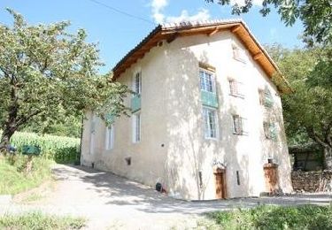
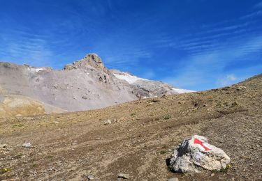
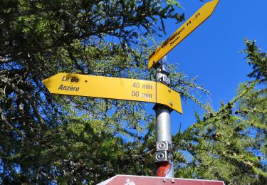
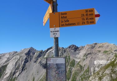
Anzère, une belle balade à faire en plein été, sur le chemin de la Cabane des Audannes. Départ à 2360 mètres, à la station supérieure du téléphérique du Pas de Maimbré. Vue imprenable sur la région du Sanetsch depuis le rebord vertigineux du Lapiaz du Sex Rouge.

Départ au sommet du télé du Pas de Maimbré (se renseigner sur les horaires, de descente aussi).

Attention ! Ce tracé, partiellement hors sentier, traverse les Lapiaz dont certaines crevasses très profondes peuvent être cachées par des ponts de neige fragiles. Prudence !
La progression est parfois laborieuse mais pas vraiment difficile.

Une balade de  " www.toprando.ch "

Elevation profile

Positioning

Country:
Switzerland
Region :
Valais/Wallis
Department/Province :
Sion
Municipality :
Arbaz
Location:
Unknown
Start:(UTM)
375716 ; 5130031 (32T) N.

Trails nearby

Trail Walking Icogne - Bisse du Sillonin - Photo
Walking
GUIDE+

Walking

Very easy
Icogne, Valais/Wallis, Sierre, Switzerland
7.1 km | 9.7 km-effort
2h 15min
No
Trail Walking Savièse - Mayen de la Zour-Prabé - Photo
Walking
lroux

Walking

Very easy
(1)
Savièse, Valais/Wallis, Sion, Switzerland
3.8 km | 10.3 km-effort
Unknown
No
Trail Walking Ayent - Au pied du Wildhorn  - Photo
Walking
pjamin

Walking

Very difficult
(1)
Ayent, Valais/Wallis, Hérens, Switzerland
33 km | 64 km-effort
15h 30min
No
Trail Nordic walking Arbaz - Grimisuat  - Photo
Nordic walking
suzanne.bron

Nordic walking

Very easy
Arbaz, Valais/Wallis, Sion, Switzerland
3.6 km | 4.8 km-effort
1h 1min
No
Trail Nordic walking Arbaz - 19.08.20 cabane Audanne - Photo
Nordic walking
suzanne.bron

Nordic walking

Very easy
Arbaz, Valais/Wallis, Sion, Switzerland
6 km | 11.3 km-effort
2h 54min
No
Trail Nordic walking Ayent - 07.08.20 Tour des Alpages  - Photo
Nordic walking
suzanne.bron

Nordic walking

Very easy
Ayent, Valais/Wallis, Hérens, Switzerland
16.9 km | 25 km-effort
5h 39min
Yes
Trail Nordic walking Arbaz - 27.07.20 Pas de Maimbré  - Photo
Nordic walking
suzanne.bron

Nordic walking

Very easy
Arbaz, Valais/Wallis, Sion, Switzerland
8.4 km | 19.2 km-effort
3h 50min
No
Trail Nordic walking Arbaz - 23.07.20 Anzère  - Photo
Nordic walking
suzanne.bron

Nordic walking

Very easy
Arbaz, Valais/Wallis, Sion, Switzerland
5.9 km | 9 km-effort
1h 48min
No
Trail Nordic walking Arbaz - 09.07.20 Anzère  - Photo
Nordic walking
suzanne.bron

Nordic walking

Very easy
Arbaz, Valais/Wallis, Sion, Switzerland
7.2 km | 11.8 km-effort
2h 11min
No


Close
My subscriptions