Trail Walking Saint-Martin (VS) - Saint-Martin, Tour de la Maya - Photo

Saint-Martin, Tour de la Maya

 rpf
rpf

User

© OpenStreetMap contributors
Length
Length
7.8 km
Max alt
Max alt
2846 m
Uphill gradient
Uphill gradient
675 m
Km-Effort
Km-Effort  
16.8 km
Min alt
Min alt
2159 m
Downhill gradient
Downhill gradient
677 m
Boucle
Boucle
Yes
Creation date :
2014-12-10 00:00:00.0
Updated on :
2014-12-10 00:00:00.0

(0 Reviews)

Walking
Walking
4h30
Difficulty : Unknown

Scan this QR Code to open this trail in the SityTrail application

FREE GPS app for hiking

Logo SityTrail SityTrail

IGN / Geographical institutes

Download SityTrail from the App Store Download SityTrail from Google Play

Logo SityTrail SityTrail World

The world is yours!

Download SityTrail from the App Store Download SityTrail from Google Play Download SityTrail on Huawei AppGallery

About

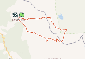
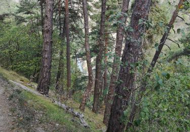
Trail Walking of 7.8 km to be discovered at Valais/Wallis, Hérens, Saint-Martin (VS). This trail is proposed by rpf.

Description

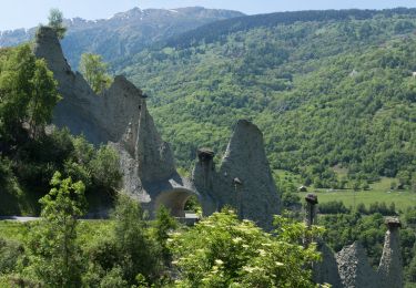
Entre le spectaculaire Haut Vallon de Réchy et les alpages du Val d''Hérens, de l''A Vieille à Lovégno, sur les tons de clair-obscur d''une journée semi-orageuse, contraste entre un monde lunaire et les étendues verdoyantes des pâturages d''altitude.

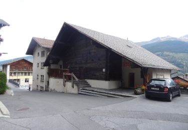
Départ au hameau de Lovégno qu''on atteint par une route en terre battue réservée aux riverains.
Montée au Pas de Lovégno qui donne accès au Vallon de Réchy qu''on remonte jusqu''au Grand Bandon.
Ce passage ramène au Val d''Hérens dont on traverse les alpages pour retourner à Lovégno.

Une balade de  " www.toprando.ch "

Elevation profile

Positioning

Country:
Switzerland
Region :
Valais/Wallis
Department/Province :
Hérens
Municipality :
Saint-Martin (VS)
Location:
Unknown
Start:(UTM)
381895 ; 5114545 (32T) N.

Trails nearby

Trail On foot Hérémence - Euseigne - fixme - Photo
On foot
GUIDE+

On foot

Easy
Hérémence, Valais/Wallis, Hérens, Switzerland
3.2 km | 6.2 km-effort
1h 25min
No
Trail On foot Hérémence - Euseigne - Hérémence - Photo
On foot
GUIDE+

On foot

Easy
Hérémence, Valais/Wallis, Hérens, Switzerland
5.2 km | 9.7 km-effort
2h 12min
No
Trail On foot Mont-Noble - La Combe - Nax - Photo
On foot
GUIDE+

On foot

Easy
Mont-Noble, Valais/Wallis, Hérens, Switzerland
6.3 km | 9.8 km-effort
2h 13min
No
Trail On foot Mont-Noble - Le Louché Lac - Col du Cou - Photo
On foot
GUIDE+

On foot

Easy
Mont-Noble, Valais/Wallis, Hérens, Switzerland
3.7 km | 6.3 km-effort
1h 26min
No
Trail On foot Mont-Noble - Le Louché-L'Ar du Tsan Lac (A) - Photo
On foot
GUIDE+

On foot

Easy
Mont-Noble, Valais/Wallis, Hérens, Switzerland
3.6 km | 5 km-effort
1h 8min
No
Trail On foot Mont-Noble - L'Ar du Tsan - Le Louché Lac (B) - Photo
On foot
GUIDE+

On foot

Easy
Mont-Noble, Valais/Wallis, Hérens, Switzerland
4.1 km | 8 km-effort
1h 49min
No
Trail On foot Evolène - Volvovron - L'A Vieille - Photo
On foot
GUIDE+

On foot

Easy
Evolène, Valais/Wallis, Hérens, Switzerland
4.2 km | 10.3 km-effort
2h 20min
No
Trail Nordic walking Hérémence - vallée de la borgne - Photo
Nordic walking
suzanne.bron

Nordic walking

Very easy
Hérémence, Valais/Wallis, Hérens, Switzerland
10.8 km | 15.4 km-effort
5h 22min
No
Trail Walking Saint-Martin (VS) - Trajet du 28.10.21 - Photo
Walking
Leemans

Walking

Very difficult
Saint-Martin (VS), Valais/Wallis, Hérens, Switzerland
14.8 km | 28 km-effort
6h 17min
Yes


Close
My subscriptions