


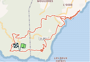

8.2 km | 10.7 km-effort


User


FREE GPS app for hiking
 SityTrail
IGN / Geographical institutes
SityTrail World
The world is yours!
Trail Walking of 15.1 km to be discovered at Provence-Alpes-Côte d'Azur, Var, Six-Fours-les-Plages. This trail is proposed by DanielROLLET.
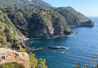
Départ/arrivée deouis iloasse Plage de la Verne - plage de Fabrégas - ancien sémaphore - Notre Dame du Mai.
Fort vent difficile de trouver un emplacement à l'abri pour manger.

Walking

Walking
Walking

Walking

Mountain bike

Walking

Walking

Walking
Walking