


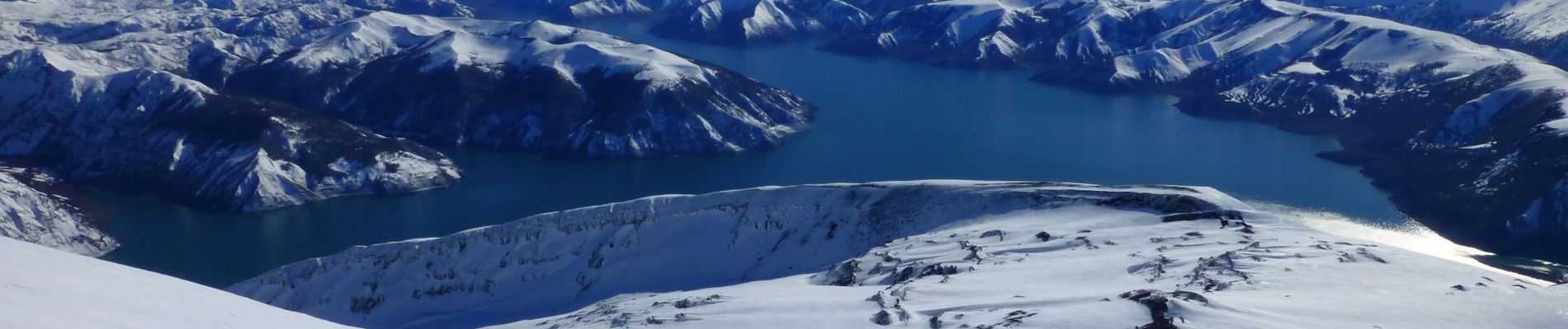
Volcan Antuco

harydh
User GUIDE
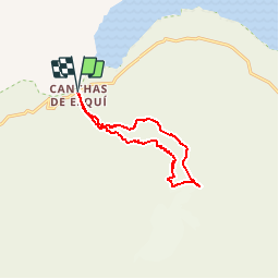

Length
12.2 km

Max alt
2720 m

Uphill gradient
1324 m
Km-Effort
30 km

Min alt
1395 m

Downhill gradient
1322 m
Boucle
Yes
Creation date :
2015-10-13 00:00:00.0
Updated on :
2019-04-04 12:19:28.206
--
Difficulty : Difficult

FREE GPS app for hiking
 SityTrail
IGN / Geographical institutes
SityTrail World
The world is yours!
About
Trail Touring skiing of 12.2 km to be discovered at Biobío Region, Provincia de Bío-Bío, Antuco. This trail is proposed by harydh.
Description
12/09/2015 06:49
Photos


Positioning
Country:
Chile
Region :
Biobío Region
Department/Province :
Provincia de Bío-Bío
Municipality :
Antuco
Location:
Unknown
Start:(Dec)
Start:(UTM)
289501 ; 5859934 (19H) S.
Comments
Trails nearby