Trail Walking Pézilla-la-Rivière - 66 PEZILLA-la-Riviere - VILLENEUVE-la-riviere - LE SOLER - vallée de la TÊT - Photo

66 PEZILLA-la-Riviere - VILLENEUVE-la-riviere - LE SOLER - vallée de la TÊT

 jeff66
jeff66

User

© OpenStreetMap contributors
Length
Length
15.9 km
Max alt
Max alt
97 m
Uphill gradient
Uphill gradient
102 m
Km-Effort
Km-Effort  
17.3 km
Min alt
Min alt
55 m
Downhill gradient
Downhill gradient
102 m
Boucle
Boucle
Yes
Creation date :
2015-09-23 00:00:00.0
Updated on :
2015-09-23 00:00:00.0

(0 Reviews)

Walking
Walking
2h44
Difficulty : Medium

Scan this QR Code to open this trail in the SityTrail application

FREE GPS app for hiking

Logo SityTrail SityTrail

IGN / Geographical institutes

Download SityTrail from the App Store Download SityTrail from Google Play

Logo SityTrail SityTrail World

The world is yours!

Download SityTrail from the App Store Download SityTrail from Google Play Download SityTrail on Huawei AppGallery

About

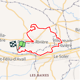
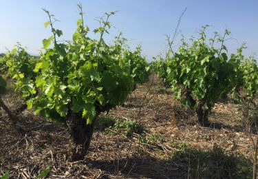
Trail Walking of 15.9 km to be discovered at Occitania, Pyrénées-Orientales, Pézilla-la-Rivière. This trail is proposed by jeff66.

Description

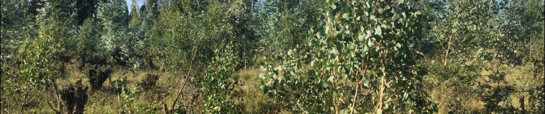
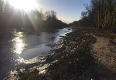
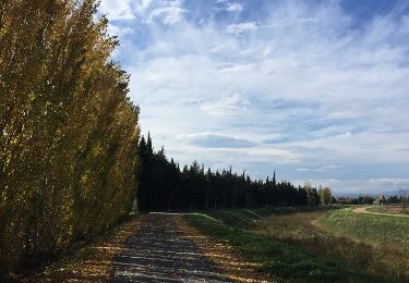
66 PEZILLA-la-Riviere - parking à proximité de la RD16a, promenade entre les serres, stade Louis Blad, chemin de saint Feliu, rue de la serre Montèze, av. de la république, place de la nation, rue portal d'amont, passage sur RD614, route d'Estagel, centre de secours, boulodrome, ancien moulin à eau, entrepôt Camilor, mas conte, le vigné, après la ligne de crête plateau surplombant la vallée de la TÊT avec panorama à 360 degrés - ravin des Gourgues - emprunter la RD614. Au mas Blanes, prendre à gauche la piste bordée de platanes - la Blanère - suivre correc de les Gorges - VILLENEUVE-la-riviere, complexe sportif, Cami. Dels Alous, RD1a, rue de l'hôtel de ville. Espace jean Noé, rue des Caves, RD1, mairie, rosaire, Poney club, rue des mûriers, écuries - route entre les serres - LE SOLER, traverser la RD39, vers réserves ornithologique - chemin en sous bois le long de la TÊT - le grand Riberal, le Riberal, Les Gourgues

Elevation profile

Photos

23 photos in total. Please click on a photo to see them all in the gallery.

Positioning

Country:
France
Region :
Occitania
Department/Province :
Pyrénées-Orientales
Municipality :
Pézilla-la-Rivière
Location:
Unknown
Start:(UTM)
479754 ; 4726045 (31T) N.

Trails nearby

Trail On foot Corneilla-la-Rivière - Sentier Lambert Narach - Photo
On foot
GUIDE+

On foot

Easy
Corneilla-la-Rivière, Occitania, Pyrénées-Orientales, France
6.7 km | 11.4 km-effort
2h 35min
No
Trail Walking Corneilla-la-Rivière - 20240316 Corneilla la rivière  - Photo
Walking
ThonyM

Walking

Medium
Corneilla-la-Rivière, Occitania, Pyrénées-Orientales, France
19 km | 28 km-effort
4h 31min
Yes
Trail Running Saint-Féliu-d'Avall - Boucle St Feliu Amont -Ill sur Tête  - Photo
Running
zazie

Running

Medium
(1)
Saint-Féliu-d'Avall, Occitania, Pyrénées-Orientales, France
23 km | 25 km-effort
2h 8min
No
Trail Walking Saint-Féliu-d'Avall - 66 ST-FELIU-D'AVALL, CORNEILLA DE LA RIVIERE, promenade autour de la Têt - Photo
Walking
jeff66

Walking

Easy
Saint-Féliu-d'Avall, Occitania, Pyrénées-Orientales, France
6.6 km | 7 km-effort
1h 16min
Yes
Trail Walking Baixas - 66 VILLENEUVE-LA-RIVIÈRE, promenade entre parcs éoliens et vignobles CALCE - Photo
Walking
jeff66

Walking

Easy
Baixas, Occitania, Pyrénées-Orientales, France
8 km | 8.7 km-effort
1h 33min
Yes
Trail Walking Pézilla-la-Rivière - 66 CORNEILLA-LA-RIVIERE, promenade sur les hauteurs vallonnées, entre vignes et parc éolien  - Photo
Walking
jeff66

Walking

Medium
(1)
Pézilla-la-Rivière, Occitania, Pyrénées-Orientales, France
8.3 km | 9.5 km-effort
1h 31min
Yes
Trail Walking Le Soler - 66 LE SOLER - ST FELIU D'AVALL, promenade le long du Rau du SOLER et de la rivière de CASTELNOU entre canaux et vergers - Photo
Walking
jeff66

Walking

Easy
Le Soler, Occitania, Pyrénées-Orientales, France
9.8 km | 10.4 km-effort
1h 39min
Yes
Trail Walking Le Soler - 66 LE SOLER - TOULOUGES, village, jardins, vergers, canaux et la Basse - Photo
Walking
jeff66

Walking

Medium
Le Soler, Occitania, Pyrénées-Orientales, France
13.5 km | 14.3 km-effort
2h 15min
Yes
Trail Walking Thuir - THUIR 66 - chapelle VILARMILA - Vinyer Capella, Rei - Photo
Walking
jeff66

Walking

Easy
(4)
Thuir, Occitania, Pyrénées-Orientales, France
10.1 km | 10.7 km-effort
1h 39min
Yes


Close
My subscriptions